Geospatial Data Collection Development Policies
Learn about geospatial collection development policies in libraries worldwide. Explore main features and adjustments to open data and financial constraints. Discover insights from a comprehensive study.

Geospatial Data Collection Development Policies
E N D
Presentation Transcript
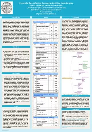
Geospatial data collection development policies’ characteristics Ifigenia Vardakosta and Sarantos KapidakisLaboratory on Digital Libraries and Electronic Publishing Department of Archives and Library Science Ionian University {ifigenia, sarantos}@ionio.gr INSERTLOGO HERE Introduction Results Conclusions In days of global economic distress, libraries implementing geospatial collections and GIS services must ensure that users will be able to make the greatest possible use of its capabilities and functions since business, public administration and environmental management strategies rely heavily upon geospatial information and technologies (Boxall, 2004). As managers of content, librarians have always used collections development policies (Phillips, 2003; Vickery, 2004; Sanchez Vignau & Meneses, 2005; Nabe, 2011) and in the case of geospatial data, their uniqueness and complexity (Janee, 2009; Erwin & Sweetkind-Singer, 2010) leads in the establishment of a tool such as a collection development policy, as several researchers indicate. The nature of data, the format and their documentation will influence the final service that will be offered to the users. The rapid growth of open geospatial data is reflected in GCDPs, since in the majority of libraries the main data sources are governmental followed by depository programs. The existence of free public data and the information regarding cooperation indicate their adjustment in reduced economic conditions. GCDPs varied in form and content among examined libraries. Most of the examined libraries use different terminology. Only 6 libraries had a GCDP exclusively for geospatial collections, 6 refers them along with map CDPs, 9 mentions them with geographical collection and 3 others includes them to the rest of their collection. The above characteristics maybe indicate the absence of a guideline in the field of GCDPs although there are several Associations that interact in geospatial collections. Our research demonstrates that libraries are trying to find ways to survive under reducing budgets giving their patrons the maximum of information by using the public data infrastructures. Additionally, cooperative arrangements in providing such kind of information seem to be one of the methods in which libraries will shift so to adapt to the requirements of our times. Objectives The aim of this study is to explore the collection development policies of libraries with geographical collections and GIS services worldwide and describe their main features. Specifically, it attempts to provide insight into answering the following research questions: 1) What are the main features of geospatial collection development policies (GCDPs)? 2) Do geospatial collection development policies include features that reflect the adjustment of libraries to the rapid growth of open geospatial data? 3) Do the existence geospatial collection policies reflect the adjustment of libraries to limited financial means the last few years? Methodology In order to collect the available data, we carried out an exhaustive search on the Internet for a two-month period (from June to August 2011). Our purpose was to search the websites of universities’ academic libraries worldwide whose curricula are based in the use of geospatial information and GIS. In other words, we focused on universities where GIS systems are necessary for their education and research. Out of 331 academic libraries investigated worldwide, 136 libraries were detected with GIS services as indicated on their websites. Out of these, only 24 worldwide had information regarding geospatial collection development policies on their website. Thus, our study was focused on investigating the policies of these 24 libraries, providing the features of each one and attempting to make a categorization of them browsing their websites. This categorization helped us to compare the various policies and provide some valuable conclusions regarding their resemblances and differences among them. Fig.1: Total Geospatial Collection Development Policies Features Future Work It would be rather useful to investigate features that appear in GCDPs of academic libraries that do not serve department/s with geographical/geospatial curricula. Additionally, the research in GCDPs of other kind of libraries that sustain geospatial collections (e.g. National Libraries, Public Libraries etc) will reveal probable differentiations in data availability or in cooperation potentials. Results Our survey revealed a quite large number of features provided in the geospatial collection development policies.Characteristics mentioned by each of libraries’ policies grouped together so to isolate what was common to all and highlight those referred to specific cases. Attempting to organize them into groups, we created five (5) main categories. These categories are: a) General Information (T.1.), b) Information addressing collection (T.2), c) Information addressing data (T.3), d) Information addressing availability of data (T.4), and e) Information addressing cooperation(T.5). In Fig.1 are the total features in detail as they recorded by each policy separately. References • Bennett, T.B. & Nicholson, S.W. (2007) Research Libraries: Connecting Users to Numeric and Spatial Resources. Social Science Computer Review, 25(3), p.302-318. • Xia, J. (2012) Metrics to measure open geospatial data quality in Issues in Science and Technology Librarianship, Winter http://www.istl.org/12-winter/article1.html • Vardakosta, I. & Kapidakis, S. (2011) Geospatial collection development policies in academic libraries: a worldwide research. In 17th European Colloquium on Quantitative and Theoretical Geography (ECQTG2011), http://eprints.rclis.org/handle/10760/16096#.T0-PsHncC2o