Download
1 / 34
340 likes | 358 Vues
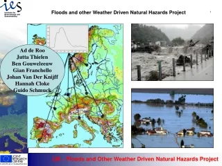
Floods and other Weather Driven Natural Hazards Project. 1. Ad de Roo Jutta Thielen Ben Gouweleeuw Gian Franchello Johan Van Der Knijff Hannah Cloke Guido Schmuck. Floods: potential actions. JRC: European Flood Forecasting. Increase flood warning time European Flood Alert System

E N D
Floods and other Weather Driven Natural Hazards Project 1 Ad de Roo Jutta Thielen Ben Gouweleeuw Gian Franchello Johan Van Der Knijff Hannah Cloke Guido Schmuck
Floods: potential actions JRC: European Flood Forecasting • Increase flood warning time • European Flood Alert System • 0-10 day leadtime; pre-warning to MS authorities • e.g. Elbe authorities: 24 hour forecast • Decrease flood risk • Technical measures • reservoirs • polders / retention areas • increase floodplain storage • increase dyke heights • Environmental measures • land use planning • catchment: (reforestation / afforestation, set aside etc) • floodplain: re-allocation of flood prone settlements • (long-term: combat climate change..) JRC: Scenario studies Oder & Meuse (IKSO, OderRegio)
TRANSNATIONAL CATCHMENTS JRC Catchment Information System August 2002
LISFLOOD system • Meteo data • ECMWF • DWD • DMI… River basin management River basin management LISFLOOD • JRC European Data • Soil, Surface, • river catchment • system, … Flood simulation & forecasting • Member States data • River dimensions, • Alert levels
The LISFLOOD modelling system • LISFLOOD-WB Water balance model initial conditions • LISFLOOD-FS Flood simulation model scenarios • LISFLOOD-FF Flood forecasting model forecasting • LISFLOOD-FP Flood Inundation model inundation extent Floodplain-scale Catchment-scale
Flood Plain Model seconds time step Waterbalance Model daily time step Flood Model Hourly time step Spatial Planning
LISFLOOD : a distributed rainfall-runoff-routing model • Division Rainfall/Snow • Interception • Evapotranspiration • Leaf drainage • Snow melt • Glacier melt • Soil freezing • Infiltration • Vertical soil moisture redistribution • Sub-surface lateral flow • Groundwater recharge • Groundwater flow • Infiltration excess overland flow • Saturation excess overland flow • River channel flow (kinematic and diffusion/dynamic wave) • Reservoir operations • Retention storage (polders
LISFLOOD input and output examples DEM SourceAreas Land Cover LIS FLOOD Discharge Coefficient Soil Type Precipitation
LISFLOOD: Main Principles I • Rainfall: inverse distance interpolation. Altitude correction. • Snowmelt: degree-day method. Altitude correction for Temp. • Interception: storage approach, based on LAI, using equations of Von-Hoyningen-Huene, Merriam and Aston • Daily extra-terrestrial radiation: Angot • Daily incoming solar radiation: Angstrom, Supit or Hargraeves • Evapotranspiration: Penman-Monteith, using dynamic LAI based on satellite images
LISFLOOD: Main Principles II • Soil Freezing: degree-day method (Molnau & Bissell) • Infiltration: Smith-Parlange equation • Saturation excess overland flow • Soil water redistribution between 2 soil layers: Equilibrium method, using van Genuchten hydraulic conductivity curves • Subsurface lateral flow • Percolation to groundwater: based on (Un)saturated conductivity of soil layer 2 and Darcy • Groundwater: two-store approach, routing along LDD
LISFLOOD: Main Principles III • Routing: kinematic wave and Mannings equation for overland flow and channel flow along LDD; dynamic wave for large rivers • Floodplain and river cross section dimensions are used • Reservoirs simulated with user-defined parameters for each specified reservoir • Retention areas simulated with user-defined parameters for each specified retention area
Use of satellite images for land use type and soil cover IRS-WIFS used to obtain seasonal variation in cover for each Corine land cover type
Soil maps 1:250.000 Oder Depth to bedrock Topsoil texture
Soils: how we use them in LISFLOOD Inputs: Look-up tables (HYPRES et al): Infiltration parameters infiltration topsoil texture topsoil Van Genuchten parameters h/v transport subsoil texture subsoil Van Genuchten parameters h/v transport depth to bedrock water storage Parent material Groundwater parameters groundwater
The LISFLOOD model: a tool for River Basin Management Original land cover map Reforestation scenario Simulates the effects of scenarios on floods and the water balance: • Changing land use in upstream areas: • reforestation • deforestation • set aside • urban growth • Consequences of climate change • Modifying river and floodplain dimensions • Building water retention areas • Building water reservoirs 20% reduction in peak flood EGEO UNIT: NATURAL HAZARDS PROJECT
Evaluation of flood defense plans Oder-LISFLOODreportJuly 2002close cooperationwith MS and IKSO, includingaccession countries
Scenario results Oder: Discharge changes 2001-2030(if flood action plan is carried out)
TOWARDS A EUROPEAN FLOOD ALERT SYSTEM 21 Link to ECMWF established Flood forecasts for all major rivers: 10 day weather forecasts: Additional data rainfall temperature + LISFLOOD MODEL 10-day forecast Meuse: 20-30 January 1995 with uncertainty range discharge forecast Example of a warning report
TheEuropeanFlood Forecasting System 10-day rainfall forecast per hour 22-01-1995 31-01-1995 DMI 0-72 ECMWF 73-240
The European Flood Forecasting System: zoom . 10-day forecast hourly discharge: 22-01-1995 31-01-1995 LISFLOOD model
EFAS team tasks European Flood Alert System : EFAS daily quick check on Rnf, also other rnf sources, WB, Q, news, Q, critical levels, Persistency to previous days, Keep logbook NO ALERT ALERT Automatic model simulation (At present: over night. Soon twice a day.) Qobs Pobs Forecasts ECMWF DWD 0 3 6 9 12 15 18 21 24 • get overview from other data sources • Monitor carefully the second simulation and check persistency • Discuss flood risk and how to proceed further with team • Unofficially inform NWA contact • In case crisis becomes certain contact DSS • in the morning check midnight run, and check status of morning run • keep logbook • Validate results if possible • - Assess scores and improve system • EFAS server • Data conversion • Data storage … Automatic 24h waterbalance On ALERT 10-day forecasts
Meuse (Borgharen) 19-01-1995 / 28-01-1995 P ECMWF Q LISFLOOD 1km
Meuse (upstream Borgharen) 20-01-1995 / 29-01-1995 P ECMWF (old EPS system) Q LISFLOOD 1km
Oder flood 1997: Miedonia (upper-Odra) 970702 970703 970705 970704
Flood Pre-Warning for 20-01-95 until 30-01-95 Example 0: all clear 1: flood watch 2: flood warning 3: severe flood warning
Outlook: • Flood modelling: • 1:250;000 data for Elbe + Danube • Validation for Danube and Elbe • Scenarios • European Flood Alert System • Drought forecasting • Using seasonal weather forecasts • Model modifications where needed • Irrigation • Landslide forecasting • Model modifications where needed
For more information:ad.de-roo@jrc.itEuropean CommissionDG Joint Research CentreIES - Ispra - Italy