
Understanding Differential GPS: Mechanism and Communication Methods
E N D
Presentation Transcript
Differential GPS An Introduction
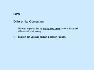
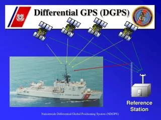
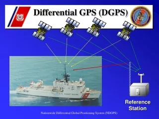
Method of Differential Correction • The reference ground station(s) at known locations receive NAVSTAR signals. • Knowing position of the station, the pseudo-range to each SV is calculated based on the almanac • The measured pseudorange, PRM(t), is determined • The pseudorange correction is calculated as the difference • The pseudorange correction, PRC(t), and the Range Rate Correction RRC(t) are sent from the reference ground station
Method of Differential Correction • Local GPS calculates corrected position Corrected pseudorange = pseudorange measured + pseudorange correction PR(t) = PRM(t) + PRC(t)
Local GPS Communications • NMEA 0183 used to communicate fix data from GPS devices • Serial character data • Baud Rate 4800 • Data Bits 8(d7=0) • Parity None • Stop Bits One(or more) • RTC SC 104 used to communicate differential data • Serial character data
RTCM SC 104 • Specification for the signal used to transmit differential correction to a GPS ground receiver • Format is referred to as the RTCM-104 format (Radio Technical Commission for Maritime Services Special Committee No. 104)
RTCM SC 104 Messages • Type 3 - Station coordinates • Type 9 - (Fast Type 1) Correction data • Scale Factor (.02 m and .002 m/s or .32 m and .032 m/s) • User Differential Range Error • 1 sigma error is < 1,2,4,8,greater • Satellite ID - PRN code • PRC - Pseudorange correction • RRC - Range Rate Correction • Issue of Data - Link to the particular GPS data from which calculations are derived • … • Sent in 30 bit words including a 5 bit parity
NMEA 0184 Example • Global Positioning Fix Data • $GPGGA,120757,5152.985,N,00205.733,W,1,06,2.5,121.9,M,49.4,M,,*52 • Synopsis: • time of fix (hhmmss) • latitude • N/S • longitude • E/W • Fix quality (0=invalid, 1=GPS fix, 2=DGPS fix) • number of satellites being tracked • horizontal dilution of position • altitude above sea level • M (meters) • height of geoid (mean sea level) above WGS84 ellipsoid • time in seconds since last DGPS update • DGPS station ID number • checksum
How to determine Health of the NAVSTAR and Coast Guard Systems • Check the Coast Guard web site for status • http://www.nis-mirror.com/default.html