Download
1 / 51
520 likes | 548 Vues
This webinar delves into surveying specifics in Canada's North, with emphasis on land reference systems, monuments, and survey instructions, including practical examples and Q&A.

E N D
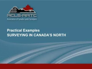
Practical Examples SURVEYING IN CANADA’S NORTH What is covered in this Webinar? • What’s specific to surveying in Canada’s North? (vs. surveying in southern jurisdictions) • Differences between surveys in the Yukon, Northwest Territories, and Nunavut • Practical Examples • Q&A
Practical Examples SURVEYING IN CANADA’S NORTH Surveying In Canada’s North • Land Reference System (NTS grid, quad & group lots, lots & blocks, Oil and Gas grid) • First Nations Lands (reserves & comprehensive claims, survey specifications) • Survey Instructions (exceptions) • Monuments (types, markings, restoration) • Plans (Field note information, supplementary information)
Practical Examples SURVEYING IN CANADA’S NORTH Land Reference System • NTS Grid • The National Topographic Map System Grid is used extensively (1:50k map sheets) to reference lands outside of communities (both surface rights and sub-surface mineral rights).
Practical Examples SURVEYING IN CANADA’S NORTH Land Reference System Quad Lots The actual limit of the NTS 1:50k Quad isn’t defined on the ground, it is only used for referencing the location of surveyed lots (e.g., Lot 1003, Quad 86O/4 is the third lot to be surveyed in Quad 86O/4
Practical Examples SURVEYING IN CANADA’S NORTH Land Reference System Quad Lots cont’d Lot numbers 1000 to 1010 were issued by the Office of the Surveyor General for the survey of 10 mineral claims in Quad 86O/4. There were previously no other surveys in this Quad.
Practical Examples SURVEYING IN CANADA’S NORTH Land Reference System Group Lots Prior to the adoption of the NTS grid system in 1977, a system with larger individual areas known as Groups formed the basis for referencing surveyed parcels and other interests in land. Lot 1 Group 1087 (in yellow) comprises a large part of Iqaluit.
Practical Examples SURVEYING IN CANADA’S NORTH Land Reference System Community Lots Different types • Lots and Blocks within a Community • Lots and Blocks within a Named Subdivision • Lots within Community
Practical Examples SURVEYING IN CANADA’S NORTH Land Reference System Oil and Gas Grid • Used for oil and gas interests in the North and Offshore • Northwest Territories Line of Delimitation partially defined by the oil and gas grid (101827 CLSR NT) • Inuvialuit Land parcels partially defined by oil and gas grid; also some of Sahtu sub-surface parcels
Practical Examples SURVEYING IN CANADA’S NORTH From Aurora Research Institute First Nations Lands • There are only two First Nation Reserves in the North; both are in the Northwest Territories: • Salt River 195 for the Salt River First Nation • Hay River Dene 1 for the K’atlodeeche First Nation • There are many Comprehensive Land Claim Agreements in the three territories: • Yukon First Nations - 11 Final Agreements (Liard First Nation, Ross River Dena Council, White River First Nation not settled yet) • Inuvialuit, Gwich’in, Sahtu Dene and Métis, Tłı̨chǫ (Dehcho, Akaitcho and the NWT Métis Nation not settled yet) • Nunavut, Nunavik • The lands surveyed under the Comprehensive Land Claim Agreements were surveyed under various specific survey instructions; in many cases, isolated boundary standards were issued to provide relief from the standard maximum one kilometre posting interval.
Practical Examples SURVEYING IN CANADA’S NORTH Survey Instructions • Canada Lands Surveyor (CLS) must register to use the online system, MyCLSS. (https://www.myclss.ca/) • Prior to commencing a cadastral survey on lands in Canada’s North, the CLS must open a survey project online in MyCLSS and apply to the Surveyor General of Canada Lands for Survey Instructions. • Depending on the area and type of survey, the Survey Instructions will indicate what lot (quad lot, lot and block, etc.) numbers are to be used for the survey and will provide other specifications to be followed. • The MyCLSS does not apply to surveys for Real Property Reports, fencing, as-built surveys, etc.
Practical Examples SURVEYING IN CANADA’S NORTH Survey Monuments - Types • Monuments approved for surveys in Canada`s North are of two basic types (National Standards, Ch 1.2 par. 3): • CLS Standard Post and CLS Standard Rock Post • CLS 77 Post and CLS 77 Rock Post
Practical Examples SURVEYING IN CANADA’S NORTH Survey Monuments – Types, cont’d • An additional type is approved only for surveys of mineral claims (National Standards, Ch 13.2 par. 27 b&c)
Practical Examples SURVEYING IN CANADA’S NORTH Survey Monuments – Types, cont’d • Many historical monuments: • DLS Standard Post and DLS Standard Rock Post * • CLS 69 Post and CLS 69 Rock Post • Pits and Mound • Mound and Trench buzzable) *After around 1960 these posts were non-magnetic (non-buzzable).
Practical Examples SURVEYING IN CANADA’S NORTH Survey Monuments - Markings • Monuments are marked specific to the survey (National Standards, Ch 1. par. 7): • year of survey • lot, bare land condo unit, or parcel numbers • ‘R/W’ or ‘R’ for a right of way or a road • ‘IR’ for First Nation Reserve • ‘NP’ for National Parks • consecutive monument number in ‘rural and remote’ areas (e.g., 1L1000, 2L1000,etc.) • ‘WT’ on a witness monument, with distance and general direction (e.g., WT 15 N)
Practical Examples SURVEYING IN CANADA’S NORTH Survey Monuments – Re-establishment & Restoration • There is a record in the Canada Lands Surveys Records (CLSR) of virtually every survey monument placed during a cadastral survey in Canada’s North. • If your survey project is contiguous to an existing survey you are required to deal with any previously placed monuments that are missing or damaged along the common boundary and indicate how they were dealt with, on your survey plan. • The National Standards, Ch 1.5 gives additional details, but in general, the following terminology is used to describe how the missing or damaged monuments are dealt with: • ‘lost or disturbed’ – re-establish • ‘obliterated’ – restore from traces of
Practical Examples SURVEYING IN CANADA’S NORTH Survey Monuments – Re-establishment & Restoration, cont’d • Even if your survey is not a MyCLSS project, if you restore or re-establish a survey monument during the course of your survey, you must file a report/field notes with the Surveyor General of Canada in the form of what was previously known as an LS56. #16B Field Notes of Re-Establishment and Restoration of Monuments (LS56)
Practical Examples SURVEYING IN CANADA’S NORTH Survey Plans • Survey plans generally provide field note information, either on the face of the plan or by reference to a Field Book Number. • Field Books are recorded in the Canada Lands Surveys Records and contain additional information to support the survey, such as: • Survey Report • Supplementary Field Notes • Pin-pricked Aerial Photographs • Survey plans that have no prospect of being finalised are converted to ‘Field Notes’ and are recorded in the CLSR in order to maintain a record of the monuments that were placed. Alternatively, the monuments are removed.
Practical Examples SURVEYING IN CANADA’S NORTH Some Basic Differences Between the Three Territories • Devolution • Evolution of Legislation • Mining Legislation • Oil and Gas Grid • NAD83 (CSRS) Epoch From Wikipedia
Practical Examples SURVEYING IN CANADA’S NORTH Devolution • Definition from a ‘Google’ search: • dev·o·lu·tion • the transfer or delegation of power to a lower level, especially by central government to local or regional administration • Yukon was the first, in 2003. • Northwest Territories was next, in 2014. • Nunavut – currently (2018) negotiating a devolution agreement with the Government of Canada
Practical Examples SURVEYING IN CANADA’S NORTH Evolution of Legislation • The Northwest Territories is the oldest of the three territories. After it was created in 1870 and subsequent to the addition of the Arctic islands in 1880, much of its land mass was overtaken by the expansion and/or creation of various provinces: Quebec, Ontario, Manitoba, Saskatchewan, and Alberta. Yukon was carved out of the Northwest Territories in 1898; Nunavut was established in 1999. • Legislation for the Yukon and Nunavut generally remained the same immediately after the creation of each new territory, mirroring the pre-existing legislation until the new territories had an opportunity to revise and customise the Acts and Regulations to suit their individual circumstances. • Devolution has resulted in a similar process occurring in the Yukon and the Northwest Territories, in regard to federal legislation. • It is important to keep this in mind when reviewing the current legislation of each territory; subtle differences can easily be overlooked but can have significant consequences for surveys; e.g., requirement for NAD27 vs. NAD83 datum.
Practical Examples SURVEYING IN CANADA’S NORTH Mining Legislation • Yukon has three types of mining surveys: surveys of mineral claims granted under the Quartz Mining Act (QMA) ; surveys of placer claims granted under the Placer Mining Act (PMA); and surveys of placer base linesunder the Placer Mining Act. A fourth type, rarely if ever surveyed, includes surveys of leases under the Dredging Regulation (Territorial Lands (Yukon) Act (SY 2003, c 17). (From Mining Surveys, Yukon) • The Northwest Territories does not have placer claims nor baselines. A number of older but still active claims (approximately 30) were staked prior to 1977 under the former Northwest Territories Quartz Mining Regulations. The current legislation applicable to mining in the Northwest Territories is: • For GNWT territorial lands the Mining Regulations, under the Northwest Territories Lands Act (SNWT 2014, c 13) • For Northwest Territories federal lands the Northwest Territories Mining Regulations, under the Territorial Lands Act (RSC 1985, c T-7)), Legal surveys may also be required to define the boundaries of dredging rights for lease purposes under the Territorial Dredging Regulations, under the Territorial Lands Act (CRC, c 1523).
Practical Examples SURVEYING IN CANADA’S NORTH Mining Legislation, cont’d • Nunavut does not have placer claims nor baselines. It also doesn’t have any pre-1977 mineral claims. The current mining legislation is the Nunavut Mining Regulations, under the Territorial Lands Act (RSC 1985, c T-7). Legal surveys may also be required to define the boundaries of dredging rights for lease purposes as per the Territorial Dredging Regulations, under the Territorial Lands Act (CRC, c 1523). • The existing Nunavut Mining Regulations are being amended to implement map-staking. The issuance of mineral rights under the proposed map-staking regime is expected to be based on the current oil and gas grid system.
Practical Examples SURVEYING IN CANADA’S NORTH Oil and Gas Grid • In the Northwest Territories, Nunavut, and the Offshore, the land division system under the Oil and Gas Land Regulations pursuant to the Northwest Territories Lands Act and the Canada Oil and Gas Land Regulations pursuant to the Federal Real Property and Immovables Act and the Territorial Lands Act is referenced to the North American Datum of 1927 (NAD27). • The system of land division for oil and gas rights in the Yukon differs from that used in NT, NU and the Offshore: • Sections are to be bounded on the north and south sides by parallels of latitude spaced at intervals of one-tenth of the interval between the north and south boundaries of the grid area, not by straight lines. • All latitudes and longitudes to be used are NAD 83, not NAD 27. (From Chapter 12, Oil and Gas Surveys – Yukon ppt )
Practical Examples SURVEYING IN CANADA’S NORTH NAD83 (CSRS) Epoch • Northwest Territories 2010.0 • Nunavut 2010.0 • Yukon 2002.0 https://webapp.geod.nrcan.gc.ca/geod/tools-outils/ppp.php?locale=en
Practical Examples SURVEYING IN CANADA’S NORTH Practical Example #1 Mineral Claim Survey in NT A client calls and asks for an estimate on the cost to survey four mineral claims north of Yellowknife: Goodwin#6, Goodwin#7, TXR7, TXR60. • Preliminary Research: • Mineral Claim Information from GNWT • Survey Information from Canada Lands Surveys Records • Mining Regulations • National Standards • Getting a Survey Done • ACLS Practice Manual • Logistics, Scheduling
Practical Examples SURVEYING IN CANADA’S NORTH Mineral Claim Survey in NT • Northwest Territories Centre for Geomatics website: • http://www.geomatics.gov.nt.ca/public_webapps.aspx
Practical Examples SURVEYING IN CANADA’S NORTH Mineral Claim Survey in NT • Northwest Territories Centre for Geomatics website: • http://www.geomatics.gov.nt.ca/public_webapps.aspx
Practical Examples SURVEYING IN CANADA’S NORTH Mineral Claim Survey in NT Mining Recorder’s Office Industry Tourism and Investment Yellowknife, NT 867-767-9210 ext 63464 Goodwin #6 A-form & sketch
Practical Examples SURVEYING IN CANADA’S NORTH Mineral Claim Survey in NT TXR7 A-form & sketch
Practical Examples SURVEYING IN CANADA’S NORTH Mineral Claim Survey in NT TXR60 A-form & sketch
Practical Examples SURVEYING IN CANADA’S NORTH Mineral Claim Survey in NT Google Earth http://www.nrcan.gc.ca/earth-sciences/geomatics/canada-lands-surveys/11092#CLGoogleEarth
Practical Examples SURVEYING IN CANADA’S NORTH Mineral Claim Survey in NT Google Earth
Practical Examples SURVEYING IN CANADA’S NORTH Mineral Claim Survey in NT Google Earth
Practical Examples SURVEYING IN CANADA’S NORTH Mineral Claim Survey in NT Canada Lands Survey System http://clss.nrcan.gc.ca/clss/plan/search-recherche
Practical Examples SURVEYING IN CANADA’S NORTH Mineral Claim Survey in NT FB 23151 CLSR MC
Practical Examples SURVEYING IN CANADA’S NORTH Mineral Claim Survey in NT FB 23151 CLSR MC
Practical Examples SURVEYING IN CANADA’S NORTH Mineral Claim Survey in NT • Prior to 1929, under the Quartz Mining Regulations, mineral claims in what is now the Northwest Territories and Nunavut were defined by a two post system - each end of a baseline was marked with a claim post and call distances to the left and right from the 'Number 1' location post (defined as "legal posts" under the Northwest Territories and Nunavut Mining Regulations, C.R.C., c. 1516) defined the extent of the claim. The maximum claim size was 51.65 acres. In 1929 the system was changed to a four post system, where each corner of the claim was marked with a claim post. In 1960, under the Canada Mining Regulations, perimeter surveys of a group of adjoining claims were introduced. Finally, in 1977 the maximum claim size was increased to 2,582.5 acres, with location posts placed a maximum of 1,500 feet apart along the claim boundaries, with tags on each one of the four corner posts. (From Historical Canada Lands eEdition http://clss.nrcan.gc.ca/clss/standards-normes/hist-chaps) Regulations
Practical Examples SURVEYING IN CANADA’S NORTH Mineral Claim Survey in NT • Quartz Mining Regulations1932 (P.C. 507) and amendments, under the Dominion Lands Act (RSC 1927, c. 113) • Mining Regulations, under the Northwest Territories Lands Act (SNWT 2014, c 13) • Government of the Northwest Territories Department of Justice Website, Regulations under the Northwest Territories Lands Act :https://www.justice.gov.nt.ca/en/legislation/#gn-filebrowse-0:/n/northwest-territories-lands/ Regulations, Cont’d
Practical Examples SURVEYING IN CANADA’S NORTH Mineral Claim Survey in NT Regulations, Cont’d Definitions: • "legal post" means a post, tree or mound of stones set up in accordance with section 26 to serve as a boundary post, corner post or witness post; • "boundary post" means a legal post, excluding a corner post and a witness post, marking the boundary of a claim or a plot of land that is being staked with the purpose of making it a claim; • "corner post" means a legal post marking the northeast, southeast, southwest or northwest corner of a claim or a plot of land that is being staked for the purpose of making it a claim; • "witness post" means a legal post set up in accordance with section 29 to provide reference to the corner of a claim or a plot of land that is being staked with the purpose of making it a claim;
Practical Examples SURVEYING IN CANADA’S NORTH Mineral Claim Survey in NT Regulations, Cont’d Evidence placed by Staker: • 26. (1) A legal post must be one of the following: (a) in a treed area, (i) a post of sound wood planted firmly in an upright position and standing not less than one metre above the ground, with at least the upper 30 centimetres squared off so that each face of the squared portion is not less than four centimetres in width, or (ii) a tree found in position and cut off not less than one metre above the ground, with at least the upper 30 centimetres squared off so that each face of the squared portion is not less than four centimetres in width; (b) in a treeless area, either a post described in subparagraph (a)(i) or a mound of stones that is not less than one metre in diameter at the base and not less than 50 centimetres in height. ........
Practical Examples SURVEYING IN CANADA’S NORTH Mineral Claim Survey in NT Regulations, Cont’d Evidence placed by Staker
Practical Examples SURVEYING IN CANADA’S NORTH National Standards & Getting a Survey Done http://clss.nrcan.gc.ca/clss/surveystandards-normesdarpentage
Practical Examples SURVEYING IN CANADA’S NORTH Getting a Survey Done • http://www.nrcan.gc.ca/sites/www.nrcan.gc.ca/files/earth-sciences/files/pdf/land-surveys/1_1-Addendum(201506001).pdf
Practical Examples SURVEYING IN CANADA’S NORTH ACLS Practice Manual https://www.acls-aatc.ca/files/english/publications/Practice%20Manual%202015.pdf
Practical Examples SURVEYING IN CANADA’S NORTH Logistics, Scheduling • Site access: • Road access? • Remote? • Camp provided?, Required? • On-site transportation – provided?, Required? • Land use permit in place? Required? • Scheduling: • Length of field season • Client on-site schedule • Claim 10 year anniversary date • Field crew availability • Air transport availability
Practical Examples SURVEYING IN CANADA’S NORTH Practical Example #2 Deferred Monumentation A developer calls and asks for an estimate on the cost to lay out the lots and prepare a plan of survey for a new subdivision to be created in Nunavut. After completing your research and further consultations with the developer you determine that the ground in the area of the survey is rocky outcrop and will require blasting prior to construction. You suggest deferred monumentation as the best option and explain the process to the developer.
Practical Examples SURVEYING IN CANADA’S NORTH Deferred Monumentation – Plan 1 Plan of Field Notes of Control Survey Network
Practical Examples SURVEYING IN CANADA’S NORTH Deferred Monumentation – Plan 2 Plan of Survey (for Deferred Monumentation)
Practical Examples SURVEYING IN CANADA’S NORTH Deferred Monumentation – Plan 3 Field Notes of Final Placement of Monuments