Download
1 / 36
360 likes | 472 Vues
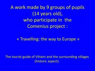
Touristic guide of the region of Vihiers and the surrounding villages. A work made by pupils (13 years old), who participate in the Comenius project : “ Travelling: the way to Europe”.

E N D
Touristic guide of the region of Vihiers and the surrounding villages.
A work made by pupils (13 years old),who participate in the Comenius project : “ Travelling: the way to Europe”. ClovisAlex AntoineNinon MarietteCharlélieAlanJessySarahStéphanieAudreyRomyMarionSteveSébastienHugo
1°) The Countries of the Loire. (Les Pays de la Loire)2°) The Anjou.3°) The département of Maine et Loire.4°) The river « le Layon ».5°) Vihiers or the country vihiersois.6°) The Mauges.
The history of the country of the Loire The administrative region of Pays de la Loire was created in 1955. The countries of the Loire are called like that because this "country" is crossed by a river: The Loire.
A river, the Loire, and among its numerous tributaries: the Maine (made by the Loir, the Mayenne, the Sarthe), the Aubance, the Layon…
LOCALISATION of the Pays de la Loire The Pays de la Loire contain five departments: the Maine et Loire, the Mayenne, the Sarthe, the Loire Atlantique and the Vendée.
The population of the departments: (in number of inhabitants). Logo until june, 2006.
Identitycard of the pays de la Loire: Surface; 32082km2. Population: 3 426 000 inhabitants. Regional prefecture: Nantes ( loireAtlantique). Sub-prefectures: Angers (Maine-et-Loire), Laval (Mayenne), Le Mans (Sarthe), La Roche-sur-Yon (Vendée). The biggest town: Nantes (282000 inhabitants). Main industries: food-processing, mechanical materials, aeronautics, shipbuilding, research centers. Agriculture (Farming): 2nd French agricultural region (milk, cattle, poultry and eggs, pigs, cereal). French classification: 5th French region
An important axis : Nantes / Paris. First logo of the région in the 90s.
The limits: The Atlantic Ocean constitutes the limit on the West of the region. Bordering regions are: for the North, Brittany and low Normandy, in the South, Poitou-Charentes and Centre region. The countries of the Loire are near the Atlantic Ocean, what allows to have a maritime business and a seaside tourism (aquatic sport, yachting). The countries of the Loire have of 450km coast and 240km of the Loire of which 75km registers on the heritage of UNESCO, 400km of navigable river.
Les pays De la Loire
Economic activities : In the Pays de la Loire, the GDP (Gross domestic product) is 90 billion euro in 2008 that is 4.6 % of the national GDP. Pays de la Loire are the third French region in the food-processing industry, with 51 % of the production of meat, 19 % for the milk and 20 % in the work of the grain.. Pays de la Loire also occupy an important place in the field of the vine growing (production of wine). Thanks to its ports, Pays de la Loire employs half of the jobs on the fishing and the navy in France.
Cultures and breedings : Vineyards Cereals Beetroot Oléaginous plant Chicken Brood cows Pigs Dairy cows
2°) The Anjou Anjou is a big province which already existed in the middle Ages. It holds its name of Gallic people: the Andécaves which lived there in this time . The counts of Anjou enlarged their territory according to their conquests, resisting to the British invasions. L’Anjou
In Anjou, there are 759 000 inhabitants. The capital is Angers which account 283 000 inhabitants. The rest of the inhabitants is especially distributed around the Loire and around its tributaries. Angers
The territories : Anjou includes a part of the Mayenne, Indre-et-Loire, Deux-Sèvres and Vienne.
Territories : Anjou includes a part of the Mayenne, Indre-et-Loire, Vienna and Deux-Sèvres. Population : The population groups together into three big regions: Angers and its suburb, Saumur and the region of Cholet. The vine growing : The vine growing is very present in Anjou. Two big regions are the region of the Layon and the Aubance. With 20 000 hectares, it is the more vast vineyard of the Val de Loire.
Twobig axes Anjou is a strategic crossroads. Many highways cross by Angers as A 11: Paris / Angers / Nantes, A 85: Angers / Saumur / tours.... The direct lines of TGV are numerous. There is an airport in Angers with international connections.
3°) The Maine et Loire Maine et Loire has a 7166 km² surface. In 2006, there were 766 659 inhabitants in Maine et Loire.
Most big cities of Maine-et-Loire are Angers, Cholet, Doué la Fontaine, Segré, Chemillé and Saumur.
The most frequented places of interest: The castle of Brissac-Quincé The castle of Angers The abbey of Fontevraud.
The Oriental Parc of Maulévrier Zoo of Doué la Fontaine
4°) The layon:A river at the edge of which the vineyard grows.. The Layon extends of Concourson over Layon to Chalonnes-over-Loire. In this region there are good wines: some rosé, some white wine and some wines of the hillside of the Layon. There are many hectares of vineyard. We also find beautiful landscapes in the Layon.
The Layon, recognized for its old wine heritage of more than fifteen centuries, is also appointed as historic border between Poitou and Anjou. At the end of the 18th century, during the wars of Vendée , the Layon was used as demarcation line enters republican and royalist.
The Layon contains some cities and villages (See list). There are approximately 15000 inhabitants. List of the villages crossed by the Layon. Cléré-sur-Layon ; Saint Georges-sur-Layon ; Saint-aubin-de-Luigné ; Passavant-sur-Layon ; Faveraye-Machelles ; Chaudefonds-sur-Layon ; Nueil-sur-Layon ; Thouarcé ; Saint-Lambert-du-Lattay Verchers-sur-Layon ; Rablay-sur-Layon ; Concourson-sur-Layon ; Beaulieu-sur-Layon ;
5°)VihiersLe vihiersois Haut-Layon The Association of local authorities of Vihiersois-Haut-Layon is a city group, situated in the department of Maine-et-Loire and the region of the Countries of the Loire.
Vihiersois-Haut-Layon is located in a triangle between Angers, Cholet and Saumur.
The Association of local authorities of Vihiersois-Haut-Layon groups together 12 municipalities: • Cernusson (263 inhabitants) • Les Cerqueux-sous-passavant (478 inhab.) • Cléré-sur-Layon (333 inhab.) • La fosse de Tigné (184 inhab.) • Montillers (1 147 inhab.) • Nueil-sur-Layon (1288 inhab.) • Passavant-sur-Layon (131 inhab.) • Saint-Paul-du-Bois (568 inhab.) • Tancoigné (285 inhab.) • Tigné (754 inhab.) • Trémont (382 inhab.) • Vihiers (4125 inhab.) The total population of the Vihiersois-Haut-Layon account 9 938 inhabitants with a 266.88 km² surface. The density of population of Vihiersois-Haut-Layon is thus 37 hab / km ².
6°) The Mauges Angers Environment Vihiers
The country of The Mauges is in the southwest of Maine-et-Loire and appears under the shape of a vast tray which gets up slightly in the South. The peak is in "Gardes" in 216 meters. This 1528 km² territory is bounded in the North by the Loire, in the South by the SèvreNantaise . On the other hand the east and western limits are not recognizable.
In 1037, The Mauges is the last territory to have entered Anjou. They are landscapes of copse (fields surrounded by hedges).
Demography The population is 120 240 inhabitants. Itsdensityis 80 inhab/km². Cholet, one of the biggest cities of The Mauges, account 54 632 inhabitants. Cholet
Economy and activities : There are 3 600 companies on the territory of The Mauges. We add up more than 40 000 jobs among which: - 10 % in the agriculture (farming). - 30 % in the industry. - 20 % in the small business sector. - 40 % in the tertiary sector. The agricultural activity extends over 120 022 hectares of surface. It occupies about 80 % of the territory of The Mauges. One account 3 363 farms among which 2 380 professional. Their surface, on average, is 47 hectares. The particular sectors are the breeding of cow and the production “except ground” (produced under greenhouse and not on the ground). The agricultural population represents 12 % of the population of The Mauges.
Sources internet: www.gifsanimes-fr.com, www.gifsanimes.net, www.toutimages.com Icône-gif.com Google map.com The end. http://upload.wikimedia.orghttp://img62.imageshack.ushttp://www.tourisme-vihiersois.comhttp://fr.wikipedia.org/ http://soeursprovidence49.cef.fr www.quigif.comGilbord.over-blog.com commons.wikimedia.ogwww.augrenadier.com etudescoloniales.canalblog.comwww.medarus.org/.../euro-drapeau.comles.guillotines.free.fracademic.rufbaillot.blog.lemonde.frhome.schule.at/hyuntal.files.wordpress.comgenerationtao.files.wordpress.com