When GOOD Maps Go BAD (Cartography)
When GOOD Maps Go BAD (Cartography). E.J. McNaughton. Introduction. Cartography The study and practice of making maps Combines Science, Aesthetics, and Technique to create an ART based on the premise that reality can be modeled in ways that communicate spatial information effectively.

When GOOD Maps Go BAD (Cartography)
E N D
Presentation Transcript
When GOOD Maps Go BAD (Cartography) E.J. McNaughton
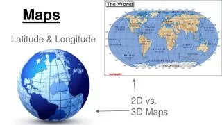
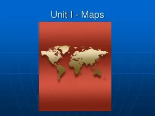
Introduction Cartography • The study and practice of making maps • Combines Science, Aesthetics, and Technique to create an ART based on the premise that reality can be modeled in ways that communicate spatial information effectively
What Makes a good map? “I don’t know much abut cartography but I know what I like”
What Makes a good map? • Conveys information to the map readers • Based on the interpretation of the viewer • Accurate, Current, Topical, Aesthetic, Timely, Relevant, and Informative • It is controlled by Map Size, Map Elements, Symbology, Typography, Color, and Design
General Map design “For a successful map, we should not stick to accurate representation, but design them in the way our brains work.” — ArisVenetikidis
Concept before compilation • Design the whole map before the part • Design once, devise, design again • Once the map purpose is achieved, do not include any feature that doesn’t fit • Important things must look important! • All parts contribute to the whole
Simplicity from sacrifice • Great design tends towards simplicity (KISS) • Design is complete when you can take nothing else out • Content determines scale or scale determines content • How much info can be gained from the map AT A GLANCE? • Minimize the users effort • Designs are always a compromise
Engage emotion to engage understanding • Only by feeling what the user feels can we see what the user sees • Aesthetics focuses the attention • Focusing the attention is the purpose of map design
Basic Principles “There are three kinds of lies: lies, damned lies, and maps.” — Mark Twain”
Visual Contrast • Extent a symbol contrasts with its background and other symbols • The basis of seeing • “Crisp, clean, sharp” • Lack of contrast can be effective • Too much contrast can overload
Visual Hierarchy • “Visual layering” of map features • Internal graphic structuring that portrays levels of importance • Goal is the separation of characteristics to show similarities, differences, and relationships
Extensional Hierarchy • Ranking of features like points and lines • Ordinal symbolization • Objective is to show relative importance • Visual variables (size, value, texture)
Visual Balance • Layout that promotes well-balanced design • Light/dark, small/large, long/short, within/outside • Relative position • Visual importance of map elements • Visual weight of each item • White space
Legibility • Ability to be seen AND recognized • Symbol size • Contrast colors and shapes • Familiarity • Perfect vision and conditions “2 minutes of angle at the eye”
Visual Flow • Movement of the eye across the page • Design can force they eye to move in a desired manor
Symbol Selection Process • Graphic marks • Point, line, area, surface, pixels • Visual Variables • For the different graphic marks • For the different conceived spatial structures • For the different levels of measurement • Level of measurement • Of data describing each feature • Of information about the feature that we want to communicate to the map reader • Spatial dimension • Point, line, area, surface, volume
In Cartography • Quantitative • Value (Lightness) • Chroma (Saturation) • Spacing (Texture) • Size (incl. Perspective Height) • Qualitative • Hue • Orientation • Shape • Arrangement
Questions? “A map is the greatest of all epic poems. Its lines and colors show the realization of great dreams.” ― Gilbert H. Grosvenor
Resources • http://mappingcenter.esri.com/ • http://blogs.esri.com/esri/arcgis/category/mapping/ • Books • Elements of Cartography • Map Use (Reading, Analysis, and Interpretation) • How to Lie with Maps “Making a map with GIS is like playing the piano. Somebody else has done the difficult job of making the tools, you just need to know what buttons to push!”
Thank you! “The good cartographer is both a scientist and an artist. He must have a thorough knowledge of his subject and model, the Earth…. He must have the ability to generalize intelligently and to make a right selection of the features to show. These are represented by means of lines or colors; and the effective use of lines or colors requires more than knowledge of the subject – it requires artistic judgment.” ― Erwin Josephus Raisz