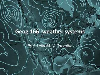
Weather Dynamics Explained: The Science of Weather Patterns
500 likes | 537 Vues
Explore the study of how air and water motion influence weather patterns. Learn about Earth's components affecting weather, global geography, heat transfer methods, and the atmosphere's layers. Discover the Earth's energy sources, heat sinks, specific heat capacity, types of heat, and latent energy in the climate system.

Weather Dynamics Explained: The Science of Weather Patterns
E N D
Presentation Transcript
Weather Dynamics • Weather dynamics is the study of how the motion of water and air causes weather patterns. • The main components of Earth that affects weather are the atmosphere, the land forms, and water in the forms (solid, liquid, and vapor).
Web sites to know and love! • Environment Canada • http://weatheroffice.ec.gc.ca/canada_e.html • USA Today site – Weather basics http://www.usatoday.com/weather/resources/basics/wworks0.htm
Weather vs. Climate • Weather - is the set of environmental conditions encountered from one day to the next. • Today is …. • Climate - is the set of environmental conditions averaged over many years. • What is the climate of St. John’s?
Global Geography • Longitude - the angle measured east or west from the 0° line, which passes through Greenwich, England. • Latitude - the angle measured south or north of the equator. • Equatorial Region - region located between the Tropic of Cancer and the Tropic of Capricorn. • Polar Regions - Region north of the Arctic Circle and the region south of the Antarctic Circle. • Mid-latitude Regions - Regions between the tropics and the polar regions.
The following methods of heat transfer distribute energy around the Earth. 1. Radiation is the transfer of energy by waves. Radiation does not require a medium. Visible light is one form of radiation that reaches us from the sun via empty space. Visible light is only one member of the electromagnetic spectrum. Some other waves from this spectrum are: microwaves, X-rays, infrared waves, etc.
2. Conduction is the transfer of energy through the collision of particles. A frying pan on a stove element heats up by conduction. Some materials are better conductors of heat than others. Metals are generally better conductors than some materials such as rock, sand, sand, etc. 3. Convection is the transfer of energy verticallyby movement of particles in a fluid ( water or atmosphere). 4. Advection is the transfer of energy horizontallyby movement of particles in a fluid ( water or atmosphere).
The Energy of the Sun • The Sun is the Earth’s main source of electromagnetic radiation. Not all of the solar energy reaching the Earth’s atmosphere actually reaches the land and water. See fig.4 of your text. • Some solar radiation gets reflected back into space. How much radiation that is reflected at any given time is dependent upon the surface features.
The albedo (percentage of light reflected) of a material will determine how much radiation is reflected. Clean snow has a high albedo whereas black soil has a low albedo. • Any material that absorbs energy and becomes warmer is called a heat sink. The oceans are good heat sinks whereas soil and rock are poor heat sinks. • The heat capacity of a substance will indicate whether a substance is a good heat sink or not.
Specific Heat Capacity • the measure of how much heat a substance requires to increase it’s temperature one degree.( Or how much energy it releases as it’s temperature decreases.) • Figure 5 in your text shows the heat capacity of some common substances.
Types of Heat • Latent heat of fusion • The amount of heat needed to change a unit mass of a substance from a solid to a liquid. • Latent heat of vaporization • The amount of heat needed to change a unit mass of a substance from a liquid to a gas. • ‘Latent’ means ‘hidden’. When a substance changes state, the substance either absorbs or releases energy without changing temperature. • A substance will have its own latent heats of Fusion and Vaporization constants. Vaporization requires more energy than Fusion. • Water has latent heat of fusion of 3.3 x 10⁵ J/kg and a latent heat of vaporization of 2.3 x 10⁶ J/kg
The Atmosphere • The atmosphere consists of air and moisture that surrounds the Earth. The common atmospheric gases are oxygen, nitrogen, carbon dioxide, and water vapor. • The density of the atmosphere varies with height above sea level (most dense at sea level). • Altitude is the height (m or km) above sea level. • The atmosphere is thicker above the equator than it is above the poles. Warmer air takes up more space because warmer air expands.
Six layers of the Atmosphere • 1. Troposphere - the layer closest to the Earth’s surface. Altitude of 8 km at the poles and up to 16 km at the equator. Most of our weather occurs in this layer. The upper part of this layer is colder than the lower part. • 2.Tropopause – the transition layer between the troposphere and stratosphere • 3. Stratosphere - a dry layer located between 12 km and 50 km above the Earth’s surface. This layer contains high concentrations of ozone. Ozone protects the Earth from harmful doses of ultraviolet given off by the sun. The ozone also cause the stratosphere to be warmer.
Atmosphere (continued) • 4. Mesosphere - the middle layer extends from 50 km to 80 km. This layer has low concentrations of gases and low temperatures. • 5. Thermosphere - extends from 80 km to 500 km. It is in this layer that X-rays (from the sun) are absorbed. This absorption by the few air molecules in this layer gives the molecules energy producing higher temperatures. The sun’s radiation cause the particles in this layer to become electrically charged to produce the northern and southern lights. • 6. Exosphere - the thin outer part of our atmosphere. There are very few particles (mainly hydrogen) in this layer.
Check out this site! • http://www.mardiros.net/atmosphere/
Gradients • Temperature Gradient - The change in temperature over a distance. The troposphere has a temperature gradient of -60 C per 1000 m (vertical distance) • Pressure Gradient - is a measure of the amount the atmosphere pressure changes across a set distance. A pressure gradient can be vertical or horizontal. A line graph or closed lines on a map can indicate a pressure gradient. To show a high pressure, lines a bunched together and vice versa for a low pressure.
Atmospheric Pressure • Atmospheric Pressure • the pressure the air exerts as gravity pulls it toward the Earth. Atmospheric pressure is greatest at sea level where the air molecules are closer together. • Atmospheric pressure generally decreases with altitude but falling/rising air will also affect atmospheric pressure. Atmospheric pressure is measured in kilopascals. (See text p.512) The average atmospheric pressure at sea level is 100kPa.
Prevailing Winds • A wind is a movement of air in the atmosphere. • Prevailing winds are winds that affect large areas/weather around the world. • Winds are affected by the Earth’s rotation. • The apparent change in direction of a moving mass in a rotating system is called the Coriolis Effect.
Major Prevailing Winds • 1. Polar Easterlies - near the poles , the air is cold and dense. This air sinks and moves toward the equator. The Earth’s rotation cause this air mass to twist to the right in the northern hemisphere (left in South) causing the easterlies. • 2. Mid-latitude Westerlies - At 300 latitude, some of the warm air from the equatorial convection current meets the cold polar air and a low pressure forms around 600 latitude. The surface air moving north twists to the right in the northern hemisphere (left in Southern hemisphere) to form the mid latitude westerlies.
3. The Trade Winds - the sun heats up everything at the equator. Hot air rises leaving behind a low pressure. This rising air moves northward, cools and becomes more dense and falls around 300 latitude. This air moves back towards the equator (low pressure area) producing the trade winds. This air movement twist to the right in the northern hemisphere to form the northeast trade winds (they twist left in the southern hemisphere - southeast trade winds)
4. Jet Streams - high speed winds in the upper troposphere near the middle altitudes. This is due to the different thickness of the troposphere. Where the troposphere is thicker (equator) the atmospheric pressure is greater. The higher pressure air at the equator will move northward while twisting.
The Hydrosphere • The hydrosphere is made up of both fresh and salt water found on Earth. Approximately 70% of the Earth’s surface is water. Only 2.5 % of all water is fresh. Of this 2.5 % , most of the fresh water on Earth is frozen in glaciers and in the ice caps.
The Water Cycle • Review Figure 4 on page 523 of your text. • Radiant energy from the sun causes water to evaporate or ice to sublimate. • Transpiration in plants adds to the formation of water vapor. • The water vapor rises , cools, and condenses into fog, mist, and clouds. • This precipitation falls to the Earth and the process repeats.
Phase Changes of Water • Evaporation - process of changing a liquid to a vapor. • Sublimation - process of changing a solid to a vapor • Condensation - process of changing a vapor to a liquid.
Major Ocean Currents • The oceans have an important effect on weather dynamics. • 1. The oceans occupy a large portion of the Earth’s surface. Water’s high heat capacity will affect temperature changes in a given area. • 2. Since there is a large vast of water at the equator, where the sun is most direct, ocean currents act as conveyer belts to transport energy around the world. • The major ocean currents are shown in figure 1 on page 525 of your text. Note that the direction of the major ocean currents are similar to the directions of the major winds.
Causes of Ocean Currents • 1. Solar heating of the oceans near the equator set up convection currents. • 2. The continents will redirect water movement along its edge. • 3. Earth’s eastward rotation affects ocean currents. Currents on the east side of oceans tend to be fast, those on the west side of oceans tend to be wider and slower. • 4. The salt content affects ocean currents. As water evaporates, sea water becomes saltier and sink, setting up convection currents.
Clouds and Fog • Solar energy heats up water causing evaporation. • This mixture of water vapor and heated air rises in the atmosphere. • As the moist air rises, air pressure and temperature lowers, causing condensation to occur. • If the temperature drops low enough ice crystals will form.
Three categories of Clouds • 1. Convective Clouds - formed when air near the ground absorbs energy from heated surfaces and rises in the atmosphere. The water vapor cools, condenses, forming clouds. • 2. Frontal Clouds - form where the leading edge, or front, of a large moving mass of air meets another mass of air at a different temperature. Warm air contains more water vapor and will be pushed up by a cold air mass. The rising warm air will cool and water vapor condenses to form clouds. • 3. Orographic Clouds - form when air moves up a mountain, expands at the lower pressure, and cools. Clouds are formed when water vapor in this air cools and condenses.
Fog • Fog is actually a cloud at ground level. Air near the ground cools (especially on clear nights ) and water vapor condenses into fog. • Fog is produced when: • 1. On clear nights, energy from the Earth’s surface radiates upward but is not reflected back to Earth by clouds. The air near the ground cools, allowing water vapor to condense into fog. • 2. When warm air passes over a snow-covered ground or moist sea air drifts over a cold current (or seashore), fog forms. • 3. When warm air rises up the sides of a mountains during orographic lifting.
Cloud Classification • Two General Shapes • 1. Cumulus clouds - these clouds have a rounded billowing shape. They tend to grow vertically, usually indicating unstable weather. They are usually formed as a result of: convection currents, orographic lifting, or when a cold air front moves into a warm air mass. • 2. Stratus clouds - these clouds have a flattened, layered shape. They tend to grow horizontally and usually indicate stable conditions. They usually form where the front of a warm air mass overruns a cold air mass.
Further classification • According to height: • alto - medium height clouds • cirrus - high-level clouds • Also: nimbus - rain-holding cloud.
What to know for the test! • Notes • Chapter 13 sections 1, 2, 3, 4, 6, 8, 9, 11, 13. • Chapter 14 section 2, 4, 5, 6, 9
Types of Precipitation • Read Section 14.5 pp. 556-557 and answer questions 2, 5 & 6.