Map of Postclassical Africa: Key Regions and Trade Routes
160 likes | 292 Vues
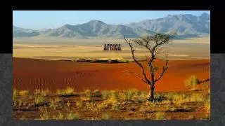
This map illustrates the geographic and cultural landscape of Postclassical Africa, highlighting significant areas such as the Sahara Desert, Sub-Saharan regions, Swahili Coast, and the Forest Kingdoms, including Ethiopia and Nubia. It depicts essential trade routes for land and sea, as well as the spread of Islam and Christianity, marked by black and red arrows, respectively. Key locations such as Timbuktu and notable resources like gold and salt mines are also identified, providing insight into the economic and religious dynamics of the time.

Map of Postclassical Africa: Key Regions and Trade Routes
E N D
Presentation Transcript
Postclassical Africa Map Africa Mapwork Psto
AP World Regions http://apcentral.collegeboard.com/apc/public/repository/AP_WorldHistoryCED_Effective_Fall_2011.pdf (page 22)
-Swahili coast -Forest kingdoms -Ethiopia and Nubia -Kingdoms of the Grasslands Kingdoms of the Grasslands
Spread of Islam: black arrowsSpread of Christianity: red arrows