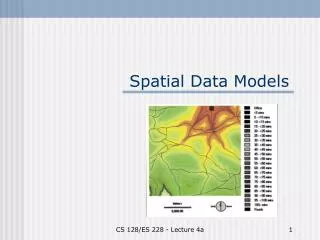
Spatial data models
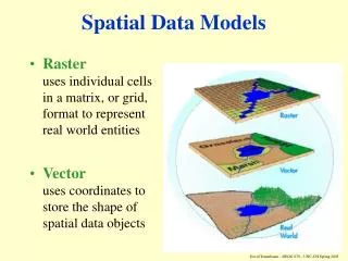
Spatial data models. Raster exhaustive regular or irregular partitioning of space associated with the field view location-based Vector points, lines, areas associated with the object view object-based. Spatial data models. Vector data models.


Spatial data models
E N D
Presentation Transcript
Spatial data models • Raster • exhaustive regular or irregular partitioning of space • associated with the field view • location-based • Vector • points, lines, areas • associated with the object view • object-based
Vector data models • An object (as opposed to field or location) viewpoint of space • represent geographic entities as discrete objects composed of points, lines, and polygons
Vector data models • Spaghetti vector data model • each point, line, or polygon that represents a geographic entity is stored as a record in a file that consists of that entity’s ID and a list of coordinates that define it’s location (or the coordinate space that it occupies)
Vector data models • Spaghetti vector data model • relationships among objects are implied
Vector data models • Spaghetti vector data model • advantages • simple • efficient for display and plotting • disadvantages • inefficient for most types of spatial analysis
Vector data models • Vector topologic data model • composed of points, lines, and polygons • node: a point at the intersection of two or more lines • in addition to coordinate locations, the topologic relationships between geometric features are explicitly recorded
Vector data models • Vector topologic data model
Vector data models • Vector topologic data model
Vector data models • Vector topologic data model: GBF/DIME
Vector data models • Vector topologic data model: POLYVRT (hierarchical data structure)
Vector data models • Freeman - Hoffman chain-code for compacting vector storage
Vector data model • TIN: Triangulated Irregular Network
Vector data model TIN: Triangulated Irregular Network
Vector data model • TIN: Triangulated Irregular Network
Vector data model • Hybrid vs. integrated systems for vector data models • A hybrid system stores spatial data in one type of data model and the attribute data in another data model that is often an existing commercial non-spatial database • An integrated system manages both spatial and attribute data using the same data model
E B A D C F ID Length Key A 5 1 B 6 2 C 6 2 D 7 1 E 9 1 F 9 3 Key Name Length 1 Main St. 21 2 Elm St. 12 3 Spruce St. 9