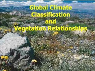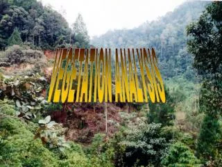
Vegetation Analysis… FROM SPACE
Vegetation Analysis… FROM SPACE. Rowan Converse. Remote Sensing and Mapping of Tamarisk along the Colorado River, USA: A Comparative Use of Summer-Acquired Hyperion, Thematic Mapper and QuickBird Data . What was the purpose of this analysis?


Vegetation Analysis… FROM SPACE
E N D
Presentation Transcript
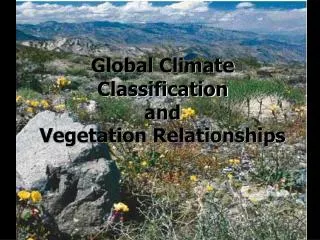
Vegetation Analysis… FROM SPACE Rowan Converse
Remote Sensing and Mapping of Tamarisk along the Colorado River, USA: A Comparative Use of Summer-Acquired Hyperion, Thematic Mapper and QuickBird Data • What was the purpose of this analysis? • What scale was this analysis done on? On what scale has this analysis performed before? • What sources were used for this analysis? What kinds of comparisons were being made? • Multispectral? Hyperspectral? What??
Multispectral Image Analysis • What is a multispectral image? • Wavelengths on the electromagnetic spectrum are separated by filters or instruments. • This allows us to render visible information that the human eye cannot capture. • True-color vs false-color analysis • Hyperspectral image: a multispectral image with extremely high resolution, hundreds of bands
MODIS (Moderate Resolution Imaging Spectroradiometer) • Instrument aboard NASA’s Terra and Aqua satellites • Coarse resolution, used for continental-scale analysis • Images the entire earth’s surface every 1-2 days; data in 36 spectral bands
Thematic Mapper (TM5)/Landsat • Multispectral data: eight spectral bands, spatial resolution of 30 meters; temporal resolution is ~16 days • The world’s longest-running, continuous collection of moderate-resolution satellite imagery of the Earth’s surface (since 1972) • Currently on the 7th working satellite in this program
Hyperion • One of three main instruments on the Earth-Observing (EO)-1 spacecraft • Hyperspectral data: can resolve 220 spectral bands = very high-resolution images of the Earth’s surface • 30 meter ground sample distance over a 7.7 kilometer swath • Greater complexity of analysis available with finer detail • What USGS has to say about Hyperion’s capabilities: • “Hyperspectralimaging has wide ranging applications in mining, geology, forestry, agriculture, and environmental management. Detailed classification of land assets through the Hyperion will enable more accurate remote mineral exploration, better predictions of crop yield and assessments, and better containment mapping.”
QuickBird (QB) • High-resolution, multispectral satellite imagery (2.4 and 2.8 meter resolution) • A commercial rather than governmental satellite • Fourth-highest resolution of all commercial satellites
Steps of the analysis 1) Calibrated the data using outside data, and landmarks in the study area • Lake vs road was important for different types of spectral data due to differences in reflectivity 2) Image processing and classification • Determined value ranges that were characteristic of tamarisk vs other vegetation • Supervised vs unsupervised algorithms: • “In supervised classification, spectral signatures are developed from specified locations in the image. These specified locations are given the generic name 'training sites' and are defined by the user. Generally a vector layer is digitized over the raster scene.” • Unsupervised: the user inputs only the # of classes desired and which bands to use– the program then divides the landscape into classes based on these bands without any other information from the user. This can be a check on user bias. Source: http://academic.emporia.edu/aberjame/student/banman5/perry3.html
Results/Conclusions • Which image source/processing method offered highest accuracy in identifying tamarisk? • What role did the condition of the vegetation itself play? What role did environmental conditions play? • How might this type of analysis be useful for other invasive plant species? What are its limitations?
Basic Image Processing: NDVI • A simple analysis method to determine the presence of live green vegetation • Rendering in near-infrared (where plants are highly reflective and bright, compared to clouds/snow, which show up dark)– will still show up green in this analysis • Not necessarily useful in all seasons, or for determining species of plants • Sensitive to atmospheric effects, soil moisture (wet soils make NDVI seem higher), presence of free-standing water, spectral effects • Working with Landsat5 imagery • Based heavily off of Image Processing with ArcGIS 10.1 online tutorial
NDVI Workshop 1) On the shared drive, copy the NDVI folder to the desktop/C drive/wherever you would like 2) Open ArcMap 3) From the NDVI folder, add the MtStHelens map document 4) There is one Landsat image from 2010 already saved as a layer on the map. Let’s add another from an ArcGIS online image service for comparison! • In the Catalog window, go to GIS Servers Add ArcGIS server Use GIS Services type http://imagery.arcgisonline.com/arcgis/services for URL • Then, in the Catalog window, expand new LandsatGLS5 folder and drag TM_Multispectral_1990 onto the map to add it as a layer
NDVI Workshop Cont’d 5) Open the Image Analysis window (Windows Image Analysis). Pin it to the right with the Catalog and Search windows where it will be easy to access and not impede your view of the map document. 6) Clip the data to the study area so there is a smaller image to process: • Make sure you are zoomed to ‘Study Area’ bookmark. Then, in image processing window, highlight both layers and click the ‘Clip’ tool under Processing (a square w/scissors) 7) If you like, examine the difference between the two layers using Swipe and Flicker in the Image Analysis window (1990 can be hard to make out– you can change the bands to make it easier to visualize but for the purpose of this exercise we can still analyze it the way it is).
NDVI Workshop Cont’d 8) Now, time for NDVI! In the Image analysis window: Options NDVI tab Set the red band to 3 and the infrared band to 4 (keep ‘Use Wavelength’ box checked) 9) Back in the regular Image Analysis window, in the processing section, use the NDVI tool (a green leaf). Do each layer separately. 10) Use Flicker and/or Swipe to look at the difference in vegetation on Mt. St. Helens across the 20-year span– much more impressive this way, right? • Make sure you uncheck everything but the two NDVI layers before you do this • Where has the most regrowth been concentrated?
The End!! Now you can analyze vegetation… FROM SPACE!!
Answers for myself • Scale: Continental scale: MODIS data for mapping out potential tamarisk habitat in the lower 48: not suitable for detection of existing populations due to coarse resolution • Scale: Intermediate scale: Landsat Thematic Mapper for local populations in China; Arkansas River CO had 98% discrimination rate from other veg. • Purpose: To figure out the most efficient way to map the spread of and evaluate management efforts of tamarisk in the west • Comparing high-spatial-resolution, multispectral satellite imagery (2.5 m QuickBird) and 30 m hyperspectral (Hyperion) or multispectral (TM5) data