SlideServe
Menu
Préférences
© SlideServe · v2026

Location, Location, Location

tarika avatar
18 diapositives · 398 Views · Jul 16, 2014

Location, Location, Location. Geodesy. The study of the size and shape of the Earth. The Earth is…. 3000 BC Babalonians An oyster 600 BC Greeks Flat 500 BC a perfect shape A sphere 300 BC Circumference ~ 25,000 miles,
Location, Location, Location - slide 1
01 / 18Location, Location, Location
1 / 17

Télécharger la présentation

Location, Location, Location
Une image / un lien ci-dessous est fourni (tel quel) pour télécharger la présentation

Politique de téléchargement : le contenu du site vous est fourni TEL QUEL pour votre information et votre usage personnel ; il ne peut être vendu, concédé sous licence ni partagé sur d’autres sites sans l’accord de son auteur.Le contenu vous est fourni TEL QUEL, pour votre information et votre usage personnel uniquement. Téléchargez la présentation en cliquant sur ce lien. Lors du téléchargement, si vous ne parvenez pas à télécharger une présentation, l’éditeur a peut-être supprimé le fichier de son serveur.Pendant le téléchargement, si vous ne parvenez pas à obtenir une présentation, le fichier a peut-être été supprimé par l’éditeur.

F I N

Plus de contenu associé

Transcription de la présentation
  1. Location, Location, Location

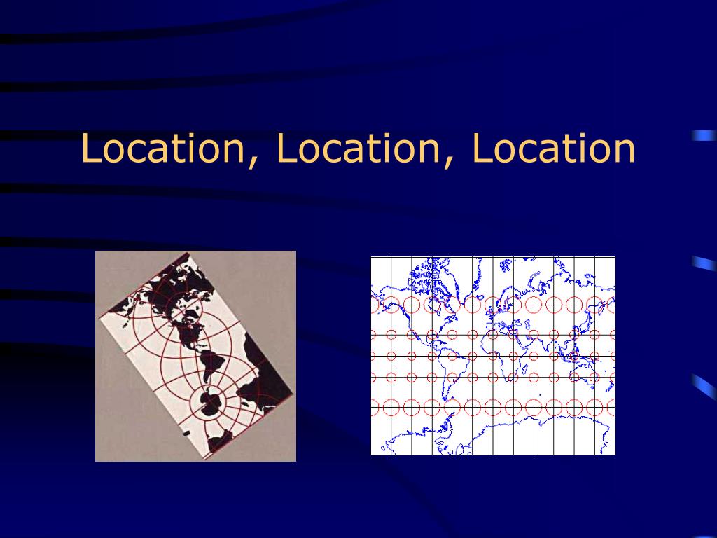
  2. Geodesy The study of the size and shape of the Earth.

  3. The Earth is… • 3000 BC Babalonians An oyster • 600 BC Greeks Flat • 500 BC a perfect shape A sphere • 300 BC Circumference ~ 25,000 miles, • Dark ages Flat again • 1492 Columbus A pear • 1753 French Oblate ellipsoid • Spheriod • Geoid to describe the deviations from a spheriod

  4. The Earth as a Geoid

  5. Geographic Coordinate System • Parallels • Meridians • Great and Small Circles

  6. Geographic Coordinate System GCS uses a 3-D spherical surface to define locations on Earth. GCS includes an angular unit of measure, a prime meridian and a datum.

  7. Locating yourself on a Sphere • You need a frame of reference • That is the purpose of Latitude and Longitude • Defining these parameters: • Earth rotates on an imaginary axis ~ North and South Poles • Equator: is a great circle that lies equidistant between them.

  8. Great Circles • ..are imaginary circles of the surface of the earth who's plane passes through the center of the earth. • The circumference of the earth is 25,000 miles or 40,000 km • "Great" because it is the largest possible circle

  9. Great Circles: • Cut the earth in half and each half is known as a hemisphere • Are the circumference of the earth • Provide the shortest routes of travel on the earth's surface. • ** Planes travel in great circles. • ** We were always taught a line is the shortest distance between two points - Not True. • Small circles: circles whose planes do not pass through the center of the earth.

  10. Latitude • Latitude: is the angular distance north or south of the equator. (0 –90 degrees N or S) • 1° of latitude = 40,000 km/ 360° • 1 degree = 60 minutes • 1 minute = 60 seconds 36°49'52" N • ArcView 3.x uses Decimal Degrees only • Sextant measures the angular distance between 2 points (sun & horizon) • **So it easy to determine latitude.

  11. Longitude: • Longitude: no natural reference point • In 1884 by International Agreement Greenwich England was the chosen starting point. • This is called the prime meridian or zero degrees and everything is east or west of that. • Longitude is the angular distance east or west from Greenwich, England • (0 – 180 degrees E or W)

  12. Geographic Coordinate System • Longitude and Latitude • Degrees, minutes, seconds • 1o latitude ~110.5 km (equator) • 1o longitude = cosine of the latitude • 1 minute of latitude ~1852 m

  13. How to convert from DMS to DD • Example: 37°36’30” • Divide each value by the number of minutes or seconds in a degree • 36 minutes = .60 degrees (36/60) • 30 seconds = .00833 degree (30/3600) • Add it all up • 37° + .60 + .00833 = 37.60833 DD

  14. The global grid: • Parallels: lines of latitude, only the equator is a great circle all other parallels are small circles (they never meet) • Meridians: these are line of longitude and when joined with its mate half way around the globe form great circles • * the distance between meridians will vary with latitude

  15. How the Earth is Divided • Hemispheres: Northern, Southern, Eastern, Western

  16. Time Zones • Solar noon: most towns used this, defined as when a vertical stake cast the shortest shadow. • By the 19th century transportation and communications (namely railroads and telegraph) connected towns and cities, the adopt of a standard time was necessary.

  17. Time Zones (continued) • 1884 at the International Meridian Conference 24 time zones were established. • Greenwich Mean Time (GMT) = Universal time = Zulu time • 360°/24 = 15° for each time zone, however for convenience many time zones follow state and country lines. • International Date Line: where each new day begins 180th meridian • Chronometer

  18. Time Zones