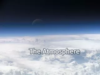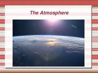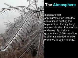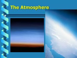
The Atmosphere
The Atmosphere. What is the atmosphere made of?. 78% is nitrogen 21% is oxygen The remaining 1% consists of the following: argon, hydrogen, carbon dioxide, water vapor, and other gases. . Why is water vapor important?.

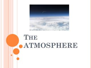
The Atmosphere
E N D
Presentation Transcript
What is the atmosphere made of? • 78% is nitrogen • 21% is oxygen • The remaining 1% consists of the following: argon, hydrogen, carbon dioxide, water vapor, and other gases.
Why is water vapor important? • Water vapor is the gas form of water, and without it, clouds could not form. • Water is also the only substance in the atmosphere that exists in three different states, solid, gas, and liquid. (snow, clouds, and rain)
What is ozone? Ozone: a layer in the atmosphere that absorbs ultraviolet radiation from the sun. Without ozone, our skin could not tolerate exposure to the sun for very long.
Layers of the atmosphere • The atmosphere is made up of several different layers.
1) Troposphere: the layer closest to the Earth. • This is the layer that most weathering takes place, and most pollution collects. • As you go from the bottom to the top of the troposphere, it get colder.
2) Stratosphere: the layer above the troposphere. • This layer is made up primarily of ozone. • Because the stratosphere absorbs a lot of radiation, it is heated, and temperature increases towards the top part.
Mesosphere The layer above the Stratosphere but below the Exosphere. This is where you see meteors as they burn up. Temperature decreases as you go up through this layer.
4) Exosphere: the outermost layer of the Earth’s atmosphere. • Light gases such as helium and hydrogen are found here. • Above the exosphere lies outer space, but there is no clear boundary between the atmosphere and space.
The sun is the source of all energy in the atmosphere. It gets to the Earth in 3 ways: 1) Radiation 2) Conduction 3) Convection
Radiation is the transfer of energy through space by visible light and ultraviolet radiation. Radiation
conduction: transfer of energy when molecules collide. • An example of conduction is when a heated pot transfers the heat energy from the pot to the water in the pot. • In the same way, energy is transferred from particles of air near Earth’s surface to the particles of air in the lower atmosphere.
convection: the transfer of energy buy the flow of a heated surface. • In a pot of boiling water, the water near the bottom is heated first, then expands, forms bubbles, and rises, bringing warm water to the top.
Air Masses and Life Cycles of Weather Systems Analyze air masses and the life cycle of weather systems: Planetary wind belts. Air masses.
Classification of Air Masses • Air masses are classified by the region they form. • These regions determine the temperature and humidity of the air mass. • There are four regions that air masses form: • Continental (over land)-dry air masses • Maritime (over oceans)- moist air masses • Tropical (over warm areas)-warm air masses • Polar (over cold areas)-cold air masses
Continental Air Masses: Continental Polar Continental Tropical • Form over large land masses • Have low humidity • Two types : • Continental Polar- cold and dry air mass • Continental Tropical- warm and dry air mass
Maritime Air Masses: Maritime Polar Maritime Continental • Form over oceans or other large bodies of water • This air mass has higher humidity and often brings fog to areas. • Two types: • Maritime Polar- cold and moist air mass • Maritime Tropical- warm and moist air mass
Weather Systems Frontal systems. Cyclonic systems Wind patterns are caused by differences in air pressure at different locations on the Earth. The unequal heating of the Earth’s surface creates air pressure differences . Low pressure belts are created as air is heated and rises (equatorial and low latitudes). High pressure belts are created as air is cooled and falls (high latitudes).
Fronts • A front is a boundary between two air masses. • There are four types of fronts: • Cold Front • Warm Front • Stationary Front • Occulded Front
Cold Fronts Cold fronts form when cold air overtakes warm air The cold, dense air pushes the less dense warm air upward. If the warm front is moist large cumulus clouds will form. This can form a long line of severe thunderstorms called a squall line.
Warm Fronts Form as a cold front leaves an area. Less dense warm air rises over the cooler air. This rising air produces a gradual slope with the cool air so clouds can extend far ahead of the warm front causing precipitation over large areas.
Stationary and Occulded Fronts Stationary Front Occulded Front Formed when air masses meet and move very slowly or not at all. The cold air moves parallel to the front. A fast moving cold front overtakes a warm front. The warm air is lifted off the ground.
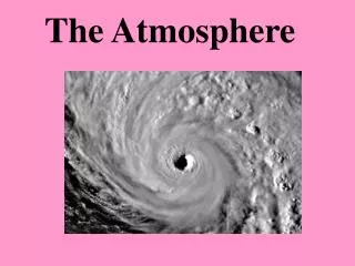
Cyclones Cyclones form in mid-latitudes where cold polar air meets warm tropical air. Midlatitude cyclones are areas of low pressure which have air moving toward the rising air of the low pressure region. In North America these cyclones generally spin counter clock-wise in an easterly direction and can last for several days.
Tornadoes Tornadoes are the smallest and most violent storms. They form when a thunderstorm meets high altitude horizontal winds. The winds cause the warm, rising air in the thunderstorm to rotate. The thunderstorm may develop a narrow, spinning cloud that may or may not reach the ground.
Hurricanes or Tropical Storms • Hurricanes differ from cyclones in several ways: • They cover a much smaller area • They lack warm and cold fronts • They are much more violent • They have winds that travel 120 km/hr and spiral inward towards the low-pressure center.
Formation of Hurricane Hurricanes develop over warm, tropical water. Warm air moving over the ocean rises rapidly, condenses, and releases energy. This energy is called Latent Heat. Hurricanes cause a rise in sea level and large waves known as a storm surge.
Classifying Hurricanes Hurricanes are categorized by the Saffir-Simpson Scale.
How Do Clouds Form? Clouds form as warm air is forced upward, expands, and cools until it reaches its dew point. The water vapor condenses, forming water droplets that group together. When millions of these droplets collect, clouds form.
3 Ways Clouds Form #2 Clouds form when warm, moist air is forced to rise over a mountain. The air cools and the water vapor condenses. #1 Clouds form when warm air is forced up in a convection current caused by solar radiation heating the Earth’s surface. #3 Clouds form when 2 air masses meet. Warmer air is forced up over the cooler air. As the warm air cools to its dew point, the water vapor condenses, or gets together to form clouds.
How are clouds classified? 4 main cloud types By SHAPE and HEIGHT
CIRRUS CLOUDS - VERY HIGH CLOUDS MOSTLY MADE OF ICE CRYSTALS - THEY LOOK VERY STRINGY, THIN, AND HAIR-LIKE - USUALLY OCCUR IN FAIR WEATHER AND POINT IN THE DIRECTION THE AIR IS MOVING
CUMMULUS CLOUDS - VERY PUFFY AND LUMPY LOOKING CLOUDS - THEY ARE LOW IN ELEVATION, THAT INDICATES WARM AND SUNNY WEATHER - IF THEY ARE HIGH UP AND TALL, THEY CAN GROW INTO THUNDERSTORMS
STRATUS CLOUDS - FLAT SHEETS OF CLOUDS - THESE CLOUDS CAN MEAN AN OVERCAST DAY OR STEADY RAIN AND DRIZZLE - THEY MAY STAY IN ONE PLACE FOR SEVERAL DAYS
NIMBUS CLOUDS • REALLY DARK AND LOW • CLOUDS THAT ARE EITHER • PRODUCING THUNDERSTORMS OR ABOUT TO PRODUCE RAIN - THEY ARE USUALLY A COMBINATION OF ONE OR MORE TYPES OF CLOUDS
Prefixes for Cloud Height Alto: middle elevation clouds Strato: low clouds Cirro: high clouds
Cirrostratus: high clouds that look like fine veils. They are made of ice crystals and sometimes appear to form halos around the moon or sun.
Altostratus: form at middle levels and look like thick veils or sheets of gray or blue. If they are not too thick, sunlight can filter through them. They produce light, continuous precipitation.
Nimbostratus: bring long, steady rain, and low to the ground. They often have streaks that extend to the ground.
Cumulonimbus: occurs when a nimbus cloud tows a cumulus cloud. Sometimes they release unexpected, giant thunderstorms.
Conditions necessary to form rain: Air near the ground has to be warm to form water vapor. Then rain droplets will form.
Conditions necessary to form sleet: Air near the ground has to be cold to form many small ice pellets. Then sleet will form.
Conditions necessary to form snow: Air near the ground has to be cold to form snowflakes. Then snow will form.
Conditions necessary to form hail: Hailstorms are pellets of ice that form as the ice nuclei go up and down in the cloud.
Sources NOAA The National Oceanic and Atmospheric Administration The Encyclopedia of Earth www.eoearth.org Wikipedia Freedigitalphotos.net Wikimedia commons Weather.com