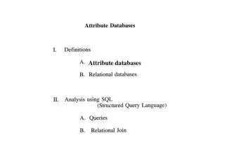
Attribute Extraction
This guide provides instructions on using various ArcToolbox functions to extract, select, clip, merge, append, and analyze geospatial data at a county level using GIS software.

Attribute Extraction
E N D
Presentation Transcript
Attribute query extraction You have tracts for an entire state, but want tracts for one county only
Attribute query extraction • Select tracts by County FIPS or ANSI ID • Cook County = 031
Attribute query extraction • Cook County tractsare selected • Export to new featureclass or shapefile
Add new layer • Cook County tracts
Select By Location • City of Pittsburgh tracts within municipality
Select by Location • Select municipality of Pittsburgh first
Points Near Polygons Schools near parks
Points Near Polygons View schools in attribute table
Points Near Points Schools are near convenient stores
Polygons Intersecting Lines Neighborhoods that Intersect Streets
Lines Intersecting Polygons Streets or sidewalks that intersect floodplains
Polygons Intersecting Polygons Buildings completely within zoning area
Clip • Acts like a “cookie cutter” to create a subset of features. • Clip features (Central Business District) • Output features (CBD streets) • Input features (streets)
Clip vs Select By Location • Clip • Clean edges • Looks good • Select by Location • Dangling edges • Better for geocoding
Clip vs Select by Location • Penn Avenue – ranging from street segment 1000-1098
Dissolve • Create regions using U.S. States • Use SUB_REGION field to dissolve • Sum population
Dissolve Results • States dissolved to form regions • Population summed for each region
Append • Appends one or more data sets into an existing data set • features must be of the same type • input datasets may overlap one another and/or the target dataset • TEST option: field definitions of the feature classes must be the same and in the same order for all appended features • NO TEST option: Input features schemasdo not have to match the target feature classes's schema
Append • DuPage and Cook County are combining public works and need a new single street centerline file
Append • Append will add DuPage streets to Cook County Streets
Resultant Layer • One street layer (Cook County) with all records and field items
Merge • Combines multiple input datasets of the same data type into a single, new output dataset
Resultant Layer • New merged voting district layer
Union • Overlays two polygon layers • resulting output layer has combined attribute data of the two inputs • contains all the polygons from the inputs, whether or not they overlap
Union • Neighborhoods and zip codes
Union • Better describes characteristics of a neighborhood. • Central business district 15222 vs 15219
Union • Attributes tables contain different fields and data
Union Results • New polygons with combined data
Intersect • Floodzones and buildings
Intersect Result • Only building polygons that intersect flood zones with combined data fields
Model builder overview • Workflow processes can be complicated • Models automate and string functions together • Example • You have census tracts for a county and want to create neighborhoods for a city • Many steps are needed to create neighborhoods (join, dissolve, etc)