Download
1 / 9
100 likes | 288 Vues
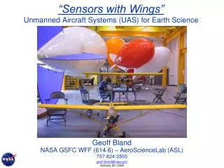
“Sensors with Wings” Unmanned Aircraft Systems (UAS) for Earth Science. Geoff Bland NASA GSFC WFF (614.6) – AeroScienceLab (ASL) 757-824-2855. Measurement Objectives. Agricultural and Environmental Observations Atmospheric Measurements Chlorophyll (Ocean Color) Salinity Soil Moisture

E N D
“Sensors with Wings”Unmanned Aircraft Systems (UAS) for Earth Science Geoff Bland NASA GSFC WFF (614.6) – AeroScienceLab (ASL) 757-824-2855 geoff.bland@nasa.gov January 29, 2009
Measurement Objectives • Agricultural and Environmental Observations • Atmospheric Measurements • Chlorophyll (Ocean Color) • Salinity • Soil Moisture • Snow/Ice Depth geoff.bland@nasa.gov January 29, 2009
UAS Examples • Internally Developed sUAS: • XAP, AEROS • Aerotenna, TwinCam, ImageAireLite • Commercially Provided/Operated UAS: • BAI Aerosystems: Tern • AAI/Aerosonde: Aerosonde • Other NASA UAS: • SIERRA geoff.bland@nasa.gov January 29, 2009
Thermal Infrared Imaging Images from ~400 ft Color Infrared geoff.bland@nasa.gov January 29, 2009
Wallops MicroSpectrometer • Miniature System for Chlorophyll Measurements, Including Ocean Color • 330 -1100 nm • Development Initiated 1999 (Yungel, et al) • <5 lb Instrument & Data System (w/Power) geoff.bland@nasa.gov January 29, 2009
Marsh Ocean Aerotenna • Integrated Sensor System Experiment for Salinity, Soil Moisture and Snow & Ice Thickness Measurements • Resolution ~10 Meters • Prototype Passive L-Band (1.413 GHz) Radiometer (Hilliard, et al) • ~12 lb sUAS with Electric Propulsion geoff.bland@nasa.gov January 29, 2009
TwinCam • Low Cost, Easy-to-Field Proof-of-Concept sUAS • Visible and Near-Infrared (>695 nm) Video Cameras • ~2.5 lb sUAS with Electric Propulsion • Developed for Agricultural Research and Remote Sensing Education geoff.bland@nasa.gov January 29, 2009
ImageAire Lite ii • Thermal Infrared, Visible, and Near-Infrared Imagers with Real-Time Video Downlink • GPS, Temperature, Humidity, and Pressure Measurements • Provisions for Miniature Carbon Dioxide (Anasphere, Vista Photonics) and Sulfur Dioxide (Pieri, et al) Sensors • ~6.5 lb sUAS, Suitable for Shipping, Assembles in Ten Minutes geoff.bland@nasa.gov January 29, 2009
Collaboration Potential • Services – Instrument Integration, Testing and Field Operations • UAS Development and Production • Instrument Development and Production geoff.bland@nasa.gov January 29, 2009