Objectives of the study
170 likes | 193 Vues
This study showcases using VEGETATION data for real-time forest cover mapping, noise reduction strategies, and classifying forest types at a regional scale. It also highlights the potential of SPOT-4 VEGETATION data for updating forest-cover maps efficiently. ###

Objectives of the study
E N D
Presentation Transcript
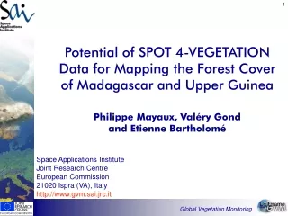
Potential of SPOT 4-VEGETATION Data for Mapping the Forest Cover of Madagascar and Upper GuineaPhilippe Mayaux, Valéry Gond and Etienne Bartholomé Unit name
Objectives of the study • The objectives of this study are • to demonstrate the possibility of updating the forest-cover maps in a near-real time manner using VEGETATION data. • to check the main advantages of VEGETATION for forest mapping at regional scale (geometry, data access, reflectance value) • to test several techniques for reducing the noise in the S-10 products (clouds, missing data, patchy aspect) Global Vegetation Monitoring
Context: the TREES Project • Baseline inventory of dense moist forests • based on AVHRR data of 1992-1993 • update with ATSR and VEGETATION data • Madagascar was missing in the first round • West Africa was not up-to-date Global Vegetation Monitoring
Grasslands and gallery-forests Dense moist forest with agriculture Dense dry forests with burns Secondary complex and dense forest Deciduous Thicket Forests of Madagascar VEGETATION colour composite (R,G,B = SWIR, NIR, R) of June 1999 and Digital Elevation Model Global Vegetation Monitoring
Data and methods • SPOT-4 VEGETATION data • S-10 products • October 1998 to September 1999 • Data preparation • monthly composition • reduce noise (haze and clouds, patchy, sensor) • minimum SWIR • Data classification • unsupervised classification of 36 channels (12 months x 3 channels: R, NIR, SWIR) • visual labelling Global Vegetation Monitoring
Minimum SWIR Monthly compositing June 1st - 10th June 11th - 20th • Noise reduction • Elimination of remaining clouds • Elimination of missing data June 21th - 30th Global Vegetation Monitoring
Temporal profiles Short Wave Infrared channel: monthly compositing Global Vegetation Monitoring
November January March September May July Seasonal activity Global Vegetation Monitoring
Unsupervised classification spectral Labelling spectral, spatial temporal, ancillary 36 channels (R, NIR, SWIR) 30 clusters 6 classes Data classification Global Vegetation Monitoring
Dense humid forest Secondary complex Dense dry forest Mangrove Savannah Swamp Forest cover map of Madagascar Global Vegetation Monitoring
Map Validation Pixel-based comparison with 3 Landsat TM classifications (interpreted by local experts) VEGETATION Landsat TM (158-70) Overall accuracy of the Forest class: 86 % Global Vegetation Monitoring
Forest mapping in West Africa • Forest classes • Evergreen forest (2 classes of density) • Secondary complex • Mangrove • Non forest • Short period with cloud-free images • No well-marked topography Global Vegetation Monitoring
Data and methods • SPOT-4 VEGETATION data • S-1 products • February 2000 • Data preparation • selection of cloud-free images (by eco-region and viewing angle) • channels R, NIR, SWIR • Data classification • unsupervised clustering (20) and visual labelling of the single-date selected images • mosaic of the single-date classifications Global Vegetation Monitoring
Spatial mosaic of 3 imagesFebruary 2000 VEGETATION colour composite (R,G,B = SWIR, NIR, R) Global Vegetation Monitoring
Evergreen forest (dense) Mangrove Evergreen forest (less dense) Non forest Secondary complex Water bodies Forest cover map of West Africa Global Vegetation Monitoring
Forest blocks in Ghana Global Vegetation Monitoring
Conclusions • Capacity of SPOT-4 VEGETATION data to update the forest-cover maps in a rapid manner. • S-10 adapted to seasonal forests (dry forests in Madagascar), S-1 adapted to evergreen forests • Poor mapping of savannahs Global Vegetation Monitoring