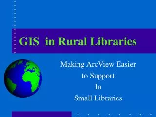
GIS in Rural Libraries
310 likes | 498 Vues
GIS in Rural Libraries. Making ArcView Easier to Support In Small Libraries. GIS in Rural Libraries. Lee Herrington SUNY College of Environmental Science and Forestry,Syracuse NY & The Institute for the Application of GeoSpatial Technology at Cayuga Community College, Auburn NY.

GIS in Rural Libraries
E N D
Presentation Transcript
GIS in Rural Libraries Making ArcView Easier to Support In Small Libraries
GIS in Rural Libraries Lee Herrington SUNY College of Environmental Science and Forestry,Syracuse NY & The Institute for the Application of GeoSpatial Technology at Cayuga Community College, Auburn NY
Overview • Purpose and System • The Region and Library • Objectives • The Plan (AV customization) • The System • Further Development • Summary esf Laboratory for Applied GIS
Purposes of the Project • To provide access to geographic data and information to users of the Indian Lake Town Library (ILTL) • To provide access to GI in such a way that the support load on the Librarian and assistants is minimized in terms of • Learning ArcView • Showing users how to use ArcView • To provide training for the Librarian and assistants esf Laboratory for Applied GIS
System and Data • The System • ArcView 3.2 Library Package • Project is a Modification of the default project • The Data • ESRI data supplied with the Library Package • NYS Data • The NFLI (Northern Forest Lands Inventory) data for New York (area North of the Mohawk River) esf Laboratory for Applied GIS
The Region Indian Lake Area 1,757 sq mi Pop ’90 5,279 = 3/sq mi Pop ’99 5,180 Households 2,153 esf Laboratory for Applied GIS
Library • Indian Lake Town Library • About 1800 square feet • One librarian • Several staff assistants • Computers available • Near center of the hamlet of Indian Lake • Across street from the Central School(K-12) esf Laboratory for Applied GIS
Objective • Provide access to geographic data for users • Elementary & high school students • Residents • Summer residents and tourists • Local government agencies esf Laboratory for Applied GIS
Objectives Requirements • Access had to be provided for users with different levels of knowledge in • Computers (PCs) • Geographic Information • ArcView • So it had to be easy to use while still allowing knowledgeable users to do it on their own. • Ideally, it would allow novice users to learn more about using the normal ArcView interface • A major challenge! esf Laboratory for Applied GIS
The Plan:the Customization of AV Must: • Lead the user through the steps of • Accessing themes and adding them to a View • Working with a View • Creating a Layout esf Laboratory for Applied GIS
The Plan: a Customization of AV Must: • Require little knowledge of AV or GI at first • Allow the user to learn how to use AV • By using as many of the menus, buttons, and tools in native mode and appearance as possible • By having a HELP system designed to instruct • By having several levels of hand holding • Be relatively bullet proof • Lead the user through the steps of esf Laboratory for Applied GIS
Data base • ESRI • Arc USA @ 1 / 2,000,000 scale • Arc World @ 1 / 3,000,000 scale • Arc Digital Chart of the World • Arc data that comes with AV • Digital Orthophotoquads of NY • Geotiffs of NY topo maps • NFLI data for Northern NY Do not have high speed access to the web so data will be on CDs esf Laboratory for Applied GIS
The Plan: Accessing data • These data sets have been created from the existing ESRI, NY State, and NFLI data • For example: • New England data set created by clipping the ESRI USA data to the New England States • Adirondack data from NFLI and State data sets which have been clipped to the county boundaries • Default Legends are made for every theme esf Laboratory for Applied GIS
The Plan: Accessing data • The default apr opens with a dialog that allows the user to • Select a data set OR • Run the Standard ArcView interface • Select the area desired • Select the themes desired • Make a Layout esf Laboratory for Applied GIS
Key Featuresof ILTL system The next slides show the user’s view of the ILTL system for the NFLI data esf Laboratory for Applied GIS
If the user checks this radio button then: Opening apr When the default apr loads this is the first dialog that the user sees. esf Laboratory for Applied GIS
ILTL tools: -Start over -Remove window -Layout Most of AV normal view button and tools. Selection tool active County Selection View esf Laboratory for Applied GIS
Jefferson and Lewis counties selected esf Laboratory for Applied GIS
This dialog allows the user to select from the data common to the selected counties esf Laboratory for Applied GIS
Help button for description of theme Layers Available; Select 1 or many Polygon layers for background; Select 1 Yes This dialog allows the user to select from the data common to the selected counties esf Laboratory for Applied GIS
User selects Roads And political subdivisons esf Laboratory for Applied GIS
OK esf Laboratory for Applied GIS
OK esf Laboratory for Applied GIS
OK esf Laboratory for Applied GIS
Objects can be dragged about with the black arrow tool. Text can be edited by dragging a selection box over the text field with the black arrow and then double clicking the text. Font size and type can be controlled by the symbol window. Use simplify from the graphics menu to ungroup the legend so it can be edited. This text can be used to describe your map by replacing this text with yours or the text can deleted if you do not need a description. esf Laboratory for Applied GIS
When done • Save the Project on your own disk • Print the Layout • Click the button to delete the current view • Click the button to restart esf Laboratory for Applied GIS
Summary • Was a lot harder to do than I expected • Won’t know how well it works until we test in the library • To do: • Finish the help system • Add label capability through dialog • Create other customized data sets • Install and provide instruction to library staff • Evaluate its use (by tracking what people do) esf Laboratory for Applied GIS
Questions? Comments? esf Laboratory for Applied GIS