Download
1 / 24
240 likes | 260 Vues
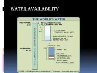
This program aims to develop a comprehensive national assessment of water availability and use through the integration of state datasets, predictive modeling tools, and applied research. It includes initiatives such as the Brackish Groundwater Assessment and the Water Use by HUC and Aquifer. The goal is to provide accurate assessments of water resources, determine available water for beneficial uses, and forecast future availability.

E N D
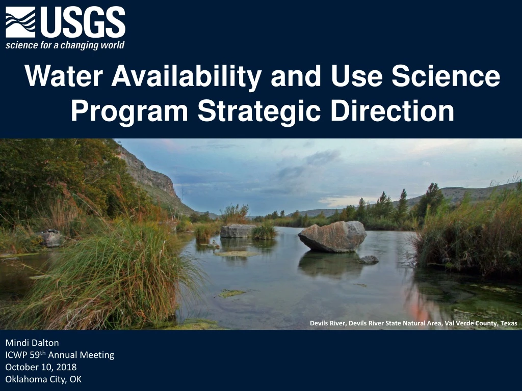
Water Availability and Use Science Program Strategic Direction Devils River, Devils River State Natural Area, Val Verde County, Texas Mindi Dalton ICWP 59th Annual Meeting October 10, 2018 Oklahoma City, OK
USGS Water Mission Area Four Budget Programs • Groundwater and Streamflow Information Program (GWSIP) • National Water Quality Program (NWQP) • Water Resources Research Act Program (WRRA) • Water Availability and Use Science Program (WAUSP) • National Water Census • Water Use Data and Research Program (WUDR)
Establish a national assessment program to be known as the “national water availability and use assessment program” SECURE Water ActSection 9508 Program Elements – National Water Census • Water Use • Maintain a comprehensive national inventory • Incorporate water use science with emphasis on applied research and statistical estimation • Integrate State datasets • Integrate water use, flow, and quality to evaluate the impact of human activity on water and ecological resources • Water Availability • Develop nationally consistent indicators of availability for both surface and groundwater resources • Maintain national database of availability (electronically available maps, reports, and data) • Develop and apply predictive modeling tools that integrate groundwater, surface water, and ecological systems
SECURE Water Act Brackish Groundwater Assessment (9507) • Describe significant brackish aquifers in the US • Identify data gaps required to fully characterize brackish resources • Collect and summarize current brackish groundwater use • Report total dissolved solids in each brackish aquifer WAUSP Grants Program Authority (9508) • Improve the availability, quality, compatibility, and delivery of water use data that is collected and/or estimated by States. • Integrate State water resource agency water-use or water-availability datasets into USGS databases.
SECURE Water Act Water Use by HUC and Aquifer (9508) • Comprehensive national inventory of spatial and temporal patterns of water use • Applied research and statistical water use estimation of the human impacts on water and ecological resources Water Availability Assessments (9508) • Develop and evaluate nationally consistent indicators of water availability including; • streamflow and storage • recharge, withdrawals, saltwater intrusion, mine dewatering, land drainage, artificial recharge, other relevant factors • impaired supplies used to meet demand • Develop and apply predictive models and tools that integrate groundwater, surface water, and ecological systems
Traditional WAUSP Approach on SECURE Focused on National Water Census – water budgets provide a unifying theme to achieve WAUSP goals and were focused on 2 main activities: • Topical Studies • National scale water budget • Focus Area Studies • Stakeholder driven regional efforts
Provide an accurate assessment of the status of the water resources of the Nation Assist in the determination of the quantity of water that is available for beneficial uses Identify long-term trendsin water availability Provide a more accurate assessment of the change in the availabilityof water in the Nation Develop the basis for an improved ability to forecastthe availability of water for future economic, energy production, and environmental uses. Goals of the USGS National Water Census
Future WAUSP Approach Integrated Planning Water issues are complex and crosscutting, which requires an integrated approach • SECURE outlines Integrated Assessments of Availability • Work with other Programs and Divisions to develop an overarching plan for the WMA • Involve other USGS Mission Areas when appropriate (Ecoflows, NHD) • Ensure that WAUSP is aligned with and contributing to WMA priorities
Integrated Initiatives in WAUSP 2 new efforts started in FY18 • Water Use Estimation • Daily HUC12 • Develop Predictive Capability • Integrated Water Availability Assessments • Realignment of WAUSP Priorities • Requires cross MA and Bureau collaboration
Water Use Future Directions • Estimation Techniques and Model Development • Water Use Data Services • Consumptive Use • Interbasin Transfer Database • Conveyance Loss • Reservoir Storage
Paradox of Irrigation Efficiency(Consumptive use) Grafton et al, Science 361 (6404), 748-750
Water Use Estimation Estimation • Focused on 3 categories (90% of use) • Irrigation • Thermoelectric • Public Supply • Plan to have baseline efforts completed by 2022 • Refine methods in following years • Need data for validation more frequently • $2M in Cooperative Matching Funds directed to Water Use Research
Process Model Irrigation Withdrawal and Consumptive Use
WUDR and Water Use Data Services (WUDS) Data Services • Re-scope Water Use Data and Research program (WUDR) to provide funds for data services • Align with WSWC Water Data Exchange (WaDE) – funding can be used to add data and information to or extend State participation in WaDE • Collaboration with National Groundwater Monitoring Network (NGWMN) • Automate data sharing and access between USGS and States • Provides ability to validate estimation models and deliver national compilations more frequently
IWAAPlanning • SECURE Water Act – Water Availability • Develop National Scale Indicators • Develop and Apply Predictive Tools • Integrate Assessments • Unified approach for assessment and prediction • Establish a core set of analyses, tools to evaluate: • Water availability for human and ecological use • Infrastructure impacts • Economic optimization • Multi-scale Approach • Periodic National Assessments • Basin Specific Assessments • Pilot in FY19
IWAA Components and Stressors Cost of Treatment and Development Water Quality Economic Drivers of Use ET Water Availability Components Ecoflows IWAA External Stressors Recharge Drought Precipitation Streamflow Soil Moisture Water Use Snowpack Water Quality www.free-powerpoint-templates-design.com
Feedback • What are your needs in regards to our plans for water use estimation and integrated assessments? • Data – daily, monthly, by aquifer, by HUC • Databases – development, data services • Tools – models, decision support • Delivery - web based, data services • Others
Questions Mindi Dalton Water Availability and Use Science Coordinator msdalton@usgs.gov 770-283-9728