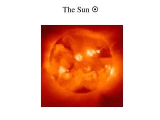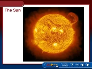
The sun
The sun. Due to the earth’s tilt and its orbit around the sun, the declination of the sun changes with time of year 23.45 o at summer solstice (21 June) 0 o at vernal and autumnal equniox (21 Mar, Sept) -23.45 o at winter solstice (21 Dec)

The sun
E N D
Presentation Transcript
The sun • Due to the earth’s tilt and its orbit around the sun, the declination of the sun changes with time of year 23.45o at summer solstice (21 June) 0o at vernal and autumnal equniox (21 Mar, Sept) -23.45o at winter solstice (21 Dec) The sun looks like a “star” that changes declination, but also moves through the background of fixed stars over the course of the year.
In a given day To a good approximation: The sun moves like a star with A fixed declination A fixed Sidereal Hour Angle Over the course of a year • To a good approximation: • The sun moves against the background of fixed stars • Declination changes like a sinusoid • SHA changes by approx. 1o per day
Declination as a function of date +23.45o Summer Solstice -23.45o Winter Solstice
Meridian height is related to latitude and declination Meridian height Latitude = 90o+Decl-Meridian height Due South
Calculating declination on a “desert island” d = declination Day = number of days after 21 March What if you don’t have a calculator or a table of sines or MS Exel?
Graphically – draw approximation to sine curve and interpolate visually Rule of 12ths: changes are 1:2:3:3:2:1 for sine curves
Draw a circle, and measure angles (Burch) Could approximate angle as days after 21 March Radius=23.45
Something you won’t remember on a desert island: This varies from the other formula by as much as 2 degrees Blame: orbital parameters of the earth, leap year differences, eccentricity of orbit…..buyer beware!!
Who are you going to trust? - Declination for Oct. 16th from various sources NB – if you tried to estimate latitude from length of day, you would see variations of 360 nautical miles!! Also- changes most rapidly this time of year.
The sun moves across the sky at 15o per hour With a compass can be used to tell local time With a shadow stick can be used to find due South (shortest shadow) or latitude
Watch method for finding South • Not talked about much because we all have digital watches these days. • Point the hour hand at the sun. • Due south is halfway between the hour hand and 12 on the watch • NB works only when the sun is below 45o in the horizon. • When sun is high, lines of azimuth converge - inaccurate • See tables in Gatty’s book for more accurate numbers using a compass
Precision of altitude measurements These are limited by 1.) height of sun and 2.) measuring instrument With hands – only if very low in the sky (arctic) can one get a degree or so. With shadow stick – depends on the geometry – maybe 1o With quadrant – maybe 1o Warning – do not look directly at noon-day sun – use smoked glass etc With sextant – maybe 2-4’
Example: Shadow stick work compared with GPS on trip from Orlando to PA
The sun will look like a star that has a declination that varies with time of year – hence rising/setting azimuth changes Rising and setting angles are (90o-Latitude) at the equinox At any latitude – the maximum rising/setting angle north or south of due east/wests called the sun’s amplitude Winter Solstice rises S of E Equinox, rises due east Summer Solstice rises N of E θ Due East
Viking sun compass Found in Greenland by the archeologist C. L. Vebæk Indicates 32 compass points. Hole in the center is where the gnomon (or pointer for Sun-shadow) goes. Markings on surface are Interpreted as guides for sunrise and sunset angles.
Interpretation of the scratches are hyperbolae that give the position of the gnomon’s shadow at different times of the day
From the azimuth/declination/latitude formula, you can get the amplitude for any latitude (use Rz formula from last week) Note: it goes offscale at 66oN or S, at the artic circle
Terminator of earth – sunset in the summer over Europe and Africa Direction of sunset is perpendicular to terminator
Length of day from latitude and declination Side view Top view dec you d day night Terminator Length of day = 24*d/360o
Time • Need a watch – typical wristwatches are pretty accurate • Can calibrate – NIST time service: • http://tf.nist.gov/service/its.htm • Keep track of gain/loss • Precision of a few seconds possible (less than a nautical mile) • Limiting factors become accuracy of sightings
Close up of daylight on Oct. 16 near latitude of Boston 1o of Latitude = 0.04 hours = 2.4 min.
Comments on latitude from length of day • Angular diameter of the sun is 32.5’ (2 minutes) • At horizon, must factor in refraction effects • Works best around the solstices • Almost impossible to use around equinox • Daylight the same at all latitudes • Accuracy of declination, other factors Distortion of sunset from refraction
Comparison – naïve approach (mine) to NOAA calculation at solstice and Oct 16th Oct 16th – 1o = 2.4 minutes of daylight Solstice – 1o = 15 minutes of daylight Oct 16th – 1o error in declination Solstice – no error in declination Oct 16th – 28 minutes difference in daylight Solstice – 8.4 minutes difference in daylight Oct 16th – difference in latitude = 6o Solstice – difference in latitude = 0.56o Huge difference!!
Special considerations for areas near the North or South Pole
Midnight above the arctic circle – perfect for determining latitude from horizon grazing!!
Mean Solar Time • The common meaning of “time” (how we set our watches) is mean solar time. • Places the highest point of the sun in the sky (solar meridian) roughly at noon. • Achieved by shifting time zones for every 15o of longitude • Greenwich Mean Time (GMT) is used as prime meridian • Variations caused by • Axial tilt of earth • Eccentricity of earth’s orbit (speeds up and slows down) • Position within time zone • Leap year effects – one year is not precisely 365.25 days (minor for the primitive navigator) • Tidal forces from moon slows down the earth’s rotation ever so slightly (VERY minor)
Time zones are approx. 15o wide in longitude centered on local noon (modulo political boundaries)
Equation of time describes deviations of the sun’s true position at noon from mean solar time (negative means the sun is late relative to mean solar time)
Memorization trick for E.o.T. – 14 minutes late on Feb. 14th (Valentines day), 4 days early three months later (May 15th), 16 minutes early on Halloween, 6 minutes late 3 months earlier (June 26th) Approximate this – 2 weeks either side of points are flat, use trapezoids to connect
Longitude from local noon • Variation of height of sun at meridian crossing is very slow – not accurate • Mid-point between a time of sunrise and sunset is most accurate • With a watch – measure identical height above horizon at sunrise and sunset using hands or kamal for accuracy
The kamal – used by ancient Arab sea traders Based on same principle as use of hands to measure angles Knotted string allows for range of angles Board at end is calibrated in degrees Hold knot in teeth and read off elevation from horizon
Local Area Noon Correction from equation of time Then – knowing watch time zone (from GMT) – caclulate time difference from of LAN from GMT, and convert to degrees from prime meridian Accuracy of sighting of sunrise and sunset with a kamal should be fairly accurate – much better than 1 degree. Fraction of the sun’s diameter (10’ = 10 nautical miles)
The analema A photo of the sun at the same time every day for a year A simultaneous plot of solar declination and time of the sun (relative to mean solar time) produces a figure 8 called an analema
An “analemmatic” sundial corrects for the equation of time – with different locations of the gnomon (shadow stick) depending on date.
Why the sky is blue and polarized? The light reaching your eyes from the sky is the result of a single scatter off of air molecules. This scattering is called “Rayleigh scattering”. It is larger at higher Frequencies (shorter wavelengths) – so blue scatters best. Also, light is polarized when scattered at 90o Scattered light is polarized at 90o scattering Incoming
At sunset, light has all the blue scattered out of it, and is red.
Polarization of the sky depends on the location of the sun Sun at zenith Sun at horizon
Photo of the sky with a polarization filter Polarization filter
The Viking sun stone From Harafns Saga: “the weather was thick and stormy…The king looked about and saw no blue sky…then the king took out the sunstone and held it up, and then he saw where the Sun beamed from the stone.” Modern speculation is that the sun stone was Icelandic spar (calcite) that was used to get polarization information from the sky for the direction of the sun.
Calcite is “birefringent” – meaning that two different polarization states of light have two different refractive indices
Speculation on the sun stone • The sun was often low on the horizon during the voyaging season • A lot of fog also was low in the sky and could obscure the sun • Sky polarization would be observable overhead, and could have been used • Large sources of calcite on east coast of Iceland.
The moon • Although the moon can be used for celestial navigation, it can’t really be used for “primitive” navigation, except for rough direction finding (i.e. not latitude and longitude – need sextant, clock and tables) • Tidal forces from the earth slowed down the moon’s rotation until it shows the same face to us. • The moon moves to the east in rotation by 12o per day (half a degree per hour). • Moves west like the sun, at 15o per hour • The lit side of the moon always faces the sun • Full moon rises opposite the setting sun around the time of the equinox • Website for moon phases: • http://tycho.usno.navy.mil/vphase.html
Bright face of moon always faces the sun – phase of the moon tells you the angle to the sun B Direction of sun 14.5o per hour Horns of moon point south Due South
Oct. 14 Nov. 4 Oct. 21 Oct. 28 Oct. 15 Nov. 5 Oct. 22 Oct. 29 Oct. 30 Oct. 16 Nov. 6 Oct. 23 Oct. 31 Nov. 7 Oct. 17 Oct. 24 Nov 1 Oct. 18 Nov. 8 Oct. 25 Oct. 26 Oct. 19 Nov. 2 Nov. 9 Oct. 27 Oct. 20 Nov. 3 Nov. 10 Moon opposite Sun 180o to 270o 270o to 0o New Moon 0o to 90o 90o to 180o