Download
1 / 37
380 likes | 549 Vues
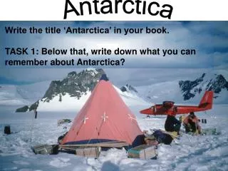
Standardizing Antarctica – a challenge for the SCAR Geospatial Information Group. Steffen Vogt (IPG University Freiburg / Germany) Henk Brolsma, Ursula Ryan, Lee Belbin (AADC Australian Antarctic Division). Australian Antarctic Data Centre Australian Antarctic Division. Outline.

E N D
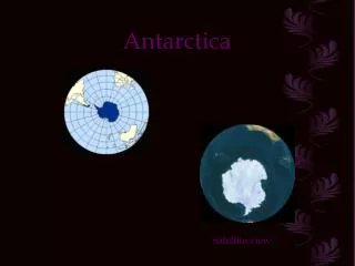
Standardizing Antarctica –a challenge for the SCAR Geospatial Information Group Steffen Vogt (IPG University Freiburg / Germany) Henk Brolsma, Ursula Ryan, Lee Belbin (AADC Australian Antarctic Division) Australian Antarctic Data CentreAustralian Antarctic Division
Outline • Introducing ourselves:Who are we?What are we doing? • Implementing ISO TC211 work- an application-oriented view Example 1: feature catalogueing – SCAR Feature CatalogueExample 2: metadata – SCAR KGIS Project
SCAR GIG: Who are we? • Scientific Committee on Antarctic Research (SCAR) is an inter-disciplinary committee of the International Council for Science (ICSU). • SCAR is charged with the initiation, promotion and coordination of scientific research in Antarctica. • SCAR also provides scientific advice to the Antarctic Treaty System(e.g. on environmental protection issues) • GIG stands for Geospatial Information Group
What are we doing? Physical Sciences Life Sciences Geosciences • from mapping an unknown continent to modern GI technology framework • promulgation of cartographic standards for Antarctica since 1961 • currently the endeavour in the GI programme is to providea spatial data infrastructure for Antarctica to support all scientific disciplines (policies and products) JCADM GIG
What are we doing? GIG Terms of Reference: • To make fundamental reference data (geographic, geodetic, geophysical) available to the Antarctic and global user communities to meet scientific research requirements • Contribute to global geodesy for the study of the physical processes of the earth and the maintenance of the precise terrestrial reference frame • To integrate and coordinate Antarctic mapping and GIS programs • Provide a common geographic reference system for all Antarctic scientists and operators as the basis for sound data management • To establish and maintain strong links with all Antarctic science research groups and Antarctic data management groups
The Challenge • research, logistics, politics, economic interest, SAR • political / administrative issues • still an comparably unknown and inaccessible continent • dynamic environment • our information community, the Antartcic Community, in fact is many communities:data producers from a broad range of agencies and institutions in many nationsdata custodians in a broad range of agencies and institutions(from large, powerful data centres to individual scientists)data users from a broad range of application fields (science, management, tourism, ...)
What are we doing? Current GI activities • Antarctic Digital Database • Place Names (SCAR Composite Gazetteer of Antarctica) • Map Catalogue • National On-line Atlases • Cybercartographic Atlas of Antarctica • East Antarctica GIS • King George Island GIS • SCAR Spatial Data Standards- ISO TC211 standards
What are we doing? Example: Antarctic Digital Database • topographic databasefor entire Antarctica • 1: 1 Mio / 5 Mio / 10 Mio http://www.nbs.ac.uk/ public/magic/add_main.html British Antarctic Survey
What are we doing? Example: SCAR Composite Gazetteer of Antarctica (CGA) • geographic names in Antarctica (>17000 entries) • searchable on-line database • downloadable GIS dataset /data file http://www.pnra.it/SCAR_GAZE
What are we doing? Example: SCAR Map Catalogue • searchable catalogueof Antarctic maps • up-to-date online version http://www-aadc.aad.gov.au/ mapping/scarmaps.asp AAD-AADC
What are we doing? Example: SCAR King George Island GIS (KGIS) • multi-national database forenvironmental applications • King George Island 1:100 000 / 10 000 http://www.geographie.uni-freiburg.de/ forschung/ap3/kgis/
What are we doing? • GI Workshops • Outreach http://www.geoscience.scar.org/geog/geog.htm AntGIS 2003 2nd International Antarctic GIS Workshop Freiburg, April 7-11
80% of all data have a spatial component Why do we need to standardize Antarctica? • The Vision:establish a distributed SCAR data and processing network for geospatial data Example: spatially enabled RiSCC Biodiversity database • RiSCC project homepagehttp://www.riscc.aq • RiSCC biodiversity homepagehttp://www-aadc.aad.gov.au/biodiversity/
RiSCC Biodiversity Database Potter Peninsula
RiSCC Biodiversity Database • observation data, taxonomy, gazetteer, map catalogue bundled into one framework at AAD-AADC Interface Interface Observations Maps Taxonomy Gazetteer GIG products AAD-AADC
Organisations and People Applications - Data Retrieval - Data Mining - Data Visualization Data Repository Applications Applications Species Taxonomy Data Repository Ontologies Feature Type Catalog ... Metadata Catalog Map Catalog Services Catalog Symbology ... Catalogs and Services Component Model technical interoperability? semantic interoperability? feasible?
Standards and Specifications • open, non-proprietary, well-established technology • maturing of standards and specifications(SCAR GIG Liaision Member of ISO TC211)
Standards and Specifications • Example 1: SCAR Feature Catalogue build on 19110 • Example 2: SCAR KGIS Project - A Testbed for 19115 Towards a Metadata Community Profile?
SCAR Feature Catalogue • should provide common semantics • shoud be applicable to any scale of spatial information • should be applicable to any GIS package • should enable exchange of spatial information across disciplines / agencies / nations / cultures
SCAR Feature Catalogue • Part of SCAR Spatial Data Model project (under co-ordination of AAD)Goal:“To provide a SCAR standard spatial data model for use in SCAR and national GIS databases” • ISO 19110 compliant • Under construction!living document (http://www.antdiv.gov.au/default.asp?casid=6259; model@aad.gov.au)
SCAR Feature Catalogue • Part of SCAR Spatial Data Model project (under co-ordination of AAD) • Goal:“To provide a SCAR standard spatial data model for use in SCAR and national GIS databases”http://www.geoscience.scar.org/geog/geog.htm#stds • ISO 19110 compliant • living document (http://www.antdiv.gov.au/default.asp?casid=6259; model@aad.gov.au)
SCAR Feature Catalogue and 19110 • in terms of implementation seems to provide a flexible enough framework • in terms of acceptance the ‘ ISO branding’ might become very helpful
King George Island • several nations operate permanent bases • important hub to Antarctic Peninsula • focal point of scientific activities • shipborne / airborne tourism • protected areas • complex context but apparent need for co-ordinated management(SCAR recommendations Tokyo 2000)
Goal of the KGIS project To produce an integrated geographic database • for use by all countries • for use in multi-disciplinary applications: • planning and coordination of activities • environmental impact assessments • scientific database • management plans (SSSIs, ASMA)
final products web inter-face raw data Integration & meta data generation standards communication & outreach Workflow
Data Input • data was provided by- FH Karlsruhe, Germany- IAA Buenos Aires, Argentina- IAAG Muenchen, Germany- IGIK Warszawa, Poland- INACH/IGM Santiago, Chile- IPG Freiburg, Germany- KORDI Seoul, South Korea- LaPAG/UFRGS Porto Alegre, Brazil- SGM/IAU Montevideo, Uruguay- ...
SCAR Gazetteer and KGIS • ca. 800 named features on KGI in SCAR Gazetteer • ca. 300 named by more than one country
Torre La, pico La Tour, cerro Tower, The Tower, The 2.5 km SCAR Gazetteer and KGIS • implications on management, SAR, etc. Source: Management Plan SSSI 8
Metadata whithin KGIS database • comes typically sparse & incomplete • SCAR adopted standard is DIF (Antarctic Master Directoy is part of Global Change Master Directory) • some institutions have strict standards • some institutions have no standards at all • most important source for metadata typically is personal communication with data producers • we started to construct comprehensive metadata records based on 19115 • these are provided as XML, HTML and text files to the users • positive feedback if tools to easily access the information are at hand • growing acknowledgement of the importance of metadata
Antarctic Metadata and ISO 19115 • an ISO 19115 compliant community profile appears to be very helpful in integrating exisiting metadata / metadata standards • tools for user oriented metadata presentation help in raising awareness of the fact that metadata actually is part of the data • this might help to stimulate the production of metadata records useable for a distributed data and processing environment
Conclusionsfrom our application-oriented point of view • users / producers slowly start to realize how they benefit from and why they should adhere to standards • looking at the implementation of some ISO TC211 based standards:technically: works, but of course the devil’s in the details ...application-oriented: break the communication barrier!
SCAR Geospatial Information Group http://www.geoscience.scar.org/ • Mr. A. Paul R. CooperBritish Antarctic SurveyLiaison Officer from SCAR to TC211aprc@bas.ac.uk • Mr. Larry HothemUnited States Geological SurveyLiaison Officer from TC211 to SCARlhothem@usgs.gov • Mr. Steffen VogtIPG University Freiburg, Germanysteffen.vogt@geographie.uni-freiburg.de