Evolution of Internet Maps: Leveraging OpenGIS Specifications for NOAA Mapping
380 likes | 424 Vues
Explore the transition from legacy to distributed web mapping methods in NOAA using OpenGIS Specifications for enhanced interactivity and data access, resulting in significant ROI.

Evolution of Internet Maps: Leveraging OpenGIS Specifications for NOAA Mapping
E N D
Presentation Transcript
OpenGIS and NOAA Maps Anna.Milan@noaa.gov University of Colorado/CIRES, September 2005
Common/Legacy Methods Stovepipe Systems Standalone Desktop Applications Near Future Methods Distributed Networks Distributed Applications Changing Data Systems
Evolution of Internet Maps Static Maps Web Mapping Interactive Web Mapping Distributed GIS Services
NOAA Maps • NOAA Maps project has documented over 400 maps and almost 150 unique capabilities • The capabilities range from no interactivity, such as a static JPEG map image, to maps with full interactivity and data access
Why should NOAA adopt OpenGIS Specifications? • It would facilitate and simplify • accessibility to data • data sharing within NOAA and between NOAA and international, federal and state agencies • Positive results from NASA study between open geospatial standards and proprietary standards • 119% Return on Investment (ROI) over a five year period • 26% savings overall
Open Geospatial Consortium • The Open Geospatial Consortium, Inc (OGC) is an international industry consortium of 284 companies, government agencies and universities participating in a consensus process to develop publicly available interface specifications.
What are OpenGIS Specifications? • Documents that identify standards for interoperable solutions of geospatial data. The specifications in this presentation address sharing data via the Web. • They address the need to • Share and reuse data • Leverage investments in software and data • To reduce technology and procurement risk
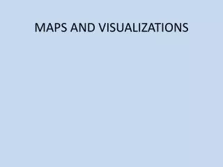
Themes of the OGC Specifications • Maps and Visualization • Web Map Service • Web Terrain Service • Data and Data Access • Web Feature Service • Web Coverage Service • Metadata and Catalogue Access • Catalogue Services • Geospatial Reference Model • EPSG database and CRS IDs • ISO 19112 • Geoprocessing Services • Web Coordinate Transformation • Web Processing Service
Themes of the OGC Specifications • Maps and Visualization • Web Map Service • Web Terrain Service • Data and Data Access • Web Feature Service • Web Coverage Service • Metadata and Catalogue Access • Catalogue Services • Geospatial Reference Model • EPSG database and CRS IDs • ISO 19112 • Geoprocessing Services • Web Coordinate Transformation • Web Processing Service
Themes of the OGC Specifications • Maps and Visualization • Web Map Service • Web Terrain Service • Data and Data Access • Web Feature Service • Web Coverage Service • Metadata and Catalogue Access • Catalogue Services • Geospatial Reference Model • EPSG database and CRS IDs • ISO 19112 • Geoprocessing Services • Web Coordinate Transformation • Web Processing Service
OpenGIS Web Map Service Implementation Specification
Web Map Service (WMS) • Defines a request and response protocol for Web-based client/map-server interactions. • Produces digital image of a map, such as a PNG, JPEG or GIF. • GetMap • Get Capabilities • GetFeatureInfo
WMS: GetCapabilities • Request produces service metadata of the Web Map Service in XML. • The document includes information about server, the data layers, query-ability, image formats, geographic extent and projections.
WMS: GetMap • URL request returns a map image • A mandatory capability http://map.ngdc.noaa.gov/servlet/com.esri.wms.Esrimap?servicename=nosa&WMTVER=1.0 &request=map&layers=Continents,GOES%20I/M%20Winds&width=1024&height=768&format=png &bbox=-126,-49,18,62&transparent=true
Examples of GetMap The URLS in the following examples begin with: http://map.ngdc.noaa.gov/servlet/com.esri.wms.Esrimap?servicename=nosa&WMTVER=1.0&request=map Therefore, this part of the URL will be represented as *.
*&layers=Continents,FSL-RADIOSONDES&width=1024&height=768&format=png&bbox=-177,-71,179,84&transparent=true*&layers=Continents,FSL-RADIOSONDES&width=1024&height=768&format=png&bbox=-177,-71,179,84&transparent=true
*&layers=Continents,DMSP%20Satellite&width=1024&height=768&format=jpeg&bbox=-174,-87,180,90&transparent=true*&layers=Continents,DMSP%20Satellite&width=1024&height=768&format=jpeg&bbox=-174,-87,180,90&transparent=true
*&layers=Continents,ETL-Fish%20Lidar%20(FLOE)&width=1024&height=768&format=png&bbox=-170,46,-116,64&transparent=true*&layers=Continents,ETL-Fish%20Lidar%20(FLOE)&width=1024&height=768&format=png&bbox=-170,46,-116,64&transparent=true
*&layers=Shaded%20Relief,ETL-Fish%20Lidar%20(FLOE)&width=1024&height=768&format=png&bbox=-168,44,-114,60&transparent=true*&layers=Shaded%20Relief,ETL-Fish%20Lidar%20(FLOE)&width=1024&height=768&format=png&bbox=-168,44,-114,60&transparent=true
WMS: GetFeatureInfo • A request that returns attributes of selected features at a user specified point • Optional capability
Benefits of WMS Interface • Enables on-the-fly overlays from network of interoperable map servers – regardless of server location, map scale, digital format or vendor. • Organizations can combine geospatial data from disparate sources. • Can be quickly implemented. • Yields huge benefits with little incremental cost.
Other OpenGIS Specifications WFS, WCS and WTS
GetCapabilities DescribeFeatureType GetFeature GetGMLObject Transaction Create, Update delete Web Feature Service (WFS) Defines interface for data access and manipulation operations on geographic features using HTTP as the distributed computing platform. The features are described in Geographic Markup Language (GML).
Web Coverage Service (WCS) • GetCapabilities • DescribeCoverage • GetCoverage Supports electronic interchanges of geospatial data as ‘coverages’: information representing space-varying phenomena, such as a GeoTIFF.
Web Terrain Service (WTS) Produces 3D views of georeferenced data. The views are digital images, such as PNG, JPEG or GIF. • GetCapabilities • GetView • Obtain a 3D Scene • GetMap
WMS Interface • The GetCapabilities request returns an XML document that describes the server side of the WMS interface. • The GetMap request defines the map image for the client side of the WMS interface. • One can deploy WMS as a • Client • Server • Client and server at the same time
Data Internet Client Web Map Server Client/Map-Server Architecture A simple flow of events for a WMS. GetMap Response GetCapabilities Request GetCapabilities Response GetMap Request
Data Data Data Interoperable Web Mapping Architecture Web Map Server Client Web Map Server Client Web Map Server
Data Tools for Implementation • Collection of files • Spatial database • ArcIMS • UMN MapServer • GeoServer • Basic HTML pages • MapViewers • Desktop apps Client Web Map Server
Interesting Issues: • Science community • Data not always represented in a map format • Spatial Reference System not included in scientific formats • GIS community • Represents data as points, lines, polygons and rasters • Focuses on static planar views of data rather than graphs • Spatial Reference System is integral to geospatial formats • Lack of time/money to learn and implement new methods • You tell me…
Bibliography Books Peng, Zhong-Ren and Ming-Hsiao Tsou. Internet GIS: Distributed Geographic Information Services for the Internet and Wireless Networks. New Jersey: John Wiley & Sons, Inc, 2003. Peterson, Michael ed., Maps and the Internet. Oxford, UK: Elsevier Science Ltd, 2003. Websites US Dept of Commerce/NOAA Observing Systems Architecture (NOSA) Home Page. NOAA Observing System Architecture (NOSA). 1 Sept 2005 <http://nosa.noaa.gov/> Open Geospatial Consortium. Open Geospatial Consortium. 1 Sept 2005 <http://www.opengeospatial.org/> Articles from websites Beaujardiere, Jeff de La. “OpenGIS® Web Map Service (WMS) Implementation Specification.” OpenGIS® Specifications. Version 1.3. Open Geospatial Consortium. 15 Aug. 2005 <http://portal.opengeospatial.org/files/?artifact_id=5316>
Bibliography Evans, John. “OpenGIS® Web Coverage Service (WCS) Implementation Specification.” OpenGIS® Specifications. Version 1.0. Open Geospatial Consortium. 15 Aug. 2005 <https://portal.opengeospatial.org/files/?artifact_id=3837> Evans, John D. ed. A Geospatial Interoperability Reference Model. Version 1.1, December 2003. Prepared by the FGDC Geospatial Applications and Interoperability (GAI) Working Group. August 15, 2005 <http://gai.fgdc.gov/girm/v1.1/#Maps>. Ramsey, Paul. “The State of Open Source GIS.” February 2, 2005.Refractions Research, Inc. August 15, 2005 <http://www.refractions.net/white_papers/oss_briefing/2005-02-OSS-Briefing.pdf> Singh, Raj. “Web Terrain Server.” Discussion Papers.version 0.3.2. Open Geospatial Consortium. 15 Aug. 2005 <http://portal.opengeospatial.org/files/?artifact_id=1072> Vretanos, Peter. “OpenGIS® Web Feature Service (WFS) Implementation Specification.” OpenGIS® Specifications. Version 1.1. Open Geospatial Consortium. 15 Aug. 2005 <https://portal.opengeospatial.org/files/?artifact_id=8339>
Bibliography Geospatial Interoperability Return on Investment. April 2005. National Aeronautics and Space Administration, Geospatial Interoperability Office. Aug 15 2005 <http://gio.gsfc.nasa.gov/docs/ROI%20Study.pdf>