Download

1 / 88
910 likes | 1.14k Vues
GIS in Environmental and Water Resources Engineering . Research Progress Report March 10, 1999. Texas data and water modeling : Hudgens, Mason, Davis Jonsdottir, Gu, Niazi Environmental Risk Assessment : Hay-Wilson, Romanek, Kim Global runoff : Asante, Lear.

E N D
GIS in Environmental and Water Resources Engineering Research Progress Report March 10, 1999
Texas data and water modeling: Hudgens, Mason, Davis Jonsdottir, Gu, Niazi Environmental Risk Assessment: Hay-Wilson, Romanek, Kim Global runoff: Asante, Lear Nonpoint source pollution: Melancon, Osborne Flood hydrology and hydraulics: Ahrens, Andrysiak, Azagra, Perales, Tate Internet: Favazza,Wei Research Areas
Texas data and water modeling: Hudgens, Mason, Davis Jonsdottir, Gu, Niazi Environmental Risk Assessment: Hay-Wilson, Romanek, Kim Global runoff: Asante, Lear Nonpoint source pollution: Melancon, Osborne Flood hydrology and hydraulics: Ahrens, Andrysiak, Azagra, Perales, Tate Internet: Favazza,Wei Research Areas
Brad Hudgens Geospatial Data Development for Water Availability Modeling
David Mason Geospatial Data Development for Water Availability Modeling
Progress on WAM • Finished parameter calculations for Nueces Basin • Finished parameter calculations for San Antonio Basin (except for one point..see next slide) • Half way through parameter calculations for Guadalupe Basin......but......
New Problems Areas for Guadalupe Gages • Discovered discrepency in area numbers of Guadalupe basin • Error is most likely due to resolution of DEM used. • Currently waiting for 30m DEM to redo parameter calcs.
Trinity River TMDL Subtask on Network AnalystKim Davis
Underway • HydroNet Programming • Exciting new ways to sort river networks • Avenue “QUERY” command is hard to use • Lists are inefficient • TMDL • Use Arc/Info to check network integrity • Investigating RIT
Reach Indexing Tool • Dynamic Segmentation Tool for ArcView developed at the Research Triangle Institute in North Carolina • Will be digging into it in the next couple of weeks • Snap Assessment • Labor Intensive • Easy to Use
Arc/Info 8.0 Beta Class • Arc/Info will look like ArcView--GUI • All the good analysis properties of Arc/Info are maintained • Super-easy data management • Move Stuff • Rename Stuff • Project on the fly (from anything to anything)
Jona Finndis Jonsdottir Geospatial Data for Total Maximum Daily Loads
Checking the Connectivity of the River Network By using the trace function in Arc Info all arcs connected to the endpoint could be identified. White and yellow arcs form together the river network for the Trinity Basin. The yellow lines represent the arcs connected to the outlet point of the basin. The white lines represent branches of the network that were not connected to the main stem of the network because of small gaps. Then by comparing the picture to a similar view in Arc View, small gaps were identified and filled.
After filling some gaps, the network is ready! According to the trace function in Arc Info, we now have a single line connected river network for the Trinity basin!
Addtopo & Txmesh I improved my script, Addtopo. By using Addtopo along with the grid Txmesh and the hotlink option in Arc View, DRGs can be added to the view with one click! Each maps extent have been cut down so that two or more DRGs can be viewed without disturbing borders...
And where to get Addtopo & Txmesh! It’s all on my website: http://www.ce.utexas.edu/stu/jonsdoj/research/hotlink.html If you want the program and the grid then go to my website, and click the icons for Addtopo and Txmesh. Addtopo contains the Avenue code Txmesh contains a zipped grid of Texas in geographic, utm 14 and utm 15 projections. Instructions on how to use this are also on the website.
Building a Time-Series Data Bases for TxRR Precipitation-Runoff Model By Richard Gu
Source data: • daily precipitation data • daily stream flow data
Database Software: HEC-DSS • Main components: • DSSUTL: import & export, copy, delete, or edit data in a DSS file. • DSPLAY: display data from a DSS file in a tabular or graphical form. • REPGEN: retrieval and representation of data from a DSS file. • DSSMATH: mathematically manipulating DSS data.
Implementation of Pre-processing Source Data CD Spatial Information of gages Rainfall data & Stream flow data Watershed Region Definition Text file Arcview GIS DSS import: DSSUTL Develop Thiessen Polygons DSS file Export weighted area percentage for each gage. (gage::area%) DSS
DSS Rainfall & stream flow, area% DSPLAY Macro NEW DSS file with Average rainfall & stream flow data for each watershed DSPLAY DSSMATH DSPLAY Macro REPGEN Data Retrieval Customized Reports Text file converter TxRR Input File
Future work • Short term goal: Implement the GIS & DSS function components • Final goal: Software Integration • Simple approach: MS-DOS batch file • Challenge: C system calls and user interfaces development with Visual C++
Announcement I have installed HEC-DSS system on C drive of one PC at PRWR under directory \HECDATA\ & \HECEXE\. Please do not delete them.
Surface/Subsurface Modeling Progress Report Shiva Niazi 3/10/99
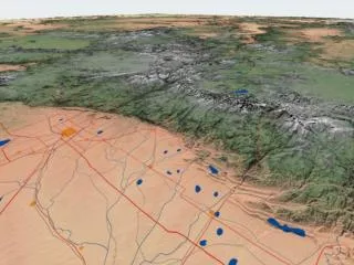
Bureau of Economic Geology ProjectArea of Interest Carrizo-Wilcox Aquifer Bastrop, Lee and Milam Counties Underlying HUC8 Subwatersheds Colorado River Brazos River Area of Interest
Progress NPS Analysis/ Accumulated Flow CRWR Pre-Pro DEM Flow Dir. Grid + Accumulated Flow Grid Runoff Grid
Current Work • Locating river gages and flow rates immediately upstream of area • Obtaining DOQs for analysis of river widths
Texas data and water modeling: Hudgens, Mason, Davis Jonsdottir, Gu, Niazi Environmental Risk Assessment: Hay-Wilson, Romanek, Kim Global runoff: Asante, Lear Nonpoint source pollution: Melancon, Osborne Flood hydrology and hydraulics: Ahrens, Andrysiak, Azagra, Perales, Tate Internet: Favazza,Wei Research Areas
Lesley Hay Wilson Spatial Environmental Risk Assessment
Current Research Status • Still working on the site conceptual model • COC list completed (80 chemicals) • developing the receptor areas for the lube plant site conceptual model • formatting Excel calculation sheet and moving some tables (e.g., receptor characteristics, chemical properties) into the SCM access database • Other SCM database changes for pathway completeness tracking
MHR project team • Working on database issues (team) • meeting February 22nd • additional refinements to the measurements database • team CD May 1999 • PaDEP Meeting March 10th • presented the spatial site conceptual model • other UT projects presented • new PaDEP CD and workshop August 1999
Andrew Romanek Building the Foundation for Environmental Risk Assessment at the Marcus Hook Refinery Using Geographic Information Systems March 12, 1999
Activities • Database meeting in Atlanta • Job search • THESIS • Now I am going skiing
Spatial Analysis of Sources and Source Areas on Marcus Hook Progress report by Julie Kim Friday, March 12, 1999
Current Work • Contoured April/May 1996 and December 1998 COC measurements for 8 COCs in groundwater for 3 sections of the refinery: • Lube Plant • North of the railroads • South of the railroads • Used each section as barriers when contouring
2. Choose appropriate output extent 1. Select points to contour 3. Select barrier that is identical to your output extent 4. Final result: contours end at the railroads, creek, and river
Left: Contours of benzene for each section WITHOUT using each section as barriers Right: Contours of benzene for each section USING each section as barriers
Future Work • Focus on the hydrology project • Analyze soil data for the 40 COCs detected in the Lube Plant • Analyze any COCs detected in NAPL in the Lube Plant • Work on tasks outlined in the Marcus Hook Action Plan
Texas data and water modeling: Hudgens, Mason, Davis Jonsdottir, Gu, Niazi Environmental Risk Assessment: Hay-Wilson, Romanek, Kim Global runoff: Asante, Lear Nonpoint source pollution: Melancon, Osborne Flood hydrology and hydraulics: Ahrens, Andrysiak, Azagra, Perales, Tate Internet: Favazza,Wei Research Areas
Global Runoff RoutingEstimating Flow Velocity Kwabena Asante
Dispersion in Routing • Checked the effect of decomposing a reach • Coded dispersion into source to sink model • Working on dispersion type cell to cell code using the same approach as source to sink
Diffusion Type Routing Perform routing from upstream cells using flow accumulation do define order of computation Calculate response from each cell to the next cell downstream Sample response coefficients and apply to inflow to get discharge For each cell, aggregate discharge from all upstream cells (convolve in time and space)
Mary Lear Flow Direction Data from Fine to Coarse Resolution
Wonderful Work • Big meeting with researchers from UNH • More Goals include: • Finding Diagonals, Flat Histogram • Creating River Networks • Reaching the Ocean • Determining Flow Length • Solving Connectivity Problems