Download
1 / 42
420 likes | 1.15k Vues
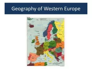
Geography of Europe. Ch. 9.1 Study the geography of the Europe and the Eurasian land mass, including its location, topography, waterways, vegetation, and climate and their relationship to ways of life in Medieval Europe. I. Location. Europe: Asia.

E N D
Geography of Europe Ch. 9.1 Study the geography of the Europe and the Eurasian land mass, including its location, topography, waterways, vegetation, and climate and their relationship to ways of life in Medieval Europe.
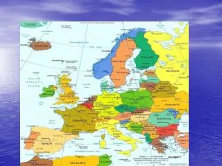
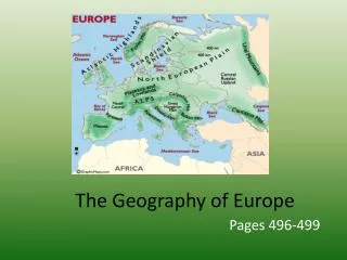
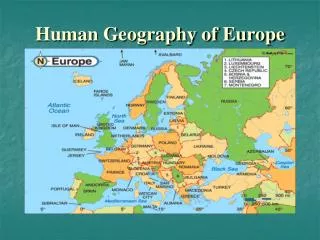
Europe: Asia Eurasia is the large landmass that includes both Europe and Asia.
Ural Mountains: “The Great Divide” 1500 miles The Ural Mountains are the boundary between the two continents.
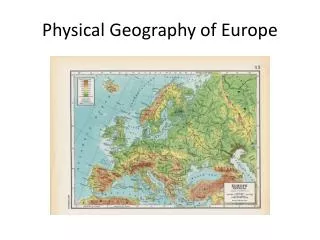
Southern Europe is covered mainly by mountain ranges. Caucasus Pyrennes Carpathians Alps Apennines
The Alps cover most of Switzerland, Austria, and parts of Italy and France. Some peaks in the Alps reach higher than 15,000 feet!
Mt. Blanc in the Alps Highest mountain in the Alps: 15,771 feet
The Caucasus Mountains The origin of the word Caucasian.
Transylvaniain the Carpathian Mountains Home of VladTepeš, theDrakul(“Count Dracula”)
Northern Europe is much flatter and is called the Northern European Plain Stretches from Atlantic Ocean in the west to the Ural Mountains in the east
Northern Europe is covered with thick forests and many types of trees.
Northern British Isles and Scandanavia Scandinavian Peninsula • Many peninsulas that give Europe a very long, jagged coastline
Southern Europe: largely warm and sunny climate allows shrubs and trees that don’t need a lot of water.
Northwestern Europe: mild and cooler, wetter climate bring freezing weather in the winter where few plants can survive
1. Label Southern Europe with a sun2. Label Northern Europe with snowflakes
Many of Europe’s rivers are in the Northern European Plain • Some important rivers are the Danube, Thames, Rhine, Rhone, Ural, Volga, Ebro • The snow in the southern mountains melts and flows out over the plain on its way to the northward sea. Rivers Volga R. Don R. Thames R. Elbe R. Vistula R. Oder R. Rhine R. Dnieper R. Seine R. Loire R. Danube R. Po R. Tagus R. Tiber R. Ebro R.
The Danube River 1770 miles
The Danube River Where Buda & Pest Meet Biking Along the Danube Flows through the 12 countries of Germany, Austria, Slovakia, Hungary, Serbia, Croatia, Bosnia and Herzegovina, Slovenia, Bulgaria, Romania, and the Ukraine.
The Volga River The longest river in Europe --> 2,300 miles.
Label these rivers and trace them in blue. • Danube • Thames • Volga
Vegetation: How geography shapes life • Southern Europe: Most people lived on coastal plains (similar to Japan) or in river valleys (like Africa) where the land was flat enough to farm • Grapes and olives were grown that could survive the region’s dry summers • People raise sheep and goats • Many people became traders and seafarers
Southern Europe • Draw grapes and olives along the Southern coast 2. Add goats and sheep 3. Now, draw boats to represent the traders and seafarers
Northern Europe: Most people lived farther from the sea and most towns grew along the river. Paris, right bank of the Seine London on the Thames Prague on the Vltava Budapest on the Danube
Northern Europe • Draw small houses near the river to represent where people lived.
VI. The Big Idea • The river provides transportation and protection • Farmers grew many crops • No mountains surrounded northern Europe making it easy to invade
VII. Checking for Understanding
Checking for Understanding What is the boundary between Europe and Asia? Where are most of Europe’s rivers located? How is the topography of southern Europe different from that of the Northern European Plain? What part of Europe do you think was open to more invasions? Why?