Discovering Tasmania: Australia's Unique Island State
Tasmania, abbreviated as Tas and often called "Tassie," is an island state of Australia, located 240 kilometers south of the mainland, separated by Bass Strait. It encompasses the 26th largest island in the world and has a rich history, diverse geography, and vibrant culture. With a population of over 500,000, many reside in the greater Hobart area. Tasmania is known for its stunning landscapes, including the Central Highlands and temperate rainforests, as well as its unique wildlife. Explore Tasmania's government, economy, and significance within Australia.

Discovering Tasmania: Australia's Unique Island State
E N D
Presentation Transcript
Tasmania • Tasmania (abbreviated as Tas and known colloquially as "Tassie") is an island state, part of the Commonwealth of Australia, located 240 kilometres to the south of the Australian continent, separated by Bass Strait. The state includes the island of Tasmania, the 26th largest island in the world, and the surrounding 334 islands.The state has a population of 507,626 as of June 2010, of whom almost half reside in the greater Hobart precinct. Tasmania's area is 68,401 square kilometres of which the main island covers 62,409 square kilometres
History • The island is believed to have been joined to the mainland of Australia until the end of the last glacial period approximately 10,000 years ago. Much of the island is composed of Jurassic dolerite intrusions through other rock types, sometimes forming large columnar joints. Tasmania has the world's largest areas of dolerite, with many distinctive mountains and cliffs formed from this rock type. • The central plateau and the southeast portions of the island are mostly dolerite. Mount Wellington above Hobart is a good example, showing distinct columns known as the Organ Pipes. In the southern midlands as far south as Hobart, the dolerite is underlaid by sandstone and similar sedimentary stones. In the southwest, Precambrian quartzites was formed from very ancient sea sediments and form strikingly sharp ridges
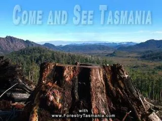
Geography • Tasmania's landmass of 68,401 km2 is located at 42°S 147°ECoordinates: 42°S 147°E, right in the pathway of the notorious "Roaring Forties" wind that encircles the globe. The island is surrounded by the Indian and Pacific Oceans and separated from mainland Australia by Bass Strait. • Tasmania has been volcanically inactive in recent geological times but has many jagged peaks resulting from recent glaciation. Tasmania is the most mountainous state in Australia. The most mountainous region is the Central Highlands area, which covers most of the central western parts of the state. The Midlands located in the central east, is fairly flat, and is predominantly used for agriculture, although farming activity is scattered throughout the state. Tasmania's tallest mountain is Mount Ossa at 1,617 metres (5,305-feet). The mountain lies in the heart of the world famous Cradle Mountain-Lake St Clair National Park. Much of Tasmania is still densely forested, with the Southwest National Park and neighbouring areas holding some of the last temperate rain forests in the Southern Hemisphere.
Government • The form of the government of Tasmania is prescribed in its constitution, which dates from 1856, although it has been amended many times since then. Since 1901, Tasmania has been a state of the Commonwealth of Australia, and the Australian Constitution regulates its relationship with the Commonwealth and prescribes which powers each level of government
Politics • Tasmania is a State in the Australian federation. Its relationship with the Federal Government and Parliament are regulated by the Australian Constitution. Tasmania is represented in the Senate by 12 senators, on an equal basis with all other states. In the House of Representatives, Tasmania is entitled to five seats, which is the minimum allocation for a state guaranteed by the Constitution the number of House of Representatives seats for each state is otherwise decided on the basis of their relative populations, and Tasmania has never qualified for five seats on that basis alone. Tasmania's House of Assembly use a system of multi-seat proportional representation known as Hare-Clark. • At the 2002 state election, the Labor Party won 14 of the 25 House seats. The Liberal Party saw their percentage of the vote decrease dramatically, and their representation in the Parliament fell to seven seats. The Greens won four seats, with over 18% of the popular vote, the highest proportion of any Green party in any parliament in the world at that time
Economy • Tasmania's erratic economy was first experienced by colonists in the early 19th century.The reasons have been many and varied over the years. Lack of a federal infrastructure highway, lack of a gold rush, lack of open immigration initiatives, lack of population, decline in the wool and mineral economies, lack of early colonial initiatives, or lack of foreign investment have all been attributed as reasons for the erraticism of the economy. For the length of colonial history of Tasmania, a continuing exodus of youth to mainland Australia to seek employment opportunities has occurred.
Transport Air • Tasmania's main air carriers are Jetstar Airways and Virgin Australia
Mr.Chanon Chantarach No.2 • Ms.Jantappha Jaroenjiengchai No.20 • Ms.Jittra Tannarat No.23 • Ms.Pantida Duangpearach No.36 • Ms.Wichaya Utamamoon No.42