Global Hydrology and Climate Center
170 likes | 279 Vues
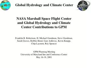
Global Hydrology and Climate Center. NASA Marshall Space Flight Center and Global Hydrology and Climate Center Contributions to GPM Franklin R. Robertson, H. Michael Goodman, Steve Goodman, Sarah Graves, Robbie Hood, Gary Jedlovec, Kevin Knupp, Chip Laymon, Roy Spencer

Global Hydrology and Climate Center
E N D
Presentation Transcript
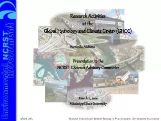
Global Hydrology and Climate Center NASA Marshall Space Flight Center and Global Hydrology and Climate Center Contributions to GPM Franklin R. Robertson, H. Michael Goodman, Steve Goodman, Sarah Graves, Robbie Hood, Gary Jedlovec, Kevin Knupp, Chip Laymon, Roy Spencer GPM Planning Meeting University of Maryland Inn and Conference Center May 16-18, 2001
Global Hydrology and Climate Center • Research Topics: • Lightning measurements from space • Global temperature • Urban environment studies • Severe weather physics • Global and regional weather/climate modeling • Atmospheric chemistry and pollution • Aerosol measurements and effects on climate • Remote-sensing land use studies Research • What we do: • Utilize space and other technology to better understand climate • Apply results to resource & environmental management • Educate next generation Earth scientists Education Applications
Global Hydrology and Climate Center • Historical MSFC / GHCC Science Strengths Particularly Relevant to GPM • Passive microwave data stream processing, product generation, distribution • Regional integrated field measurements for precipitation process studies, air / ground truthing, validation • Lightning measurements from space and integration with precipitation science and applications • Spectrum of water and energy cycle science studies embracing climate variability, precipitation algorithm development, regional modeling, hydrologic applications
Passive Microwave Processing at GHCC • Special Sensor Microwave Imager Products (http://ghrc.msfc.nasa.gov) • Producing derived geophysical products based upon Wentz / Remote Sensing Systems (RSS) algorithms (1987-present) • WetNet project supported SSM/I processing and global algorithm precip analysis (PIP-1, PIP-2, PIP-3) • Passive Microwave ESIP (http://pm-esip.msfc.nasa.gov) • Ingesting AMSU and TMI data streams (1997 – present) • Generating global temperatures and tropical cyclone max. wind products • RSS generates TMI products, GHCC archives and distributes • Advanced Microwave Scanning Radiometer-EOS SIPS on Aqua • In 2002-2009 will produce full range of Level-2B & -3 products (e.g., rain rate and type, water vapor, SST, cloud water, wind speed, sea ice, etc.) • Lightning Imaging Sensor SCF (http://thunder.msfc.nasa.gov) • Ingesting LIS data on TRMM and surface validation data sets • Produces daily, weekly, and monthly lightning products • Field Experiments (http://ghrc.msfc.nasa.gov/camex) • CAMEX-3 and –4 hurricane research • TRMM surface validation (TRMM-Brazil, TEFLUN)
GHCC Data Processing Role in GPM • Serve as a data center for generation, archive, and distribution of data sets and products from the: • Advanced TMI (ATMI) • Constellation Microwave Radiometers (CMRs) • Continue heritage of SSMI data products with ingest generation of geophysical products from SSMIS temperature data records • Serve as a ground validation data center
GHCC Strengths in Field Measurements • Aircraft Instrumentation • Newly-selected UAV project • (Richard Blakeslee -- ACES) • Ground-based Instrumentation • Mission Science Leadership • CoHMEX, CAMEX-3, CAMEX-4 • In -house • Modeling and Data Assimilation • Data Management and Data Mining • Educational Outreach • Graduate Student Pool
COOPERATIVE HUNTSVILLE-AREA RAINFALL MEASUREMENTS (CHARM) NETWORK • Local precipitation network ( est. 1/2001) • 96 sites in Huntsville & Madison County, AL • NASA, Army, USGS, and NWS sites and weather enthusiasts • Daily rainfall totals • 3600 km2 coverage (1 gauge per 6x6 km) • Plans to expand to 200 stations by 2003 • 4x4 km average spacing • twice daily manual observations • 1 minute data from 40 automated sites • Supports local weather and climate research at the GHCC • validate weather radar and lightning data from satellites • monitor spatial distributions of precipitation for modeling activities • various satellite remote sensing studies of soil moisture and energy fluxes CHARM LOCATION MAP 76 manual and 20 automated rain gauges 80km May 2001
Water Resources Planning Apalachicola-Chattahoochee-Flint (ACF) and Alabama-Coosa-Tallapoosa (ACT) river basins of Alabama, Georgia, and Florida. • The ACF and ACT basins are the subject of a comprehensive river basin study involving many stakeholders. • MSFC locating, assessing, collecting relevant data bases • A tri-state compact and water allocation formula is currently being negotiated between the states and U.S. Army Corps of Engineers (COE) that will affect the availability of water among competing uses within the ACF river basin.
ESE Objectives Key Problems ThOR Mission Enablers Global Water & Energy Cycle Existing observations do not see intensity and evolution Limits understanding, predictability Total lightning measures intensity; Responsive to convective regime. We can observe it rapidly from space, over large regions. Optical LMS GEO @ 90oW Wide FOV 2 yr baseline Warning lead-times too short Warning false alarms too high Weather Hazards
Tropical Deep Convective Ice Index Climatology Synthesized From MSU Ch2 --- A new data set for climate diagnostics and model validation --- Precipitating ice formed high within tropical rain storms produces local Tb minima in MSU Ch2 data. (Units K x 103) Interannual Variability Over The Tropical Oceans • Deep convective ice index, DCI, (green line) expressed in percent departure from normal. SST departures from climatology in Kelvin x 50. • Averaged over the tropical oceans, year-to-year variations in precipitating ice follow variations in sea-surface temperatures. Franklin Robertson MSFC Climate Dynamics and Modeling Group
Anomaly Frequency Distribution Contributions qs – qa effect Anom weighted freq (Wm-2) Wind speed effect Latent heat flux anom (Wm-2) Evaporation / SST Sensitivity Over the Tropical Oceans During ENSO Events • ENSO composite data from da Silva, Young, Levitus Surface Marine Data Set • Tropical-mean SST perturbations during ENSO raise ocean-mean latent heat fluxes at rate of ~5.0 Wm-2 K-1 • Thermodynamic anomalies, , dominate wind anomaly effects, . ENSO Latent Heat Flux Anomalies (Wm-2) for SST Anomaly > 1.0 S.D.
Using Advanced Regional Prediction System (ARPS) to Study the Coupled Hydrologic response to 2 X CO2 (Contact: Roy Spencer, Danny Braswell) • 1000 model day runs • 2-D, 1 Km res, 12 sec time step • Tropical domain • Persistent solar flux with diurnal cycle (May) • Software enhancements to insure water conservation • ARPS provided by CAPS at the University of Oklahoma Cumulative difference in rainfall for normal and doubled CO2 over a 1 year period after model equilibration shows invigorated hydrologic cycle.