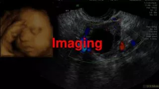

Fire Imaging
E N D
Presentation Transcript
Fire Imaging USDA Forest Service Fire and Aviation Management
Sustaining NIROPS • Falls under the Fire Perimeter Mapping Mission • Map 50-70 fires in one operational period • Provide map products (KMZ/KML, vector files), calc acres, IRIN log • NIROPS products and services are in high demand • Demand is increasing • 2 planes w/ AC3: geared towards workload from the last decade • Need ways to increase capacity • Increase role of satellites (National System and commercial)? • Increase role of vendor aircraft (manned and unmanned)
Requirements (Data and Products) Desired Data • GPS coordinates of heat sources to derive perimeter or isolated spots, calculate acres • Data forentire fire or just actively burning portions may be requested • Imagery mosaic in lossless compression format • GeoTiff or JPEG 2000 Desired Products • Geo-rectified PDF map showing areas of intense, scattered, and isolated heat concentrations • Generate GIS ready data (points, lines and polygons) • Generate KMZ or KML • G-STOP fire mapping standards https://gis.nwcg.gov/standards_agency.html • Provide notes on significant changes or questionable data that needs ground verification (interpreter’s log)
Requirements (Aircraft and Sensor) Manned Aircraft: • Day or night capable • Turbine engine and pressurized cabin • VHF-AM capability • Equipped with Automated Flight Following (AFF) and/or transponder (mode C) • Acquisition above 6,000’ AGL to avoid conflict with incident aircraft and/or TFR • Perform data gathering flights under IFR • Transmit data while in flight • Minimum of a 4 hour mission that can cover multiple incidents in a geographic area Sensor and Image Processor: • Line Scanner or EO/IR step-stare camera • Inertial Measurement Unit stabilized • MWIR 3 - 5 μm and LWIR 8 - 14 μm • Meets ASPRS 1:24,000 map standards • GSD: 4 meters at nadir or better, not to exceed 10m on edges of usable view • Able to detect 6” x 6” red hot coals (600 degrees C) from 10,000 ft. AGL or higher • Ability to scan 100,000+ acres per hour • Ability to differentiate false positives • Ability to mitigate against blooming (saturation) effects caused by hot gases from crown fires
Satellites • GSD: <10m • Differentiate false positives • Post-processing to limit off-nadir distortion • Terrain corrected, geometrically ready for interpretation • Algorithms to automate process • Reduce latency to <12 hours • National System Satellites • FireHawk • Other? • Commercial Satellites • HDDS (DigitalGlobe, SPOT, etc.) • EVR2EST • Other? • CONOPS for requesting and dissemination • Ability to predict which fires within path of comm. sat
Sustaining NIROPS (Aircraft) Short Term (2019-2021): • Evaluating vendor capability to provide NIROPS-like service and products • End Product Contract (~4-5 vendors in 2019) • Market research of current gen technology • Mix of aircraft capabilities and sensors • Regional and National level Longer Term (2020-2025): • Aircraft modernization • Aircraft replacement schedule • What is right mix of agency AC? • Maintain organic capability • Sensor modernization • Re-engineer Phoenix –miniaturize and automate –or- • Convert to current gen system • Role of vendors
Sustaining NIROPS (Satellites) National Systems: • Firehawk –AC3 has been our go-to for surge capacity • Analyst support is limiting factor • Options? Commercial / HDDS Systems: • Developing proposal to use imagery from comm. or HDDS sat systems for fire mapping • Predict which fires are within path of sat systems and when • Post-processed imagery ready for IRIN interpretation • Can Machine Learning assist?
End State • Sufficient capability to meet average year demand • Scalable for peak year demands • Surge capacity • Standard products and retrieval for end users • Same look and feel as NIROPS • Standard map products (shapefiles, KMZ/KML) • Easily retrieved and exploitable format • Evaluating increased use of sat imagery for mapping • Reduce reliance on manned AC • Maintain agency’s ability to perform mission • NIROPSagency aircraft/sensor