AIR NAVIGATION
AIR NAVIGATION. LET ONE. INTRODUCTION. Air travel is different. You determine your heading and fly in a straight line from point A to point B. You may be free from terrain difficulties in the sky, but flying comes with its own set of rules. AIR NAVIGATION CHARTS.

AIR NAVIGATION
E N D
Presentation Transcript
AIR NAVIGATION LET ONE
INTRODUCTION • Air travel is different. • You determine your heading and fly in a straight line from point A to point B. • You may be free from terrain difficulties in the sky, but flying comes with its own set of rules.
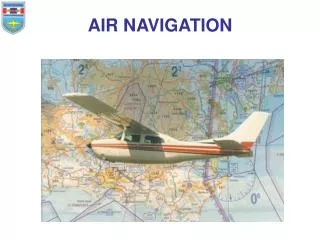
AIR NAVIGATION CHARTS • You need a map designed for air navigation, specifically an aeronautical chart that will show landmarks to aid you in navigation. • Not all aeronautical charts are the same. The pilot of a light aircraft flies low enough to navigate by landmarks identifiable from the air. • Therefore, the light plane pilot and the airline pilot need to use different charts with different scales.
CONT. • Remember, when it comes to charts, covering a large area means using a small scale, while covering a small area means using a large scale. Since you are flying within the state of Alabama, you will use a large scale chart that shows more detail of a small area. An airline pilot crossing the U.S. would use a small scale chart covering a large area. • For example, 1:500,000 indicates that one unit on a chart equals 500,000 units of the same measure on the ground. • Air navigation is the nautical mile.
CONT. • To understand the size of a nautical mile, recall that you can divide each degree of latitude and longitude into 60 minutes. A nautical mile is one minute of latitude or approximately 6,080 feet — slightly larger than the statute mile used in road travel in the U.S., which is 5,280 feet.
JET NAVIGATION (JN) • The JN has a scale of 1:2,000,000 or one inch to 27.4 nautical miles. • Pilots flying long-range, high-speed aircraft use the JN which details hydrographic and cultural features identifiable from high altitudes.
OPERATION NAVIGATION CHART (ONC) • The ONC has a scale of 1:1,000,000 or one inch to 13.7 nautical miles. • Pilots flying higher-speed aircraft use the ONC for medium- and some low-level navigation.
SECTIONAL AERONAUTICAL CHART • The sectional aeronautical chart has a scale of 1:500,000. It is the largest scale of the three charts discussed here. • Since sectional aeronautical charts cover small areas, there are 37 that make up the continental U.S. You must choose which one to use. • Atlanta Sectional covers Alabama and is the appropriate chart for your trip. • navigate using visual landmarks from Alexander City to Talladega. This type of landmark flying, called pilotage.
PREFLIGHT • There are several responsibilities to tend to before any flight. Since these occur before your actual flight, they are generally referred to as preflight. • Preflight activities include: • choosing and studying the appropriate charts • planning your flight route • checking the weather • checking the aircraft • filing a flight plan.
STUDYING THE APPROPRIATE CHARTS • Around the edge of a map are marginal (title) information, relief data, and other symbols that make up the legend. • Check the title information on your chart first, noting that you have the right sectional and, most importantly, that the chart is not obsolete. • Next, familiarize yourself with the aeronautical symbols used on the chart.
Read the list of prohibited, restricted, warning, and alert areas included on your chart. • For example, altitude is restricted to 5,000 feet over Anniston Army Depot, Alabama, from 0700 to 1800 Monday through Friday under the authority of the CO, Anniston Army Depot.
PLANNING YOUR FLIGHT ROUTE • Planning a route includes the four elements of navigation: position, direction, distance, and time. • Position is a point that you can identify. • Direction is the position of one point in relation to another without reference to the distance in between them. • Distance is the space between two points measured by the length of the line joining them.
Time is an elapsed interval. Your aircraft cruises at 120 mph or 2 miles per minute. To determine your flight time enroute, divide 40 miles by 2 miles per minute and you get 20 minutes. Add a few minutes for climbing and reaching cruising speed, and your flight time from Russell Field to Talladega Airport is about 25 minutes. • Familiarize yourself with the locations of other airports or airfields in case you need to make an emergency landing. Look for alternate routes. Identify linear features that you can follow.
CHECKING THE WEATHER • After planning your flight route, call the Federal Aviation Administration (FAA) Flight Service Station (FSS) or the National Weather Service (NWS) for a preflight weather briefing tailored to your specific flight. • as well as winds at flying altitude and pilot weather reports.
FILING A FLIGHT PLAN • In this scenario, since you are traveling in good visibility, the FAA does not require you to file a flight plan. • FAA highly recommends a flight plan for all flights regardless of visibility. • A flight plan contains your name and address, aircraft description, airspeed, departure and destination points, cruising altitude, and departure and arrival times.
Unlike ground travel, especially on foot, you travel faster and farther when flying. Therefore crossing time zones becomes a concern. • Before the establishment of time zones in 1883, every city and town had their own time, which led to much confusion. An international convention designated that the prime meridian. • This established Greenwich Mean Time, the time of day at any given moment in Greenwich, England.
THE FLIGHT • Unique to flight, the altimeter measures your aircraft’s altitude. Throughout your trip, check your instruments to ensure you are on track with your planned direction, speed, and altitude. • The Global Positioning System (GPS) is a high-tech worldwide radio-navigation system formed from a network of 24 satellites and their ground stations.