Polygons
Polygons. Outline. Definitions Periglacial Patterned Ground Polygons Types and Formation Theories Extraterrestrial. Periglacial Environments:. A number of definitions

Polygons
E N D
Presentation Transcript
Outline • Definitions • Periglacial • Patterned Ground • Polygons • Types and Formation Theories • Extraterrestrial
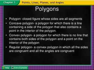
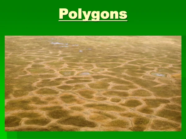
Periglacial Environments: • A number of definitions • Definition from Physical Geography.net “Landforms created by processes associated with intense freeze-thaw action in high latitude areas or near an alpine or continental glacier”Features Include: • Pingos • Ice wedges • Thermokarsts • Patterned ground • Polygons are a type of patterned ground
Non-sorted: “Are polygonal-shaped features often delineated with a furrow or crack but without a border of stones…vegetation is frequently concentrated in the furrow and helps to emphasize the pattern” (Price 1972). Usually found on near horizontal surfaces but may be found on slopes. Occur only in groups Range in size from a few cm up to 100m in diameter. Similar to mud beds but on a larger scale Largest size polygons are the result of ice wedges. Sorted: “are Polygonal features given definition by a border of stones surrounding a central area of finer material” (Price 1972). Form on fairly level ground Small to large sizes from 10cm-10m in diameter. Occur in groups Stone size in the border increases with the size of the feature and decreases with depth. Stones on border are often on their edge and oriented parallel to the border, which may or may not be coincident with crack patterns. Polygons
Polygon Formation • Usually the result of cracking due to dessication or thermal contraction. • Cracks are vertical and are a result of horizontal contraction of the surface layer. • Sorting sometimes occurs by movement of coarse material towards and into the cracks. • In an experiment by Pissart (1974) in which the ground was artificially leveled and mixed found that it took small stones two years to accumulate on the surface and those that did moved toward and eventually fell into thermal contraction cracks. This material was caused when the ground warms and expands. Fine grained material below the polygon is pushed upward and inward. Eventually stones reach the surface of the raised, fine grained material and gradually fall into the bordering cracks. The process then continues.
Types of Polygons • There is a variety of polygon formations • Different types may include: • Frost-crack polygons • Ice-wedge polygons • Sorted and non-sorted circles • Stone or soil stripes
“Frost cracks are steep fractures formed by thermal contraction in rock or frozen ground with substantial ice content. They commonly intersect to create polygonal patterns, which may lead to the formation of wedges of ice and surficial material. The frequency of cracking is linked to the intensity of winter cold..” (http://www.gcrio.org/geo/frozen.html) Pic:(http://uregina.ca/~sauchyn/geog323/419.jpg) Frost Crack Polygon:
Begin with cracking due to intense cold and thermal contraction. The cracks gradually fill with ice The vertical wedges of ice shape the polygons which occur below the active seasonal freeze-thaw layer. The visible surface formation is a result of the soil slumping above the ice wedges. (Williams and Smith 1989) May be a few metres to over 100 metres in diameter. Can form low-centered or high centered polygons: Low centered if ice wedge is growing High centered if thawing and erosion are more prevalent causing stream channels along ice-wedges Ice Wedge Polygons:
Sorted http://www.ucsc.edu/currents/02-03/art/patterns.03-01-20.240.jpg Non-sorted www.://uregina.ca/~sauchyn/geog323 Sorted and Non-sorted Circles
Sorted Have a definite ring of stones or rocks in a circular formation Defined as “circular accumulations of stones around a center of finer material. Vary in size from a few centimeters to over 3m on diameter and can extend to depths of about 1m. Stones are largest at the surface and decrease with depth. Occur singly or in groups on horizontal surface. If the surface is not horizontal, elongation may occur creating stripes. Non-sorted Lack definite ring of stones. Classified as “bare circular areas margined by vegetation” (Price,1972). Usually 0.5-3m in diameter. Can be found singly or in groups on fairly level ground. Sorted and Non-Sorted Circles -Some classify them as a separate category
One definition of stripes is “linear patterns of soil or vegetation on slopes without related lines of stones…frequently consist of parallel lines of vegetation and intervening strips of relatively bare ground oriented down the steepest slope” ??? (Price, 1972) Are believed to be created as stone circles but elongate due to slope and creep. Range in size from a few cm to 1-2m in width and can extend down slope several tens of metres but are often discontinuous. Can be sorted or unsorted Sorted Stripes often have stones turned on edge parallel to the stripe. Stripes
Extraterrestrial: • Mars • Have identified three types: • Small Scale • Large Scale polygonal nets on level terrain • Large scale polygonal nets in craters • Are thought to be caused from freeze and thaw frost cracking
Mars impact Crater: Polygon Formations-Each section slightly larger than a football field(http://www.msss.com/mars_images/moc/7_19_99_fifthMars/07_npolys)
(A) Polygon troughs highlighted by frost as the south polar cap retreats during spring. The circular features are the locations of buried craters that were originally formed by meteor impact. This image was acquired on 1 October 2001. • (B) Summertime view of polygons, highlighted by dark, windblown sand, on the floor of a crater. Obtained on 21 January 2002. • (C ) Polygon troughs highlighted by the retreating south polar frost cap during southern summer. This picture was taken on 13 January 2000. • (A) (B) (C )
Cycle of polygons, thermokarst lakes and pingoshttp:/arctic.fws.gov/permcycl.htm