Download
1 / 24
250 likes | 820 Vues
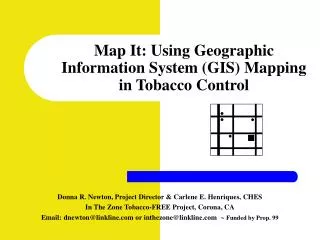
Map It: Using Geographic Information System (GIS) Mapping in Tobacco Control. Donna R. Newton, Project Director & Carlene E. Henriques, CHES In The Zone Tobacco-FREE Project, Corona, CA Email: dnewton@linkline.com or inthezone@linkline.com ~ Funded by Prop. 99. What Is GIS Mapping-.

E N D
Map It: Using Geographic Information System (GIS) Mapping in Tobacco Control Donna R. Newton, Project Director & Carlene E. Henriques, CHES In The Zone Tobacco-FREE Project, Corona, CA Email: dnewton@linkline.com or inthezone@linkline.com ~ Funded by Prop. 99
What Is GIS Mapping- • Geographic Information Systems (GIS) is a computer-based tool that helps visualize information and see patterns and relationships that aren’t otherwise apparent in written data. • Provides a “birds eye” view of data including actual locations of retailers who were willing to sell tobacco to minors • Can be used for monitoring compliance, enforcement and evaluation
How To Begin GIS Mapping for Tobacco Retailers in Your City • Obtain a list of businesses within your city from the city clerk, business license or finance department (this is usually in an Excel file) • Identify all tobacco retailers (by type of store, business name) • Call and/or visit each store to assess whether they do in fact sell tobacco
GIS Mapping Database • It’s easy to transfer data from an Excel file • Have the name of the retail store, store type, address, and zip code • For attempt-to-purchase tobacco or zoning activities, have the “sales rates” by store
What Other Information Can Be Added? • Locations of places where youth hang-out: • Recreational parks • Movie theatres • Skate parks • Fast food restaurants • Laser tag centers • Amusement parks • Schools (elementary, middle/junior high/high schools) • School bus stop locations (next to tobacco retailers) • Minority & low income neighborhoods
What You Can Do With GIS MappingAnything You Want… • Map density of tobacco and alcohol retailers (zoning) • Nutrition programs can map fast food locations in proximity to schools and youth hang-outs • Location of youth service programs • Cities currently map location/type of trees • Overlay multiple indicators: tobacco and/or alcohol advertising by store type/location/ethnic areas, alcohol sales to minors, low socio-economic status neighborhoods
How We MAPPED IT! in Corona, California Know Your Community: • Demographics (population, ethnicity/race, # of youth/children, income, commuters) • What is of interest to residents? • Anything having to do with their children • School and community service activities • Issues that youth take the time to advocate for • Who can make or break an issue? (i.e. city council, city manager, chief of police, chamber of commerce, Corona-Norco American Cancer Society Board)
Recruitment Efforts • Identified active & well-respected youth groups from Corona & Norco: • American Cancer Society Youth Board (high school) • U.N.I.T.Y. Youth Council (junior high and high school)
Training Our Volunteers • Adult and youth volunteers were trained in Tobacco 101 • Youth and adults were taught how to conduct youth attempt-to-purchase tobacco surveys (using the next to the last worst protocol in California!) • Youth received media, spokesperson and policy advocacy training • Lastly, youth and adults were trained on why illegal sales of tobacco rates are still so high and how a licensing ordinance could reduce those rates • Completed the Midwest Academy Strategic Chart
Strategic Planning • Long-term goal: to pass a retail licensing ordinance for the City of Corona • Short-term goal: get support or neutral stance from critical organizations (law enforcement, chamber of commerce, city manager, store owners, etc.) • Who became allies: city manager, city council member (children on UNITY Youth Board), Corona-Norco PTA, ACS, ALA, Riverside County Community Health Agency, Parents
Community Opinion Surveys: 300 people surveyed and 89% expressed support for licensing tobacco retailers 90% feel that licensing these retailers would reduce illegal sales of tobacco to youth Petitions (collected over 2,000 petition signatures from adults and youth in Corona) Cards to city council members Letters from youth to city council Attendance of youth and adult supporters at city council meetings How Did We Demonstrate Community Support?
Why Use GIS Mapping? • Because no one at city hall knew just how many retailers were selling tobacco in Corona • To provide a visual picture of how many merchants were illegally selling tobacco to minors and where they were located • Because “hell hath no fury like a woman’s scorn” (moms/parents hate it when their kids are being targeted or victimized) • Because a picture is worth a thousand words
U Can Map It 2! The following companies have mapping software: • www.esri.com • www.gisportal.com • www.agis.com (free) • www.maptitude.com