Analysis Tools
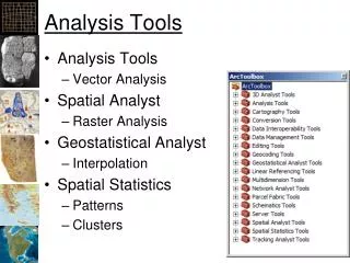
Analysis Tools. Analysis Tools Vector Analysis Spatial Analyst Raster Analysis Geostatistical Analyst Interpolation Spatial Statistics Patterns Clusters. Measuring Autocorrelation. Moran’s I Spatial Statistics Tools -> Analyzing Patterns -> Spatial Autocorrelation (Moran’s I)

Analysis Tools
E N D
Presentation Transcript
Analysis Tools • Analysis Tools • Vector Analysis • Spatial Analyst • Raster Analysis • Geostatistical Analyst • Interpolation • Spatial Statistics • Patterns • Clusters
Measuring Autocorrelation • Moran’s I • Spatial Statistics Tools -> Analyzing Patterns -> Spatial Autocorrelation (Moran’s I) • 0 ~ Random • 1 = Perfect Correlation • -1 = Perfect Dispersion (pattern) ArcGIS Help
Moran’s I Results 0.8 = Spatial Autocorrelation -0.05 = Random -1 = Opposite of autocorrelation
Spatial Autocorrelation Game • Northern Kentucky University • http://www.nku.edu/~longa/cgi-bin/cgi-tcl-examples/generic/SA/SA.cgi
Other measures • Geary’s C • Inversely related to Moran’s I • More sensitive to local spatial correlation
Spatial Cluster Analysis Wikipedia
Ripley’s K • Measure of spatial homogeneity http://www.stat.iastate.edu/preprint/articles/2001-18.pdf
Ripley’s K - ArcGIS ArcGIS Help
Cluster Analysis ArcGIS Help
Fragmentation Statistics • how fragmented is the pattern of areas and attributes? • are areas small or large? • how contorted are their boundaries? • what impact does this have on habitat, species, conservation in general?
1975 1986 1992 Note the increasing fragmentation of the natural habitat as a result of settlement. Such fragmentation can adversely affect the success of wildlife populations.
FragStats http://www.umass.edu/landeco/research/fragstats/fragstats.html
FRAGSTATS Overview • Derives a set of useful landscape metrics • Public domain code developed by Kevin McGarigal and Barbara Marks under U.S.F.S. funding
Situation • FragStats only supporting 4.x from now on • There tutorial data is in ArcGRID format • Following FragStats instructions on adding support for ArcGRIDs results in: • Only other formats supported are ASCII GRID and binary (neither appear to work)
FRAGSTATS Fundamentals • PATCH… individual parcel (Polygon) A single homogeneous landscape unit with consistent vegetation characteristics, e.g. dominant species, avg. tree height, horizontal density ,etc. A single Mixed Wood polygon (stand) CLASS… sets of similar parcels LANDSCAPE… all parcels within an area
FRAGSTATS Fundamentals PATCH… individual parcel (Polygon) • CLASS… sets of similar parcels All Mixed Wood polygons (stands) LANDSCAPE… all parcels within an area
FRAGSTATS Fundamentals PATCH… individual parcel (Polygon) CLASS… sets of similar parcels • LANDSCAPE… all parcels within an area “of interacting ecosystems” e.g., all polygons within a given geographic area (landscape mosaic)
FRAGSTATS Output Metrics • Area Metrics (6), • Patch Density, Size and Variability Metrics (5), • Edge Metrics (8), • Shape Metrics (8), • Core Area Metrics (15), • Nearest Neighbor Metrics (6), • Diversity Metrics (9), • Contagion and Interspersion Metrics (2) • …59 individual indices (US Forest Service 1995 Report PNW-GTR-351)
More Spatial Statistics Resources • GeoDA (geodacenter.asu.edu) • S-Plus • Alaska USGS freeware (www.absc.usgs.gov/glba/gistools/) • Central Server for GIS & Spatial Statistics on the Internet • www.ai-geostats.org • GEO 541 – Spatio-Temporal Variation in Ecology & Earth Science