Download
1 / 27
270 likes | 453 Vues
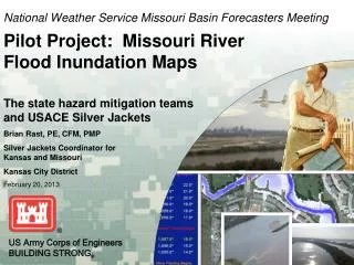
National Weather Service Missouri Basin Forecasters Meeting Pilot Project: Missouri River Flood Inundation Maps . The state hazard mitigation teams and USACE Silver Jackets Brian Rast, PE, CFM, PMP Silver Jackets Coordinator for Kansas and Missouri

E N D
National Weather Service Missouri Basin Forecasters MeetingPilot Project: Missouri River Flood Inundation Maps The state hazard mitigation teams and USACE Silver Jackets Brian Rast, PE, CFM, PMP Silver Jackets Coordinator for Kansas and Missouri Kansas City District February 20, 2013 US Army Corps of Engineers BUILDING STRONG®
Overview Topics • Silver Jackets Program and Background • Leading Change in Managing Risks from Natural Hazards • Pilot Projects • For More Information
Natural Hazards • Flood • Earthquake • Hurricane wind • Wildfire • Tornado • Storm surge • Landslide • Erosion • Severe winter weather • Extreme temperatures • Tsunami • Drought • Lightning • Hail • Subsidence USACE mission exists in those underlined
Flood Risk Management Life Cycle “Getting Ready” Actions taken BEFORE the event, including planning, training, and preparations “The Flood Fight” Actions taken DURING the initial impact of a disaster, including those to save lives and prevent further property damage Involve a planner! • Flood Risk Management system assessment / inspections • Monitoring / forecasting threats • State and Local Coordination • Reservoir operations • Flood Fight Preparation • Emergency system strengthening • Monitor and report flood impact • Monitor system performance • Support State / Local Flood Fight Event Preparation / Training Response Partnerships • Hazard mitigation planning • Floodplain management plans • Pre- & post- response & recovery activities “Driving Down the Risks” Measures that PREVENTa disaster, reduce its chance of happening, or reduce its damaging effects. Mitigation Recovery “Getting back on our feet” Actions taken AFTER the initial impact, including those directed toward returning to normalcy. • Repair damaged systems • Assess and document system performance • Implement mitigation measures / system improvements • Modify mitigation plans • Identify future mitigation opportunities • Develop system improvements
Background What is ? • Silver Jackets is the US Army Corps of Engineers (USACE) Civil Works program enabling participation in the states’ hazard mitigation teams. This is about collaboration between USACE, the Federal Emergency Management Agency, and other federal, state and local agencies to createan interagency team at the statelevel to develop and implement solutions to state natural hazard priorities. The Silver Jackets Program provides a formal and consistent strategy for an interagency approach to planning and implementing measures to reduce the risks associated with natural hazards. SILVER JACKETS Many Agencies - One Solution – Be Risk Aware!
Background The primary goals are to • leverage information and resources, • improve risk communication to the public in a unified effort, • and create a mechanism to collaboratively solve issues and implement initiatives. Many Agencies - One Solution – Be Risk Aware!
Shared Flood Risk Management Shared Flood Risk Management Measures for driving down flood risks: Initial Risk Outreach Federal / State / Local Natural Storage Federal / State / Local Structural Federal / State / Local Non – Structural Federal / State / Local Risk Contingency Plans Federal / State / Local / Individual Building Codes State / Local Zoning Local Insurance Individual / NFIP Residual Risk All Stakeholders contribute to reducing risk!
Natural Hazard Priority 1: FRM The USACE Flood Risk Management (FRM) Program is the umbrella program for all our programs related to the hazards of flooding. Silver Jackets Flood Plain Management Services Planning Assistance to States Emergency Response P.L. 84-99 Levee Program Dam & Levee Safety FRM Business Line Interagency Levee Task Forces (on Missouri and Mississippi Rivers) Coastal Storm Damage Reduction Public Affairs Office Planning, Regulatory, Environmental FRM Planning Center of Expertise Federal Task Force, E011988, Unified National Plan R&D, Critical Infrastructure, CERB, IWR International Interagency Flood Risk Management Committee
Silver Jackets in KC District Accomplishments with hazard mitigation team • Steady presence in state hazard mitigation team meetings since 2009 • Regular “Status Update” reports (originally for upward reporting) • Invitational Travel Orders (ITOs) to FRM workshop, 3 years in a row • ITOs to Natural Hazards workshops • Pilot Projects: 3 (as of Dec 2012)
Pilot Projects Wildcat Creek • Manhattan, KS • a floodplain management plan • flood forecast inundation mapping Cross Creek • Rossville, KS • flood forecast inundation mapping
Pilot Projects Missouri River Inundation Maps • flood inundation mapping • Parkville, MO to Leavenworth, KS • River miles 377 to 398 • development of a process for consistent FIM for remainder of Missouri River
Partners • State Risk Management Team • State Emergency Management Agency • Missouri Department of Natural Resources • Counties in Kansas and Missouri • Missouri River County Officials Coalition (MRCOCO) • National Weather Service (NWS) • US Army Corps of Engineers (USACE) • US Army Corps of Engineers, Risk Management Center - Modeling Mapping & Consequences (MMC) • US Geological Service (USGS) • Natural Resource Conservation Service (NRCS) • FEMA • Missouri River Flood Task Force • Kansas Hazard Mitigation Team • Kansas Department of Agriculture, Division of Water Resources • Kansas Division of Emergency Management • Kansas Water Office
Missouri River Mapping Missouri River Inundation Maps
State Risk Management Team Top 3 Team Activities: • State Hazard Mitigation Plan Updates • Inundation Mapping & LiDAR Sharing • Working Disasters & Exercises The team is interested in • Inundation Mapping, • Flood Fighting, • Flood Mitigation, • Levees, • Interagency Grant Programs, • and Sharing LiDAR and Flood Risk Related Information. Event Preparation / Training Response Partnerships • Hazard mitigation planning • Floodplain management plans • Pre- & post- response & recovery activities Mitigation Recovery
Kansas Hazard Mitigation Team Top 3 Team Activities: • Maintain State Hazard Mitigation Plan Updates • Prioritize mitigation actions across KS • Provide technical assistance for emergency managers in maintaining local hazard mitigation plans The team is interested in • Alternative mitigation actions • Strategies for doing mitigation actions Event Preparation / Training Response Partnerships • Hazard mitigation planning • Floodplain management plans • Pre- & post- response & recovery activities Mitigation Recovery
Technical Challenges • How to map behind levees? • Storage in the floodplains
Find Out More Silver Jackets Program with states’ hazard mitigation teams http:// www.nfrmp.us/state http:// www.nfrmp.us/state/factMissouri.cfm http://www.nfrmp.us/state/factKansas.cfm Wildcat Creek Pilot Project, Manhattan, Kansas • Interagency White Paper http://www.awra.org/proceedings/Spring2012/doc/abs/BrianRast_5ad7b2de_7818.pdf • USACE National FRM Program Workshop Presentation http://www.nfrmp.us/frmpw/docs/WORKSHOP/Plenary/4%20-%20Thursday/0830_Rast_121024_FRM-SJ%20Wildcat_Ck_FULL.pdf http://www.nfrmp.us/frmpw/docs/WORKSHOP/Plenary/4%20-%20Thursday/0830_Rast_120822_Wildcat_Handout.pdf • Flood Forecast Inundation Map http://water.weather.gov/ahps2/inundation/inundation.php?gage=mwck1 SimSuiteWebviewer http://rsc.usace.army.mil/SimSuite/External-Users Email questions to NWK.SilverJackets@usace.army.mil
Extra Slides Not part of presentation
title blank Robert Gonsalves
The variety of tools on the webpagecan help any stakeholder understand their flood risks better • Inset, including Historical Crests, will be visible for users to relate past flooding to current forecast • Depth grids are also available, showing water depth associated with any inundation map
What Can Agencies onState Hazard Mitigation Teams Do? • Will this information be useful? What can it be used for? • How does this process align with the state’s hazard mitigation plan (SHMP)? How will it inform the SHMP? • What Actions does this process enable? • How can state teams assist communities in the communication of flood risk (and LSAC assignment)? • What can participating agencies do to help communities at risk? Can team collaboratively work with communities to reduce and manage risk? • Are there additional coordination activities needed? • Two-way updates through state team meetings? • Closer coordination with communities? • Impacts to SHMP process?
National Flood Risk Management National Flood Risk Management Planning • FMPS / PAS • Levee and Dam Safety FRM Business Line • FRM PCX • Regulatory Environmental • R&D • International • Coastal FEMA • DOI • EPA • NOAA / NWS NOAA CSC • USBR • HUD • USDS • DHS NRCS • Tribes • States • Locals Silver Jackets • IFRMC • FIFM-TF • ILTF / RFRMT Roundtables • Regional FRM Teams • CERB EO 11988 • PL 84-99 • Section 404 Unified National Plan • Risk MAP Disaster Response • Mitigation Land Use Planning / Zoning • Emergency Services Contingency Response • Evacuation • Flood Fighting Water Resources Management • Building Codes Floodproofing • Environmental Protection
What Can Cooperation Among Agencies onState Hazard Mitigation Teams Do? • Share information on risk - Why? • Other agencies can use risk assessments to prepare and mitigate hazards. • Our actions, your actions - How do they inform the SHMP? (interim risk reduction measures) • Other agencies manage the hazards differently, and may not understand the other agencies’ roles. They may be able to reinforce communication. • Processes vary – What processes get enabled? • Pre-meditated hazard mitigation (stage one action prepares way for effective action later) is needed to take advantage of the higher public interest, after an event. • Same message, different agencies - How can state teams assist communities in the communicate and reduce (flood) risk? • Consolidate known risks in the SHMP with lead actions, specific at the more local level in county HMPs • Stove pipes make us blind - Why meet periodically with SRMT? • Situational awareness enables better hazard mitigation reducing costs to the state from future damages