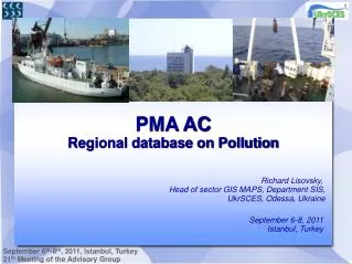
PMA AC Regional database on Pollution
190 likes | 319 Vues
This project, led by Richard Lisovsky, Head of GIS Maps Sector at UkrSCES, aims to establish a comprehensive online regional database to monitor pollution and its impact on the Black and Azov Seas. Key activities include the regulation of basin environments, ecological expertise, and the creation of interactive maps utilizing UMN Mapserver software. The database features user-friendly access for public use, security measures for data management, and a structured framework for consistent reporting across countries involved in monitoring efforts.

PMA AC Regional database on Pollution
E N D
Presentation Transcript
PMA AC Regional database on Pollution Richard Lisovsky, Head of sector GIS MAPS, Department SIS, UkrSCES, Odessa, Ukraine September 6-8, 2011 Istanbul, Turkey
Activities • Regulation of the use of the Black and Azov Sea basin environment; • Development of the use of the Black and Azov Sea basin environment. Scientific problems of ecological expertise; • Monitoring of the environment; • Development of information systems; • Development and maintenance of data bases; • International obligations in the sphere of environmental protection; • Development of new methods and methodology of taking measurements.
Proceeded activities with RDB • Create and maintain an on-line Regional Database on pollution and its impacts on the Black Sea ecosystem: • Created database structure • Filled out data for the Country, Sample type, Parameter group, Parameter, Quality, Unit, Biota type and Sediment type tables • Organize easy access to the Regional Database on pollution: • The user interface for access to RDB is now developing • 3. Organize Interactive Map Services (via www-access to UkrSCES Web Site): • Developed Interactive Cartographic Information System for accommodation of cartographic materials and environmental data based on open source UMN Mapserver software
What steps are ready • Developed structure of Regional Database – tables, links, indexes • Developed web-interface of RDBP for public access, read, edit, update or import data • Developed security matrix for RDBP access – public, BSC members, data provider, AG members • Developed GIS mapserver application and integrated to database web-interface • Developed common user interface
What steps are ready • RDB-P includes the information coming from every country in the BSC in a consistent reporting format AG PMA: • Organizations who provide monitoring • Place of sampling • Samples taken and their details • The methods used for sampling and analysis: Sample method, Analysis method • List of mandatory and additional pollutants to be monitored. • Concentrations of contaminants in the following samples: sea water, sediments, biota.
Client side Web browser Common structure of portal Vector & Raster Data Regional DB
Data input process Regional Data Holder Regional Data Provider Approval DB Data check-out Data input Data approve QC maintenance is performed for data input control from errors and misprints based on a human or technical factor Regional DB
Metadada query result (example) Country, Name Organization, Address, Tel, Fax, Description, Site, Email, ContactPerson, ContactPersonEmail. And metadata for stations.
Not all data are presented in the format of PMA Reporting, • bringing to the desired format requires additional • time-consuming when writing. • The most common error in these data: X Sometimes the data is not tied to the type of sample, ie there is no certainty - that the data on water or on bottom sediments; X Do not specify a unit of measurement; • X There are errors in the coordinates of the station is located on the shore; Data obtained from the Secretariat for 2000-2005, 2006-2009.
Developing now Excel data parser for automatic data import to database via user web-interface Mapserver GIS layers and navigation tools GIS map objects identification upon user request Preparations for migrating database and web-interface to dedicated server and set up test-production status Statistics visualization – map data, charts, tables Tools for export requested data in common formats – text files, excel files, ocean data view files
Thanks for your attention! Any questions? www.sea.gov.ua