Download

1 / 5
Creating a Regional Routable Centerline
50 likes | 80 Vues
Create a robust regional centerline with unique IDs, speed limits, road classifications, one-way indicators, ramp naming, and crossovers. Implement intersection modeling, border street standards, and elevated crossing methodology.
Télécharger la présentation 
Creating a Regional Routable Centerline
An Image/Link below is provided (as is) to download presentation
Download Policy: Content on the Website is provided to you AS IS for your information and personal use and may not be sold / licensed / shared on other websites without getting consent from its author.
Content is provided to you AS IS for your information and personal use only.
Download presentation by click this link.
While downloading, if for some reason you are not able to download a presentation, the publisher may have deleted the file from their server.
During download, if you can't get a presentation, the file might be deleted by the publisher.
E N D
Presentation Transcript
Creating a Regional Routable Centerline 2009 Fairfax County GIS and Mapping
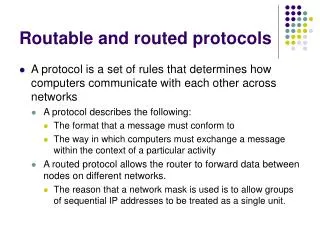
Key Items • Persistent Unique Id’s and parent child ID tracking • Include speed limit attribute • Establish a common road classification scheme • Include a one-way attribute • Ramp naming • Crossovers • Modeling Intersections Fairfax County GIS and Mapping
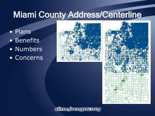
Standards for dealing with border streets Fairfax County GIS and Mapping
Establish methodology for elevated crossings Fairfax County GIS and Mapping
More Related