Download
1 / 4
40 likes | 331 Vues
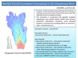
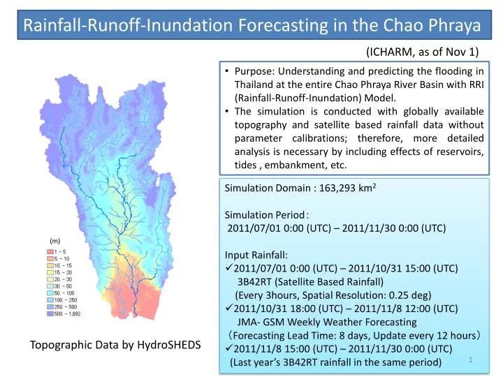
Rainfall-Runoff-Inundation Forecasting in the Chao Phraya. ( ICHARM, as of Nov 1). Purpose: Understanding and predicting the flooding in Thailand at the entire Chao Phraya River Basin with RRI (Rainfall-Runoff-Inundation) Model.

E N D
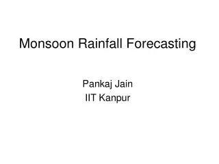
Rainfall-Runoff-Inundation Forecasting in the Chao Phraya (ICHARM, as of Nov 1) • Purpose: Understanding and predicting the flooding in Thailand at the entire Chao Phraya River Basin with RRI (Rainfall-Runoff-Inundation) Model. • The simulation is conducted with globally available topography and satellite based rainfall data without parameter calibrations; therefore, more detailed analysis is necessary by including effects of reservoirs, tides , embankment, etc. • Simulation Domain: 163,293 km2 • Simulation Period: • 2011/07/01 0:00 (UTC) – 2011/11/30 0:00 (UTC) • Input Rainfall: • 2011/07/01 0:00 (UTC) – 2011/10/31 15:00 (UTC) • 3B42RT(Satellite Based Rainfall) • (Every 3hours, Spatial Resolution: 0.25 deg) • 2011/10/31 18:00 (UTC) – 2011/11/8 12:00 (UTC) • JMA- GSM Weekly Weather Forecasting • (Forecasting Lead Time: 8 days, Update every 12 hours) • 2011/11/8 15:00 (UTC) – 2011/11/30 0:00 (UTC) • (Last year’s 3B42RT rainfall in the same period) (m) Topographic Data by HydroSHEDS
Simulated Water Depths on Oct 13 (Case 4) Inundation Extent by Satellite (as of Oct 13) NakhonSawan Ayutthaya Bangkok • The simulated inundation extent agrees general pattern with the remote sensing image • Large degree of uncertainty in the simulation in Bangkok due to no tidal effect consideration
Forecasted Inundation Depths(Case 4) Nov. 15 Nov. 30 Nov. 1 NakhonSawan Ayutthaya • At Nov. 1, flooding still remains high around the NakhonSawan and Ayutthaya • At Nov. 15, flooding around the NakhonSawan is reduced • At Nov. 30, the flooding remains only partially at the northern part of Bangkok
5 m 1 : July 2 31 : Aug 1 62 : Sep 1 92 : Oct 1 123 : Nov 1 152 : Nov 30 0 m