Download
1 / 42
420 likes | 538 Vues
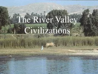
GEOGRAPHY & EARLY RIVER VALLEY CIVILIZATIONS. UNIT ONE. BASIC GEOGRAPHY. Culture : all the things that make up a people’s way of life Nuclear Family : traditionally a wife, husband, and their children Extended Family : several generations living in one household

E N D
BASIC GEOGRAPHY • Culture: all the things that make up a people’s way of life • Nuclear Family: traditionally a wife, husband, and their children • Extended Family: several generations living in one household • Monotheism: worship of one God • Polytheism: worship of more than one God • Democracy: form of government in which the people have supreme power
7. Republic: form of government in which people choose the leaders who represent them • 8. Dictatorship: form of government in which a ruler has power by force • 9. Technology: skills and tools a people use • 10. Diffusion: movement of customs or ideas from one place to another • 11. Ethnocentrism: judging other cultures by the standards of one’s own culture • 12. Racism: belief that one racial group is superior to another
13. Nomad: member of a hunting people who travel from place to place to find food • 14. Capital: money that can be invested in business ventures for the purpose of making a profit • 15. Entrepreneur: person who risks his money to set up a business • 16. Cash crop: crop sold on the world market • 17. Modernization: changes in a nation that enable it to set up a state government and produce a high level of goods and services
18. Tariff: tax imposed on imported goods • 19. Population density: average number of people living in a given area • 20. Civilization: highly organized group of people with their own language and ways of living
GEOGRAPHY is the study of people, their environments, and resources. To understand people, you must know their LOCATION, or position on the Earth’s surface. To determine where a place is on a many maps, you can use the lines of LONGITUDE and LATITUDE. Once you locate a place, it is useful to understand its TOPOGRAPHY, or physical characteristics.
A physical map shows MOUNTAINS, or steep rugged land:PLAINS, or level, gently rolling lands; HILLS, or raised lands; and PLATEAUS, areas of high, flat land. When you determine a place’s ELEVATIONfrom sea level and CLIMATE, or average weather, you will know what VEGETATIONcan grow in that place.
CIVILIZATIONE– highly organized group of people with their own language and ways of living • URBANIZATIONG– growth of cities • IMPERIALISMF– control by one country of the political, economic, or cultural life of another country or region • WESTERNIZATIONB– adoption of western culture • NATIONALISMC– pride in and loyalty to one’s country • LITERACYA– ability to read and write • PRIVATIZATIOND– selling state-owned industries to private investors
BAY – an inlet of land on a large body of water • CAPE– point of land surrounded by a body of water • CONTINENT– one of 7 large land masses on earth • DELTA– land built up from soil carried downstream • DIVIDE– stretch of land that separates river basins
ELEVATION– height of land above sea level • GLACIER– large body of slowly moving ice in polar regions • GLOBE– sphere shaped model of the earth • GULF– part of a large body of water; larger than a bay • ISLAND– land area completely surrounded by water
LAKE– sizeable inland body of water • MOUNTAIN– land with steep sides; rises sharply from surrounding land • MOUTH OF RIVER– place where a river flows into a larger body of water • OCEAN– major body of salt water; surrounds a continent • PENINSULA–body of land almost fully surrounded by water
PLAIN– area of level land; usually at a low level • PLATEAU– area of flat, rolling land at a high elevation • RIVER– large stream of water that runs through land • SEA– large body of water completely or partly surrounded by land • SOURCE– place where a river or stream begins
STRAIT– narrow stretch of water joining two bodies of water • VALLEY– area of low land between mountains or hills • VOLCANO– mountain created as liquid rock or ash are thrown up from inside the earth
BASIC GEOGRAPHY Geographers divide most of the earth’s land surface into seven large landmasses called continents. The earth’s continents are: • NORTH AMERICA • SOUTH AMERICA • ANTARCTICA • AUSTRALIA • EUROPE • AFRICA • ASIA
LARGEST VS. SMALLEST ASIA is the LARGEST AUSTRALIAis the SMALLEST
LANDFORMS Cover about 30% of the surface of the earth. Landforms include: MOUNTAINS, HILLS, PLATEAUS, PLAINS
Geographers describe each landform by its ELEVATION or height above sea level. MOUNTAINS are the highest of the world’s landforms.
The world’s highest mountain is Mount EVEREST (29,028 feet above sea level), part of the HIMALAYA mountain range located in NEPAL.
The world’s largest plateau area is the TIBETANPlateau in ASIA.
The world’s largest plain is the NORTH EUROPEAN Plain, which stretches for more than 1000 miles from FRANCEto RUSSIA.
About 70% of the earth’s surface is covered with water. Geographers identify bodies of water by their shapes and sizes. The major types include: OCEANS, SEAS, BAYS, GULFS, LAKES, RIVERS.
The largest bodies of water in the world are the four saltwater oceans: • ATLANTIC • PACIFIC • INDIAN • ARCTIC
The PACIFIC Ocean is the largest (64 million square miles)
The world’s largest sea is the SOUTH CHINA SEA (1.1 million square miles) located in ASIA
The world’s largest bay, measured by area, is the BAY OF BENGAL (839,000 square miles) located in ASIA
A lake is a body of water completely surrounded by land. The world’s largest lake is Lake SUPERIOR (31,820 square miles).
The world’s largest inland body of water is the CASPIAN Sea (143,550 square miles) located between EUROPE & ASIA
The world’s longest river is the NILE River in AFRICA (4,160 miles) Seen in green
GEOGRAPHY • The Study of PEOPLE, their ENVIRONMENTS, and their RESOURCES • FIVE THEMES OF GEOGRAPHY: 1. LOCATION 2. PLACE 3. INTERACTION 4. MOVEMENT 5. REGION
LOCATION • Position of a place on the Earth’s surface A. LATITUDE: measures distance north/south of the equator B. EQUATOR: divides earth into northern/ southern hemispheres C. LONGITUDE: measures distance east/west of the Prime meridian D. PRIME MERIDIAN: divides earth into eastern/ western hemispheres {runs through Greenwich, England}
PLACE • Human and Physical Characteristics of a location • PHYSICAL CHARACTERISTIC EXAMPLES: Landforms, Climate, Soil, Animal Life • HUMAN CHARACTERISTIC EXAMPLES: Religion, Language, Transportation
INTERACTION • How Humans adaptto and modify the environment • Humans shape the landscape through their interaction with the land • Both positive and negative effects on the environment EXAMPLES:CLEARING FORESTS, POLLUTION
MOVEMENT • Travel of people, goods, and ideas to and from a place {MIGRATION} WHY? Find food, freedom, better life war, disasters • Early reason for movement – TRADE {movement of goods between areas} EXPORTS: goods sent outside of country IMPORTS: goods brought into country • Movement has led to INTERDEPENDENCE Countries depending upon one another for goods, resources, knowledge
REGION • Everything that borders or surrounds the location, how they interact,howthey are alike {Example:Mexico and Canada are in the same region as the United States, and they are all in North America} • Can be identified by: physical characteristics, cultural, political, economic features