Download
1 / 9
90 likes | 196 Vues
Explore the discrepancies in the Deep Creek Station location data and how it affects drainage area determination. Learn about manual determination of watershed properties and the importance of precise station placement for regionalization.

E N D
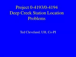
Project 0-4193/0-4194Deep Creek Station LocationProblems Ted Cleveland, UH, Co-PI
Station Location – Deep Creek 08140000 • Latitude-longitude for Deep Creek Station did not plot in a location that agreed with the total drainage area. • USGS supplied follow-up documentation to help determine station location. • Next several exhibits should explain the confusion.
Station ID File Content 08140000 Deep Creek Subwatershed #8, near Placid, TexasLatitude 31()24'09“Longitude 99()08'13“Drainage area(mi2) = 5.41
Station ID File Location Latitude 31()24'09“Longitude 99()08'13“Drainage area(mi2) = 5.41
Problem • Location is reasonable for station 08140500 • Data is for station 08140000 • In any event, it does not affect the unit graphs except when we try to regionalize using watershed properties, then it makes a big difference.
How we found out • Watershed properties were manually determined using paper maps, and the geo-referenced topographic maps from a commercial service. • When locating this station, the drainage area did not make sense (it was much larger than the 5 square miles). • We arbitrarily moved upstream to the riser pipe on the header tank (the dam) and the drainage area upstream of that location was still a bit large but useable.
Location used for Watershed Properties We initially used the riser pipe location (red box) The target is close to the position shown on the USGS report. The red circle was used to obtain watershed properties for regionalization, because it made the most sense. It is located on a “stream bed” and drains about the correct area. 31()22’58”N 99()08’25”W 31()22’ 55”N 99()08’48”W 31()22’38”N 99()08’25”
Another Problem station08140500.dat # site=Deep Creek Subwatershed No. 4, near Placid, Texas# latitude=31()18'19“# longitude=99()07'52“# drainagearea(mi2) 1.22 • Location data in file name associated with 08140500, is much farther south than the station location indicated on the USGS report. • It plots 6 minutes south of the 08140500 marker on the report, but the location does coincide with a riser pipe, thus it is a logical measuring location.