Download
1 / 25
260 likes | 460 Vues
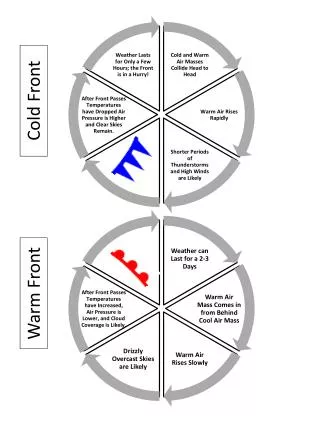
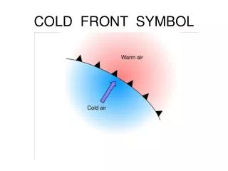
Fronts. front - an area between two colliding air masses. cold front - leading edge of cold air denoted with a line and filled blue triangles pointing in the direction of advance . warm front - leading edge of warm air

E N D
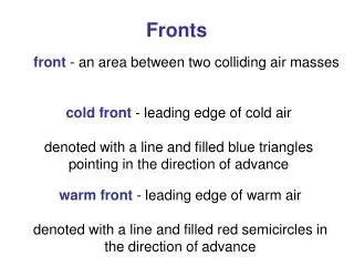
Fronts front- an area between two colliding air masses cold front - leading edge of cold air denoted with a line and filled blue triangles pointing in the direction of advance warm front - leading edge of warm air denoted with a line and filled red semicircles in the direction of advance
Frontal Lifting Cumulonimbus clouds MAR lifting condensation level more dense DAR less dense mT is a maritime tropical air mass - warm, humid, unstable cP is a continental polar air mass - cold, dry, stable
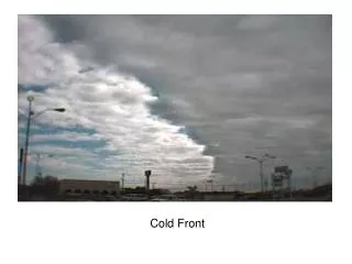
An advancing cold front cirrus clouds signal an advancing front note that cumuliform clouds develop in this case this is a cP or mP air mass heavy rain, winds this is a mT air mass note the steep nature of the front air pressure and temperature at the front line fall dramatically
An advancing warm front cirrus clouds signal an advancing front note the progression of cloud development note that stratiform clouds develop in this case temperature inversion often occurs drizzly rain the active warm air mass slides over the ‘wedge’ of passive cold air
the polar front is the area of contrast between cold polar air and warm subtropical air
Aleutian Low Icelandic Low
Midlatitude Cyclones these migrating storm systems have low pressure cores, converging, ascending air, and they rotate counterclockwise in the NH
the polar jet stream follows the edge of Rossby waves - it meanders between 30-70° N
Mid-latitude Cyclones • Also known as wave cyclones due to the undulating nature of frontal boundaries and course of the jet stream • Form due to the collision of warm and cold air masses • Different from tropical cyclones • High-speed jet stream winds guide cyclones along their “tracks”
the initiation of a cyclone occurs when cold and warm air masses collide - it requires surface convergence towards a low pressure area and divergence aloft it takes about a week for this whole process to occur
eastward of the collision front, warm air moves northward and cold air moves southward - the beginning of counterclockwise rotation - this movement draws warm air from the south and cold air from the north will winds flowing into the low flow parallel to the isobars? warm front cold front
A squall line can form when a fast-moving cold front encounters warm air and violently uplifts it these frontal clouds are 17,000 m (55,000 ft) high, and extreme winds and rain are affecting the surface
precipitation is heavy to moderate at this stage during this stage of a cyclone’s life cycle, the faster-moving cold front overtakes the warm front and wedges beneath it (”occluding” or closing it)
there is still some counterclockwise air flow with light winds during this stage, there is no more uplifting of air and the storm gradually fades
average cyclone storm tracks follow the sun’s movement in the sky with the seasons