Download
1 / 22
220 likes | 351 Vues
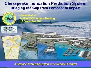
Chesapeake Inundation Prediction System Bridging the Gap from Forecast to Impact. Presented to: MARACOOS Annual Meeting 15 December 2011. A Regional Prototype System for a National Problem. What Emergency Managers Get Now. Current Text Storm Surge Forecast.

E N D
Chesapeake Inundation Prediction System Bridging the Gap from Forecast to Impact Presented to: MARACOOS Annual Meeting 15 December 2011 A Regional Prototype System for a National Problem
What Emergency Managers Get Now Current Text Storm Surge Forecast
What Emergency Managers Want Where will it flood? When will it flood? How deep will it be? How long will it last? What is the uncertainty in the forecast? Forecast Impact
From Forecast… Bridging the Gap To Impact • MATURING TECHNOLOGY • Regional scale atmospheric wind forecast model • Very high-resolution hydrodynamic models with land flooding • Very high-resolution land elevation data (LIDAR) • Emerging GIS and visualization capabilities for integrated, high-resolution pictures and products
Chesapeake Inundation Prediction System (CIPS) Partners Project Management: • Chesapeake Bay Observing System (CBOS)/Old Dominion University • Chesapeake Research Consortium Atmospheric Modeling and Validation: • NOAA National Weather Service (NWS) Weather Forecast Offices • Wakefield, VA; Sterling, VA; Mt. Holly, NJ • WeatherFlow, Inc. Hydrodynamic and Hydrologic Modeling and Validation: • Virginia Institute of Marine Science, College of William & Mary • University of Maryland Center for Environmental Science (UMCES) Horn Point Laboratory • NOAA NWS Middle Atlantic River Forecast Center Overland Inundation Validation: • USGS Water Science Centers in VA and MD • USGS Office of Surface Water, Reston, VA Visualization and Validation: • Noblis, Inc. Economic Valuation and User Engagement: • UMCES Chesapeake Bay Laboratory • CBOS/Old Dominion University Data Management and Communications: • NOAA Chesapeake Bay Office
CIPS Components Economic Evaluation - UMCES Forecast wind fields Data Management System – NOAA CBO, ASA Transmit forecast NWS offices WeatherFlow Forecast major river discharge Middle Atlantic River Forecast Center Transmit forecast Forecast on-land flooding Retrieve wind field and river discharge forecasts VIMS UMCES Visualize on-land flooding Transmit flooding forecast Retrieve flooding forecast Noblis NWS Weather Forecast Office Transmit visualized flooding forecast Retrieve visualized flooding forecast Guidance to brief emergency management Validate land flooding USGS
Veteran’s Day Nor’easter 11-13 November 2009 Susquehanna River Baltimore Annapolis Delaware Bay Washington Alexandria Potomac River Chesapeake Bay James River Richmond CIPS Forecast Demonstration Hampton Norfolk
Nor’Ida Storm Tide - NOAA CO-OPS Data Nov 10-13, 2009 Tue Fri Thu Wed Watch Issued Warning Issued Major Moderate Minor
Coastal Flood WatchIssued 4 AM Tue Nov 10, 2009 408 AM EST TUE NOV 10 2009 ...COASTAL FLOOD WATCH IN EFFECT FROM WEDNESDAY AFTERNOON THROUGH THURSDAY MORNING... THE NATIONAL WEATHER SERVICE IN WAKEFIELD HAS ISSUED A COASTAL FLOOD WATCH...WHICH IS IN EFFECT FROM WEDNESDAY AFTERNOON THROUGH THURSDAY MORNING. A COMBINATION OF STRONG HIGH PRESSURE BUILDING FROM THE NORTH AND REMNANTS OF IDA OFF THE SOUTHEAST COAST...WILL ALLOW AN EXTENDED PERIOD OF STRONG OFFSHORE FLOW TO DEVELOP ALONG THE COAST OF NORTHEAST NORTH CAROLINA AND SOUTHEAST VIRGINIA. THE APPROACHING NEW PHASE OF THE MOON...IN TANDEM WITH THE STRONG ONSHORE FLOW...WILL LEAD TO INCREASING TIDAL ANOMALIES OF AROUND 2 TO 3 FT ABOVE NORMAL...BEGINNING WEDNESDAY AFTERNOON AND CONTINUING THROUGH THE SUCCESSIVE HIGH TIDE CYCLES LATE IN THE WEEK. PRECAUTIONARY/PREPAREDNESS ACTIONS... A COASTAL FLOOD WATCH MEANS THAT CONDITIONS FAVORABLE FOR FLOODING ARE EXPECTED TO DEVELOP. COASTAL RESIDENTS SHOULD BE ALERT FOR LATER STATEMENTS OR WARNINGS...AND TAKE ACTION TO PROTECT PROPERTY.
Forecast Impact Nor’Ida Maximum Flooding Flooded Area All three forecasts Two of three forecasts One of three forecasts Poquoson Langley AFB Chesapeake Bay James River Chesapeake Bay Bridge-Tunnel Newport News Hampton Hampton Roads Naval Base Norfolk Atlantic Ocean Norfolk Portsmouth Virginia Beach Chesapeake
Forecast Validation Poquoson Flooded Area All three forecasts Two of three forecasts One of three forecasts
Flooding Forecast with Uncertainty Flooded Area All three forecasts Two of three forecasts One of three forecasts Langley AFB
Flooding Forecast with Uncertainty Flooded Area All three forecasts Two of three forecasts One of three forecasts
Flooding Forecast with Uncertainty Flooded Area All three forecasts Two of three forecasts One of three forecasts Poquoson Newport News Hampton
Flooding Forecast with Uncertainty Flooded Area All three forecasts Two of three forecasts One of three forecasts
Flooding Forecast with Uncertainty Flooded Area All three forecasts Two of three forecasts One of three forecasts
Flooding Forecast with Uncertainty Flooded Area All three forecasts Two of three forecasts One of three forecasts
Flooding Forecast with Uncertainty Flooded Area All three forecasts Two of three forecasts One of three forecasts Where Jay Titlow Lives
Public Works Dept Public Works Dept Jay’s Home Fire Dept Fire Dept Police Dept Poquoson High School
Flooding Forecast with Uncertainty Public Works Dept Fire Dept Jay’s Home Police Dept Flooded Area All three forecasts Two of three forecasts One of three forecasts Poquoson High School
Flooding Forecast with Uncertainty Public Works Dept Fire Dept Jay’s Home Police Dept Flooded Area All three forecasts Two of three forecasts One of three forecasts Poquoson High School
From Forecast… Bridged the Gap To Impact