Download
1 / 20
200 likes | 335 Vues
This Severe Weather Operation Plan (SWOP) aims to enhance staffing and utilization of workstations during severe weather events. Key updates include integrating social media coordination, improving event descriptions, and establishing clear duties for team members during pre-storm, during-storm, and post-storm phases. The plan emphasizes flexibility, awareness of warning fatigue, and leveraging team strengths for effective operation. Various staffing models are outlined to address different severity levels of storms, ensuring preparedness for historic weather events that could lead to substantial impacts.

E N D
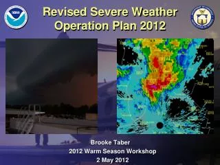
Revised Severe Weather Operation Plan 2012 Brooke Taber 2012 Warm Season Workshop 2 May 2012
Motivation/Goal • Improve staffing and utilization of workstations during historic events • Updated to include social media and public information officer for improved DSS • Better description of events with previous severe/hydro events reference in staffing models • Improve overall SA with team approach to operations
SWOP Development • Severe weather team produced a list of duties and responsibilities associated with pre-storm, during storm, and after storm • Developed Excel spreadsheet, then placed into SWOP staffing charts • Team revised event descriptions with storm write up reference material
SWOP Guidelines • Have flexibility, no two events are similar • Use only as guidance and adjust as the situation or event changes • Beware of warning fatigue and have people potentially rotate working the radar • Place people in areas of their strengths, especially during big events
Staffing Model 4-5 For example, June 25, 2005 Williston Pulse Severe
Staffing Model 5-6 For example, August 21, 2011 severe weather event
Staffing Model 6 • Definition: Scattered to widespread severe/hydro issues, which requires two radars to cover completely. SPC outlook usually will have the CWA in Slight Risk or higher for severe thunderstorms but the threat to life is low. A high CAPE (>2000 J/kg), along with a moderate to high shear (0 to 3km=40 knots) environment. Severe thunderstorm warnings and/or flash flood warnings are issued. Very active weather day with both severe and hydro products issued. Occurs 2 to 5 times a year. Also, please be thinking about warning fatigue and rotating radar operators, especially during the larger and more complex events, which may extend several forecast periods. For example, May 9, 2009 (Washington County Tornado)
Staffing Model 7 • WIDESPREAD SEVERE CONVECTION AND OR MAJOR FLOODING (RECORD BREAKING POSSIBLE: • Definition: Widespread severe convection or hydro issues, which requires two radars to cover completely. SPC outlook usually will have the CWA in Slight Risk or greater for severe thunderstorms some threat to life. Convection is widespread with multiple lines, which produces extensive flooding or from a tropical system. A numbers of severe thunderstorm warnings and/or flash flood warnings issued. This staffing model maybe used once or twice a year at most and could be needed for several forecast periods. Also, please be thinking about warning fatigue and rotating radar operators, especially during the larger and more complex events, which may extend several forecast periods. • For example, May 26th-27th Event (widespread flooding) or July 18, 2008 Event (Cambridge Tornado)
Staffing Model 8 EXTREME SEVERE/HYDRO ISSUES (HISTORIC): Definition: Organized, widespread, severe convection and hydro issues. Life threatening scenario with supercell storms, tornadoes, derecho, or a tropical system, with widespread historic flooding. SPC outlook has most of the CWA in moderate to high risk or highlighted in heavy rain potential. Also, expecting multiple thunderstorm/tornado watch boxes with numerous warnings. A historic event with widespread and significant damage, with numerous severe and hydro products issued. Briefings and damage surveys could last for weeks during the clean-up process. These events occur once every 5 to 10 years and this staffing model would not be used very often. For example, Hurricane Irene on August 28, 2011.
Position Descriptions • Public Forecaster (short term) -This person is responsible for creation, updating, and issuance of all NWS Public enhanced short term forecast products (ESTF) (AFD, ZFP, Grids, AFM, PFM, RVD, and Web Graphics) and watch information (WCN). Potential coordination with SPC. • Aviation Forecaster (long term) -This person is responsible for creation, updating, and issuance of all NWS aviation products, such as TAFs, Aviation Discussions, days 4-7 of the forecast, and the NFDRS products and could brief airport ops. When utilized, this forecaster could also issue the office’s NOW, Special Weather Statements, along with updating the HWO related to the severe weather event
Position Descriptions • RADAR/Hydro 1 -This primary Radar Operator will be responsible for issuance of warnings and follow-up statements across the entire CWA until a second radar person is introduced to the team. RADAR 1 will utilize Warn Gen for all warnings and statements. This position will obviously be utilized in all severe weather events. • RADAR/Hydro 2 -When level 5 or 6 staffing is required, a second Radar Operator will be utilized. At this point, the warning area becomes sectored. This additional Radar Operator will be responsible for issuance of warnings and follow-up statements across his/her sector of the CWA. RADAR 2 will also employ Warn Gen for warnings and statements. The Shift Leader and WACO should work together to ensure that the workload is evenly distributed between the two Radar Operators.
Position Descriptions • Public Service Desk -This person is responsible for things such as initiating/receiving calls to trained spotters or other affiliations, sending Local Storm Reports, and social media updates, (web graphics, Facebook, Twitter), and D-LAN, possible media interviews, make changes to the ORPG for radar performance and normal PSD duties (CLI, REC, HYD, and creating local climate maps). Furthermore, monitor CRS, Disaster Lan, NWS Chat and HAM Radios. • Public Information Officer–This person will be responsible for coordination with FEMA/VEM/EM’s/ and local media through emails and phone. Also, this person will monitor Disaster LAN and NWS-chat. In addition, this person would be responsible for information in Public Information Statements and Record Event Reports. Also, the PIO could be responsible for updating social media outlets and the web page.
Position Descriptions • Warning Coordinator -This person is the communications link between the other operational positions. Keeps track of all watches, warnings, advisories, statements, public products issued, and updating the radar operator (s) on the status of warnings/statements issued as well as other critical products. The WACO can also coordinate with the SPC or adjacent offices about watch information via 12 Planet or the phone, but mainly acts as a facilitator to guarantee effective communication. Finally, the WACO could be responsible for coordination with FEMA/VEM/EM’s/airport ops, and local media through emails, Disaster LAN and NWS-chat. (models 6,7, and 8) • Severe Weather Analyst or Mesoscale Forecaster (SWAN) - This person will assist the severe weather team by identifying mesoscale features or boundaries, which could initiate convection or cause hydro issues. The SWAN will focus on near storm environments and will complete a convective checklist.
Final Thoughts • Have flexibility and try to develop a plan early based on expected convection • Remember: use only as guidance and try to share best practices with staff members • Be-aware of scheduling conflicts and summer leave when limited staffing is available
Remember Always Be Prepared and Expect the Unexpected Look: Snow shovel at 430 Poker Hill Road in North Underhill, Vermont (Prepared for the next storm) and the home of the most snow in VT