Download
1 / 1
10 likes | 98 Vues
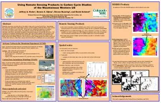
MODIS Products. Using Remote Sensing Products in Carbon Cycle Studies of the Mountainous Western US Jeffrey A. Hicke 1 , Dennis S. Ojima 1 , Steven Running 2 , and David Schimel 3 1 Natural Resource Ecology Laboratory, Colorado State University, Fort Collins, CO

E N D
MODIS Products Using Remote Sensing Products in Carbon Cycle Studies of the Mountainous Western US Jeffrey A. Hicke1, Dennis S. Ojima1, Steven Running2, and David Schimel3 1 Natural Resource Ecology Laboratory, Colorado State University, Fort Collins, CO 2 University of Montana, Missoula, MT 3 National Center for Atmospheric Research, Boulder, CO In addition to GPP, other MODIS products will be utilized in the study: Leaf area index (and the fraction of absorbed photosynthetically active radiation) are ecosystem model outputs that will be used in model parameterization. During the recent ACME flights, LAI at Niwot Ridge varied from over 3 at the lower elevations to less than 0.5 in the highest elevations. Abstract Remote Sensing Products Mountain ecosystems are major drivers of carbon cycling in the western United States. Quantifying their role in the continental carbon budget requires an understanding of both fast fluxes (hours to days) and longer term fluxes (years to decades). Two projects are studying the importance of montane ecosystems in regional carbon cycling. The Airborne Carbon in the Mountains Experiment is collecting carbon fluxes and related atmospheric information using aircraft and eddy flux towers. The Carbon Data Assimilation Modeling project utilizes these observations together with remotely sensed information to constrain estimates by ecosystem models. The projects focus on the Colorado Front Range and the Niwot Ridge LTER site. Here we discuss remote sensing products that allow analysis of variables that influence carbon fluxes and provide information for assimilation into ecosystem models. A suite of derived products from the MODIS sensor will be used to specify spatial and temporal patterns of vegetation and driving variables for data assimilation and modeling MODIS products are available from daily (e.g., surface reflectance) to 8-day (e.g., GPP) to monthly (e.g., LAI) to annual (e.g., NPP) temporal resolutions, and as such are useful for characterizing the temporal behavior of variables important in ecosystem modeling When longer time periods or higher spatial resolution is needed, we will utilize Landsat imagery and products CU Tower, Niwot Ridge LTER Surface temperature regulates carbon cycling through effects on photosynthesis and respiration. In addition, surface temperature is an indicator of soil moisture, another regulator of carbon fluxes. MODIS land surface temperature products will be incorporated in the data assimilation to improve model estimates of controls on photosynthesis and respiration. Airborne Carbon in the Mountains Experiment (ACME) Spatial scales • Goal: to understand carbon dynamics in montane forest regions by developing new methods for estimating carbon exchange at local to regional scales. • Activities: make carbon flux measurements at • the stand scale using eddy covariance • small catchment or "carbonshed" scale using measurements of CO2 concentrations • regional scales using measurements of CO2 and other species from aircraft • Several spatial scales are of interest: • Tower sites (nearest pixel) • remote sensing products will be assessed relative to tower data • Carbonshed • analogous to watersheds, these areas are of the order of 10s to 100s of km2 • Regional Carbon Data Assimilation Modeling (CDAM) In ecosystems that experience summer drought, such as in the Colorado Front Range, carbon cycling is strongly influenced by the timing of snow melt. MODIS snow extent will allow us to better estimate these hydrologic controls of ecosystem dynamics. Below shows a time series of snow cover (in black) across central Colorado in spring 2004. • regional products will useful in larger scale data assimilation and ecosystem modeling • Examples of the three scales are shown: • gross primary production is the carbon transferred from the atmosphere to the biosphere by plants • MODIS GPP is available every 8 days at 1-km spatial resolution • Goal: to constrain model estimates of fast fluxes and long term sequestration rates by combining satellite and in situ observations in a data assimilation context. • Activities: • Carry out benchmark state and parameter optimization studies for a range of key biosphere attributes such as carbon stocks and fluxes, stand ages, plant phenology, hydrological regimes, and soil carbon levels. • Evaluate remote sensing observations of land surface spatial and temporal heterogeneity relative to terrestrial ecosystem dynamics and carbon fluxes. • Design and implement assimilation that explicitly incorporates information on the multiple timescales of the carbon cycle, and that combines in situ and satellite information. CU Tower, Niwot Ridge LTER Project spatial scale and extent • Multiple scales will be addressed in the projects, from stand to regional scales • Eddy flux tower Niwot Ridge LTER • Colorado Front Range Colorado Western US • Map at right shows proposed flight paths of ACME Acknowledgements Regional: Central Colorado Carbonshed: Niwot Ridge Continental Divide This work is supported by the National Science Foundation and NASA.