The Swedish Cadastral System
820 likes | 1.25k Vues
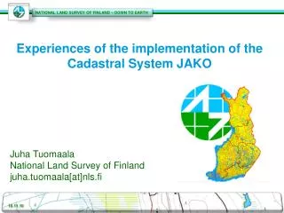
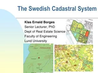
The Swedish Cadastral System. Klas Ernald Borges Senior Lecturer, PhD Dept of Real Estate Science Faculty of Engineering Lund University. Swedish land use. Map. Cadastral & Real Estate Authorities. Swedish cadastral & management data. More cadastral data (30 June 2012). Map. Sweden

The Swedish Cadastral System
E N D
Presentation Transcript
The Swedish Cadastral System Klas Ernald Borges Senior Lecturer, PhD Dept of Real Estate Science Faculty of Engineering Lund University
Swedish land use • Map
Sweden 9 mio inhabitants 450,000 km2 3.2 mio property units 22-25,000 new prop. units/mio prop.units & year Comparison – Sweden & Austria Austria • 8 mio inhabitants • 100,000 km2 • 12 mio property units • 20,000 new prop. units/mio prop. units & year
Historic cadastral development- Åby village, before 18th century ÅBY nr 1 - 1 mtlÅBY nr 2 - ½ mtlÅBY nr 3 - ½ mtlÅBY nr 4 - 1 mtl Norrby Bete 2 Skog 3 Skog 1 4 Åker
Åby – 1780 – storskifte ÅBY nr 1 - 1 mtlÅBY nr 2 - ½ mtlÅBY nr 3 - ½ mtlÅBY nr 4 - 1 mtl 2 3 4 Bete 1 1 2 1 3 3 4 4 2 2 2 Skog Skog 3 3 1 1 4 4 Åker 4 1 1 2 4 1
Åby – 1840 – laga skifte ÅBY nr 1 - 1 mtl - AÅBY nr 2 - ¼ mtl - BaÅBY nr 2 - ¼ mtl - BbÅBY nr 3 - ½ mtl - C ÅBY nr 4 - 1 mtl - D Ba C Bb Samf A A D
Åby nr 4 – hemmansklyvning 1870 ÅBY nr 4 - 3/8 mtl - DaÅBY nr 4 - ¼ mtl - DbÅBY nr 4 - ¼ mtl - DcÅBY nr 4 - 1/8 mtl - Dd Ba C Bb Dd Da A A Samf Dc Db
Åby – cadastral record (1910) Anmärkning: Fram till omkring 1970 skrevs 2:2 - 2² 3:2 3:3 3:4 2:3 2:2 3:5 3:8 3:7 3:6 4:5 ÅBY 1:1 1:1 4:2 4:6 4:4 4:3
Cadastral procedures • Subdivision • Reallotment • Property definition • Transfer of detachment of fixtures to real property • Amalgamation • Partition • Establishment of joint facilities • Utility Easement procedures • Adjudication • Legalisation
Case 1a – Residence and joint housing farm • PÅGÅENDE MARKANVÄNDNING/FASTIGHET Mindre jordbruksfastighet bebyggd med bostadshus och oanvänd ladugård. • FÖRÄNDRING (FASTIGHET/ÄGARE) • Fastighetens bebyggda delar kompletteras med: • • två nya ”hästinriktade” fastigheter (tomter) avsedda att bebyggas med bostadshus (två nya ägare), • • ladugård och betes-/åkermark som blir gemensam för de tre fastigheterna och används för hästhobby.
Examples of cadastral managementCase 1b - Residence with hourse farm
Case 2 – Residencial property unit with access to firewood • PÅGÅENDE MARKANVÄNDNING/FASTIGHET • Bebyggd bostadsfastighet på landet. • FÖRÄNDRING (FASTIGHET/ÄGARE) • Bostadsfastighet utökas med närliggande lövskogsområde i syfte att ge möjlighet till uttag av egen ved (oförändrad ägare).
Case 3 Hunting property • PÅGÅENDE MARKANVÄNDNING/FASTIGHET Skogsfastighet bebyggd med bostadshus och med delaktighet i samfälligheter. • FÖRÄNDRING (FASTIGHET/ÄGARE) • Fastigheten ombildas: • • Skogskiftet överförs genom fastighets-reglering till angränsande skogsfastighet (ny ägare). • • Återstoden av fastigheten som är en bebyggd bostadsfastighet har del i samfälld mark med jakträtt.
Case 4 - Residencial village • PÅGÅENDE MARKANVÄNDNING/FASTIGHET • Jord- och skogsbruksfastighet. • FÖRÄNDRING (FASTIGHET/ÄGARE) • Delar av fastigheten förädlas genom detaljplaneläggning för ny bostadsbebyggelse inriktad på bosättning kombinerad med hobbyverksamhet, i detta fall fiske, friluftsliv. • • 14 nya bostadsfastigheter med friluftsinriktning bildas. • • Genom gemensamhetsanläggning får dessa del i båt/fiske/bastu med flera anläggningar.
More cases - cadastral records • Urban property units • Site leasehold • Joint facilities • Joint property units • 3D property units • 3D joint facilities • Joint fishing property units • Allotment area (urban leisure or cultivation leasehold plot)
Need of urban detailed plan? Stångby kyrkby Stångby Ca 5 km till Lund Vallkärra