Download

1 / 21
210 likes | 372 Vues
Use of High-Resolution WRF Simulations to Forecast Lightning Threat. E. W. McCaul, Jr. 1 , K. La Casse 2 , S. J. Goodman 3 , and D. J. Cecil 2 1: USRA Huntsville 2: University of Alabama in Huntsville 3: NASA Marshall Space Flight Center Huntsville, Alabama, USA. SPoRT Meeting

E N D
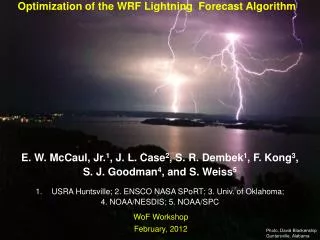
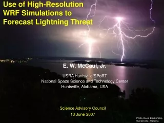
Use of High-Resolution WRF Simulations to Forecast Lightning Threat E. W. McCaul, Jr.1, K. La Casse2, S. J. Goodman3, and D. J. Cecil2 1: USRA Huntsville 2: University of Alabama in Huntsville 3: NASA Marshall Space Flight Center Huntsville, Alabama, USA SPoRT Meeting 14 February 2007 Photo, David Blankenship Guntersville, Alabama
Premises and Objectives Given: Precipitating ice aloft is correlated with LTG rates Mesoscale CRMs are being used to forecast convection CRMs can represent many ice hydrometeors (crudely) Goals: Create WRF forecasts of LTG threat, based on ice flux in layers near -15 C, and on simulated reflectivity. WRF: Weather Research and Forecast Model CRM: Cloud Resolving Model Additional Forecast Interests CI - convective initiation Ti - First lightning (35 dBZ at -15C, glaciation) Tp - Peak flash rate ~ VIL (Mass) Tf - Final lightning
0 oC Flash Rate Coupled to Mass in the Mixed Phase Region Cecil et al., Mon. Wea. Rev. 2005 (from TRMM Observations)
SPC Experimental Product - Pr (CPTP) >= 1 x Pr (PCPN) >= .01” Uncalibrated probability of lightning F15 SREF 3-hr COMBINED PROBABILITY OF LIGHTNING
WRF Lightning Threat Forecasts:Methodology Use high-resolution (2-km) WRF simulations to prognose convection Develop diagnostics from model output fields to serve as proxies for LTG: graupel fluxes; reflectivity profiles Create 0-6, 0-8 or 0-12 h forecasts of LTG threat based on WRF output for the selected diagnostics Calibrate WRF forecasts with actual total LTG rates from HSV LMA and reflectivity from TRMM PR radar Assess WRF capabilities for forecasting LTG threat
WRF Lightning Threat Forecasts:10 December 2004Cold-season hailstorms, little LTG
2-km horizontal grid mesh 50 vertical sigma levels Dynamics and physics: Eulerian mass core Dudhia SW radiation RRTM LW radiation YSU PBL scheme Noah LSM WSM 6-class microphysics scheme (graupel; no hail) 8h forecast initialized at 12 UTC 10 December 2004 with AWIP212 NCEP EDAS analysis; Also used METAR, ACARS, and WSR-88D radial vel at 12 UTC; Eta 3-h forecasts used for LBC’s WRF Configuration (typical)10 December 2004 Case Study
WRF Sounding, 2004121019Z Lat=34.8 Lon=-85.9 CAPE~500
Compute field of upward graupel flux at -15C Rescale dynamic range of values against observed LTG flash rates on the same 1 km grid; for experiments looked at thus far, scale coefficient is ~0.2 (this will change) With histogram truncation, could match areal coverage to observations; not done here because of loss of some simulated storms which appear to be important After applying scaling factor, obtain field of LTG flash rates in units of fl/(5 min)/km2 LTG threat derived from WRF graupel flux at -15C
Method based on LTG physics Method supported by solid observational evidence Can be used to obtain quantitative estimates of flash rates Method is fast and simple; based on basic model output fields; no need for complex electrification modules Graupel flux method can be expanded to include a flux threshold, which will allow truncation of flux histogram so as to allow matching of areal coverages of predicted and observed LTG activity, as model accuracy improves LTG threat methodology advantages
WRF Lightning Threat Forecasts:30 March 2002Supercell ahead of Squall Line
WRF Sounding, 2002033003Z Lat=34.4 Lon=-88.1 CAPE~2800
Conclusions:1. On 100 km scales, WRF forecasts of LTG are useful in terms of location, timing and amplitude2. On 10 km scales, LTG forecasts are only as good as the model3. Inclusion of WSR-88D velocity data helps; so does dBZ if storms already up at t=04. WRF microphysics still too simple; need more ice categories; need double-moment or better microphysics5. Finer model mesh may improve updraft representation, and hydrometeor amounts6. Biggest limitation is likely errors in initial mesoscale fields
Future Work:1. Expand catalog of simulation cases to obtain better statistics2. Test newer versions of WRF, when available: - more hydrometeor species - double-moment microphysics3. Run on 1-km or finer grids, whenever feasible4. In future runs, examine fields of interval-cumulative wmax, and associated hydrometeor and reflectivity data, not just the instantaneous values; for save intervals of 15-30 min, events happening between saves may be important for LTG threat5. Refine dBZ-based LTG threat computation to account for size of individual storms, not just storm systems6. Assess WRF utility in prognosing LTG onset, cessation
Acknowledgments:This research was funded by the NASA Science Mission Directorate’s Earth Science Division in support of the Short-term Prediction and Research Transition (SPoRT) Project at Marshall Space Flight Center, Huntsville, AL.