Download
1 / 57
570 likes | 762 Vues
CUAHSI Hydrologic Information System Status Review, July 28, 2004. Agenda. Review the work of the five project partners CUAHSI (Rick Hooper, Jon Duncan) San Diego Supercomputer Center (John Helly, ….) University of Texas (David Maidment, …) University of Illinois (Praveen Kumar ….)

E N D
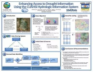
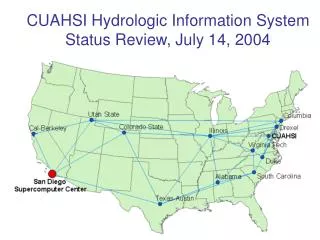
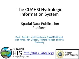
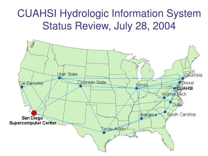
CUAHSI Hydrologic Information SystemStatus Review, July 28, 2004
Agenda • Review the work of thefive project partners • CUAHSI (Rick Hooper, Jon Duncan) • San Diego Supercomputer Center (John Helly, ….) • University of Texas (David Maidment, …) • University of Illinois (Praveen Kumar ….) • Drexel University (Michael Piasecki…) • Involving the collaborators: V. Lakshmi, X. Liang, Y. Liang, U. Lall, L. Poff, K. Reckhow, D. Tarboton, I. Zaslavsky, C. Zheng • HIS review meetings • SDSC (August 12-13) – technical detail • Logan (August 23) – user needs assessment
Agenda • Review the work of thefive project partners • CUAHSI (Rick Hooper, Jon Duncan) – meeting with NSF today • San Diego Supercomputer Center (John Helly, ….) • University of Texas (David Maidment, …) • University of Illinois (Praveen Kumar,...) • Drexel University (Michael Piasecki,…)
Agenda • Review the work of thefive project partners • CUAHSI (Rick Hooper, Jon Duncan) – Neuse HO report status • San Diego Supercomputer Center (John Helly, ….) • University of Texas (David Maidment, …) • University of Illinois (Praveen Kumar ….) • Drexel University (Michael Piasecki…)
Agenda • Review the work of thefive project partners • CUAHSI (Rick Hooper, Jon Duncan) – Neuse HO report status • San Diego Supercomputer Center (John Helly, ….) • University of Texas (David Maidment, …) • University of Illinois (Praveen Kumar ….) • Drexel University (Michael Piasecki…)
UT Update • General issues • Landscape characterization for HO Design • Flux algebra for surface water systems • XML for interchange of groundwater objects
Science Tools Corporation • http://sciencetools.com/ • work with NASA and other institutions integrating databases for scientific purposes • Chief Scientist is Richard Troy – he wants to explore potential of working with CUAHSI • Commercial system that operates over Oracle, SQL/Server,… • Company is based in Oakland, CA
GenScn • A tool for generation and analysis of model simulation scenarios for watersheds • Incorporated in EPA Basins system • Produced by AquaTerra in Decatur, GA • Handles lots of different time series types
Suwannee River Watershed Data • Contact from Wendy Graham (former Vice-Chair of HIS Committee) • Offering data for consideration in HIS data model • How to discuss this in Logan?
UT Update • General issues • Landscape characterization for HO Design • Flux algebra for surface water systems • XML for interchange of groundwater objects
Landscape Characterization for HO Design • Idea suggested by Larry Band at the end of our call on July 14 • have a set of rules for defining subdivisions of the landscape using orders of magnitude of catchment size, type of land use, etc • need to work with LIDAR as well as regular DEM • define points at outlets of these catchments as potential gage sites
Pfaffstetter Basins 9 basins divided into 99 basins divided into 999 basins
Email from Larry Band In this case the emphasisis on first retrieving all catchments of a certain size (or range of > sizes) developed by specifying threshold areas or perhaps other > criteria for identifying first order catchments. Likely this would > actually be area as we are less interested in knowing precisely where > channelized flow begins as identifying characteristics of catchments > of specified drainage areas. In response to a set of scientific > questions or hypotheses dealing with scaling issues, we may specify we > need to gauge X streams for each of 5 orders of magnitude of drainage > area that satisfy a set of selection criteria. You're correct that > the procedure would select the set of candidate sites, from which a > final set would need to be chosen. > > The rules can be quite simple, such as 1. all catchments with > 20% > impervious cover (assuming we have an impervious surface layer), or > more complex such as 2. all catchments with > 80% forest in a > specified riparian buffer. It could also include topographic > characteristics including extent and development of floodplain using > some of the indices John Gallant has recently introduced. You're also > correct that this can be a complex problem specifically with lidar > data due to the size of the dataset and also the lack of elevation > data in open water, and the potential apparent drainage disruption due > to infrastructure. My impression is that most or at least many > hydrologists who can carry out this type of activity with standard USGS DEM would have difficulty > handling the lidar data. Most software packages cannot handle the > data volumes. I raised this as a question regarding whether this > would be an efficient use of the HIS groups time and abilities, or > whether this is too specific an application and should be left to the > individual HO. Their ability to handle these and similar problems may > be a good attribute to consider in the proposals.
UT Update • General issues • Landscape characterization for HO Design • Flux algebra for surface water systems • XML for interchange of groundwater objects
Mass Balancing A South Florida Basin Flow In Rain ET Flow Out Flow Out What volume of water is stored within this basin?
Process Horizontal Inflow Horizontal Outflow #1 Horizontal Outflow #2 Select Time Series Related to Basin Vertical Inflow Vertical Outflow Hydrologic Data Model Add to Calculate a Net Flow Cumulative Horizontal Storage Cumulative Vertical Storage Cumulative Total Storage Net Horizontal Inflow Net Vertical Inflow Net Total Inflow Integrate To Calculate A Storage
Complications to Process Extracting time series Need ability to query a large database to extract relevant time series for one or more discrete watersheds Dimensions Conversions Need spatial and temporal integration Units Conversions Need unit conversions Discrete-Continuous Time Need a spatiotemporal referencing system (TGIS)
UT Update • General issues • Landscape characterization for HO Design • Flux algebra for surface water systems • XML for interchange of groundwater objects
Creating a 3D model of the subsurface Stratigraphy from the North Carolina database (tabular), imported into ArcGIS
Importing borehole data to GMS Data is imported from GIS into GMS (Groundwater Modeling System)
Solid model Solids are generated in GMS using the Horizons method Contacts are assigned horizons (from bottom to top) and then solids are created by interpolating a surface for each horizon extruding downward.
Solid model in GIS The solid model is read back into ArcGIS through an XML file
Transfer of the solid model via XML • Solids can be represented as a set of vertices and triangles • Each vertex has a x, y, and z coordinates • Each triangle is constructed of three vertices
Storing solids in an XML file Solids represented as a set of vertices and triangles Vertices Triangles
Full process Interpolation in external software (for example GMS) Stratigraphy information in a spatial database Back to spatial database Store solids in XML
Agenda • Review the work of thefive project partners • CUAHSI (Rick Hooper, Jon Duncan) – Neuse HO report status • San Diego Supercomputer Center (John Helly, ….) • University of Texas (David Maidment, …) • University of Illinois (Praveen Kumar ….) – Praveen is overseas… • Drexel University (Michael Piasecki…)
The Modelshed Framework Update July 28, 04
What is a Modelshed? • A volumetric spatial (GeoVolume?) model unit, registered in three dimensions by a GIS, with which time-varying data, model fluxes, spatial relationships and descriptive metadata are associated
What can the Modelshed Framework do? • Store data for diverse spatio-temporal applications & phenomena • A generalized 4D data model for environmental science • Addresses issues of scale, heterogeneity, and resolution • Build on top of existing data models (e.g. ArcHydro) to leverage existing data structures and tools • Establish new relationships • Models environmental fluxes • Connects raster data and numerical models with object-relational data models
Applications: Helping Raster & Vector Talk • How can continuous data in rasters be related to database objects? • Summarize the data using statistics, aggregated by overlapping Modelshed areas • Statistics are stored as indexed data records • Modelsheds can be physically meaningful, like watersheds • This process can be automated for a large number of rasters
Applications: Automating data management with the Modelshed Tools • The ModelShed Tools automate some database tasks: • Adding new descriptive indexes • Building the index of raster datasets • Automatically processing a timeseries of raster datasets based on areas in the database, and ingesting the statistical data into the database • Building AreaLink tables • ModelShed Tools are an extension to ArcGIS 8, and use ArcGIS Spatial Analyst geoprocessing routines
Dynamic Features • Supports database features that move and change in time • The full range of Modelshed features are still supported, including vertical indexing, flux links, and area links. • A parallel UML structure for static and dynamic features
Applications 2: ILRDB • A prototype geodatabase of the Illinois River Basin using the Modelshed geodata model • Combining base hydrography from the NHD / ArcHydroUSA database with supercomputer-generated regional climate data, remote sensing data, land use data, and multi-layer soils data • A proof of concept for study using a much more extensive multi-disciplinary integrated database
Studying the relationships between large-scale phenomena and hydrology using the ILRDB • Climate simulation precipitation and humidity data is modeled along with NDVI vegetation and surface hydrology • Query-based analysis is used to analyze the relationships between these datasets