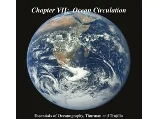
Chapter 7 Ocean Circulation
Chapter 7 Ocean Circulation. Essentials of Oceanography 7 th Edition. Ocean currents. Surface currents Affect surface water within and above the pycnocline (10% of ocean water) Driven by major wind belts of the world Deep currents Affect deep water below pycnocline (90% of ocean water)


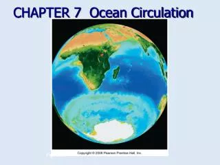
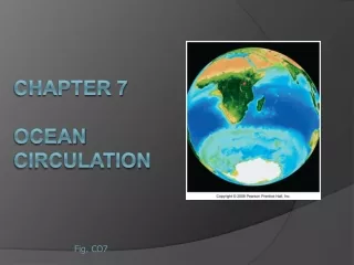
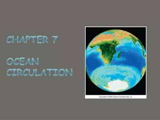
Chapter 7 Ocean Circulation
E N D
Presentation Transcript
Chapter 7 Ocean Circulation Essentials of Oceanography 7th Edition
Ocean currents • Surface currents • Affect surface water within and above the pycnocline (10% of ocean water) • Driven by major wind belts of the world • Deep currents • Affect deep water below pycnocline (90% of ocean water) • Driven by density differences • Larger and slower than surface currents
Measuring surface currents • Direct methods • Float meters • Intentional • Inadvertent • Propeller meters • Indirect methods • Pressure gradients • Satellites • Doppler flow meters Figure 7B
Surface currents closely follow global wind belt pattern • Trade winds at 0-30º blow surface currents to the east • Prevailing westerlies at 30-60º blow currents to the west Figure 7-3
Wind-driven surface currents Figure 7-4
Current gyres • Gyres are large circular-moving loops of water • Subtropical gyres • Five main gyres (one in each ocean basin): • North Pacific • South Pacific • North Atlantic • South Atlantic • Indian • Generally 4 currents in each gyre • Centered at about 30º north or south latitude
Current gyres • Gyres (continued) • Subpolar gyres • Smaller and fewer than subtropical gyres • Generally 2 currents in each gyre • Centered at about 60º north or south latitude • Rotate in the opposite direction of adjoining subtropical gyres
Ekman spiral • Ekman spiral describes the speed and direction of flow of surface waters at various depths • Factors: • Wind • Coriolis effect Figure 7-6
Ekman transport • Ekman transport is the overall water movement due to Ekman spiral • Ideal transport is 90º from the wind • Transport direction depends on the hemisphere • Internet visualization Figure 7-6
Geostrophic flow and western intensification • Geostrophic flow causes a hill to form in subtropical gyres • The center of the gyre is shifted to the west because of Earth’s rotation • Western boundary currents are intensified Figure 7-7
Western intensification of subtropical gyres • The western boundary currents of all subtropical gyres are: • Fast • Narrow • Deep • Western boundary currents are also warm • Eastern boundary currents of subtropical gyres have opposite characteristics
Currents and climate • Warm current warms air high water vapor humid coastal climate • Cool current cools air low water vapor dry coastal climate Figure 7-8a
Upwelling and downwelling • Vertical movement of water () • Upwelling = movement of deep water to surface • Hoists cold, nutrient-rich water to surface • Produces high productivities and abundant marine life • Downwelling = movement of surface water down • Moves warm, nutrient-depleted surface water down • Not associated with high productivities or abundant marine life
Coastal upwelling and downwelling • Ekman transport moves surface water away from shore, producing upwelling • Ekman transport moves surface water towards shore, producing downwelling Figure 7-11
Other types of upwelling • Equatorial upwelling • Offshore wind • Sea floor obstruction • Sharp bend in coastal geometry Equatorial upwelling Figure 7-9
Antarctic surface circulation Figure 7-13
Atlantic Ocean surface currents Figure 7-14
North Atlantic Ocean circulation Figure 7-15
The Gulf Stream and sea surface temperatures • The Gulf Stream is a warm, western intensified current • Meanders as it moves into the North Atlantic • Creates warm and cold core rings Figure 7-16
Pacific Ocean surface currents Figure 7-17
El Niño-Southern Oscillation (ENSO) • El Niño = warm surface current in equatorial eastern Pacific that occurs periodically around Christmastime • Southern Oscillation = change in atmospheric pressure over Pacific Ocean accompanying El Niño • ENSO describes a combined oceanic-atmospheric disturbance
Normal conditions in the Pacific Ocean Figure 7-18a
El Niño conditions (ENSO warm phase) Figure 7-18b
La Niña conditions (ENSO cool phase; opposite of El Niño) Figure 7-18c
The 1997-98 El Niño • Sea surface temperature anomaly map shows warming during severe 1997-98 El Niño • Internet site for El Niño visualizations • Current state of the tropical Pacific Figure 7-19a
El Niño recurrence interval • Typical recurrence interval for El Niños = 2-12 years • Pacific has alternated between El Niño and La Niña events since 1950 Figure 7-20
Effects of severe El Niños Figure 7-21
Indian Ocean surface currents Northeast monsoon Southwest monsoon Figure 7-23
Deep currents • Deep currents: • Form in subpolar regions at the surface • Are created when high density surface water sinks • Factors affecting density of surface water: • Temperature (most important factor) • Salinity • Deep currents are also known as thermohaline circulation
Deep ocean characteristics • Conditions of the deep ocean: • Cold • Still • Dark • Essentially no productivity • Sparse life • Extremely high pressure
Identification of deep currents • Deep currents are identified by measuring temperature (T) and salinity (S), from which density can be determined Figure 7-24
Atlantic Ocean subsurface water masses Figure 7-25
Conveyer-belt circulation Figure 7-27
End of Chapter 7 Essentials of Oceanography 7th Edition