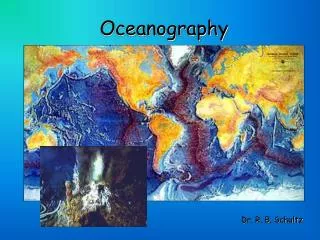
Oceanography
Oceanography. The study of the oceans Essential to an understanding of weather and climate Oceans play 3 important roles in weather and climate: Source of atmospheric water vapor Exchanges energy with the atmosphere Transfer heat poleward. Structure of the Ocean. Surface Zone

Oceanography
E N D
Presentation Transcript
Oceanography • The study of the oceans • Essential to an understanding of weather and climate • Oceans play 3 important roles in weather and climate: • Source of atmospheric water vapor • Exchanges energy with the atmosphere • Transfer heat poleward
Structure of the Ocean • Surface Zone • Top 100 meters with a constant temperature • Waves and currents mix this layer • Only about 2% of the ocean water • Thermocline • Transition zone between top and bottom layer • Temperature decreases rapidly with depth • Water between 100 meters and 1000 meters • Deep Zone • Below 1000 meters • Uniform temperature of -1˚ C to 3˚ C
Differences in Ocean Structure • The temperature variation with depth is a function of latitude • Deep zone temperatures are similar for polar, mid-latitude, and tropical areas • Tropical waters have the warmest surface zone temperature, polar regions have the coldest (because of amount of insolation) • Tropical and midlatitude regions have the steepest thermocline
Sea Surface Temperature Distributions • Ocean currents establish the following pattern: • Western coasts in mid-latitudes and subtropics are bordered by cool water • Western coasts in tropical latitudes are bordered by warm water • Eastern coasts in the middle latitudes are bordered by warm water • Eastern coasts in polar regions are bordered by cool water
Ocean Currents • A massive, ordered pattern of water flow • Global-scale wind patterns initiate this flow • In each hemisphere, a large gyre exists in each ocean • Gyre – swirling ocean currents • Gyres rotate clockwise in the Northern Hemisphere • Surface water will move 45˚ to the right of the wind direction due to friction and Coriolis • Ekman Spiral – flow of water gets weaker with depth, and continues to turn to the right • The net movement of water moves at right angles to the direction of the wind (toward the right)
Upwelling • Winds blowing along a coastline will result in the net flow of water away from the coast • Upwelling – cold water from deeper in the ocean moves up to replace water moving away from the coast • Typically found off the western coasts of continents because of subtropical highs • Deep water contains many nutrients vital to marine organisms – so abundant life is found
El Niño • Periodic warming of the equatorial Pacific Ocean off the coast of South America • Upwelling conditions cease, resulting in much warmer surface water • Lasts for several months • Disrupts marine food chain • Occur periodically every 2 to 7 years • Triggered when trade winds weaken or reverse direction
Southern Oscillation • High pressure is found over cold water • Low pressure is found over warm water • Normally, warmer water is by Indonesia and cold water is by South America • Therefore, Darwin will have lower pressure and Tahiti will have higher pressure • In an El Niño, the situation flips • Lower pressure over Tahiti and higher pressure over Darwin • This see-saw relationship between Darwin and Tahiti is called the Southern Oscillation
Affect of Weather Patterns • Western Pacific experiences drought • Low pressure follows the warmer surface water, which moves eastward towards South America • This alters the typical path of the subtropical jet stream • Some areas experience predictable weather changes in an El Niño • Chicago doesn’t experience any typical change (perhaps less snowfall)
La Niña • Cooler than normal sea surface temperatures off South America • The counterpart to El Niño • Trade winds are stronger, and upwelling of cold water increases as a result • Normally, but not always, follows El Niño • Typically last for 9-12 months • As with El Niño, some areas experience predictable changes…but not Chicago
Other Oscillations • Pacific Decadal Oscillation • Occurs over periods of several decades • North Pacific oscillation • May interact with El Niño • Cause unknown • Arctic Oscillation • Changes from decade to decade • Relationship between pressure in the Arctic and central Atlantic Ocean • Affects strength and direction of jet stream • Cause also unkown
Tropical Cyclones • Occur in the tropical oceans in the late summer and fall • Large circular swirl of clouds • Couple of hundred miles in diameter • Intense area of low pressure • Different from mid-latitude cyclones in that they do not possess fronts • Name depends on location, but no physical difference • Hurricane: Atlantic or Eastern Pacific • Typhoon: Western Pacific • Cyclone: Indian Ocean, Australia
Structure of a Tropical Cyclone • Eye – central portion of storm, lowest pressure, weak winds, relative lack of clouds • Eye Wall – Narrow, circular wall of thunderstorms surrounding the eye (most intense part of the hurricane – million tons of air moves through every second!) • Spiral Rainbands – lines of thunderstorms spiraling into the eyewall like a pinwheel
Ingredients for a Hurricane • Preexisting area of disturbed weather • ITCZ • Easterly tropical waves • MCC (complex of thunderstorms) • Sea surface temperatures greater than 80˚ Fahrenheit • Warm ocean water must be at least 200 feet deep (waves can’t bring up cold water) • Absence of wind shear • Not closer than 5˚ latitude from Equator
Vertical Structure of a Tropical Cyclone • Intense low pressure at the surface • Subsidence in the eye causes lack of clouds • High pressure is found aloft • High clouds will spin clockwise away from the eye in the Northern Hemisphere • The high pressure aloft helps to vent the hurricane
Stages of Development • Tropical Disturbance – area of disorganized disturbed weather (thunderstorms) • Tropical Depression – area of low pressure and cyclonic rotation is noticed; storm assigned a number for a name • Tropical Storm – Sustained winds of 39 mph or more; storm obtains a name from the list • Hurricane – Sustained winds of 74 mph or more • “Supertyphoon” – Sustained winds > 150 mph
Typical Movement in its Life • Tropical cyclones typically move around the edge of the subtropical highs • Storms usually form in the lower latitudes and move along with the trade winds • Earlier storms develop in the Carribbean Sea and Gulf of Mexico (smaller bodies of water that heat up faster) • Cape Verde Hurricanes: Storms that form off the coast of Africa and later develop into hurricanes (Aug/Sept) • Recurvature – turning of a tropical cyclone to the north and northeast when they are west of the subtropical high • Entering the prevailing westerlies will cause the hurricane to later move off towards the east • All hurricanes are different, and wobbles can occur
Damage from Hurricanes • Wind – hours of strong winds due to intense pressure gradient • Storm Surge • Pileup of water that occurs as the cyclone nears the shore • #1 killer and destroyer of property near the coast • Wind and storm surge damage worst on the right flank of the hurricane facing the direction of motion • Saffir-Simpson scale – rating of 1 to 5 of the damage to be expected from a hurricane (wind & storm surge) • Flooding • Hours of torrential rains • #1 killer and destroyer of property away from the coast
Killing a Hurricane • Simply removing the ingredients that formed a hurricane will weaken it • Landfall, cold water (lack of latent heat fuel) • Wind shear (destroys circulation) • La Niña years –stronger jet stream, more shear, lower number of hurricanes in the Atlantic • Satellites, radar, and aircraft constantly monitor the storm and the environment in order to forecast its movement and behavior