Exploring Oceanography: Features, Boundaries & Processes
Dive into oceanography with identification of plate boundaries, shoreline erosion, coral reef formations, and ocean layers—all explained with visuals and explanations in this resourceful guide. Learn about ocean currents, tides, wave movements, salinity changes, and more.

Exploring Oceanography: Features, Boundaries & Processes
E N D
Presentation Transcript
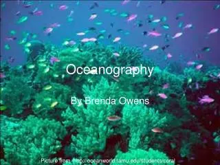
Oceanography By Brenda Owens Picture from http://oceanworld.tamu.edu/students/coral/
1. Identify the types of plate boundaries at A,B, & C C B A http://www.oceanexplorer.noaa.gov/explorations/05galapagos/background/mission_intro/media/GSC3D_600.html
2. Identify these features of shoreline erosion A B C Picture adapted from http://www.fs.fed.us/r6/rogue-siskiyou/recreation/geology/coastal.shtml
3. What term is given to this picture? http://earthobservatory.nasa.gov/Study/Paleoclimatology_Evidence/paleoclimatology_evidence_2.html
4. What does the blank space represent? Picture from http://www.seagrant.umn.edu/rip/
5. What movement do the white boxes in the picture represent? B A Picture was adapted from http://www.geology.ucdavis.edu/~gel150b/sp05_billen/lec21_fig2.html
6. Identify the types of plate boundaries at A, B and C. B C A http://facweb.bhc.edu/academics/science/harwoodr/GEOL101/labs/PlateTectonics3/index.htm
9. Identify A, B, C, D, E, F, & G. B A C http://www.msstate.edu/dept/geosciences/CT/TIG/WEBSITES/RESEARCH/Christine_Oxenford/index.html
10. Identify these layers of the ocean according to temperature.
11. Calculate the Dissolved Oxygen content of the water if Salinity is 35 0/00 and Temp. is 23oC.
12. Name at least 5 processes that change the salinity of water. http://www.k12.de.us/warner/hydrometer.htm
13.Label A, B, C, & D. A B C D http://www.onr.navy.mil/Focus/ocean/motion/waves1.htm
15. Identify the process here and give its significance. http://ww2010.atmos.uiuc.edu/(Gh)/guides/mtr/eln/upw.rxml
16. Identify the conditions of each picture. A B http://en.wikipedia.org/wiki/La_Ni%C3%B1a
17. Identify the warm and cold currents at A, B, C, D, & E. B A C E D http://www.physicalgeography.net/fundamentals/8q_1.html
18.Where do Hurricanes form? http://www.stormsurf.com/page2/tutorials/hurricane.shtml
19. What kind of wave period would surfers prefer and why ? http://www.backpackingqueensland.com.au/v2/site/goldcoastandhinterland.php
20.What is this instrument is and what is it used for? http://www.uscg.mil/lantarea/iip/Photo_Gallery/Oceanographic_Equipment_1.shtml
21.What is this instrument and what does it do? http://www.fishfarmsupply.ca/sampleequip.htm
22. Where do ocean salts come from? http://www.klbschool.org.uk/exchanges/expeditions/argentina_05/rock%20salt.JPG
23.What causes the currents in the Northern and Southern Hemisphere to be opposite? Picture modified from http://www.physicalgeography.net/fundamentals/8q_1.html
24. What kind of tides are represented in the picture? http://home.hiwaay.net/~krcool/Astro/moon/moontides/
25. How do particles in a wave move? http://sprott.physics.wisc.edu/fractals/natural/waves.jpg by J. C. Sprott
References Q. 7 http://www.answers.com/topic/atoll Q. 7 http://encarta.msn.com/media_461529282_761572186_1_1/Moor%C3%A9a_Fringing_Reef.html Q. 10 http://ww2010.atmos.uiuc.edu/(Gh)/wwhlpr/thermocline.rxml Q. 7 http://www.great-barrier-reef.net/ Q.8http://www.cascadia.ctc.edu/facultyweb/instructors/jvanleer/astro%20sum01/Hyrothremal%20Vent%20Final/hydrothermal_vents.htm