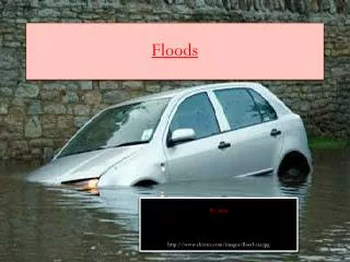
Floods
Floods. By Stephanie Millett & Brittany Uhlman. INTRODUCTION. A flood is usually caused by rain, heavy thunderstorms, and thawing of snow. Its considered to be a temporary condition of two or more acres of dry land either: Overflowed with inland or tidal waters


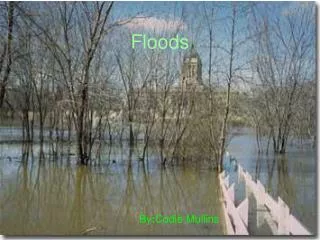
Floods
E N D
Presentation Transcript
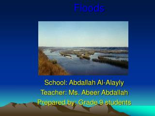
Floods By Stephanie Millett & Brittany Uhlman
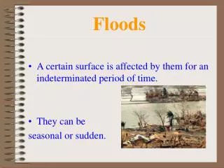
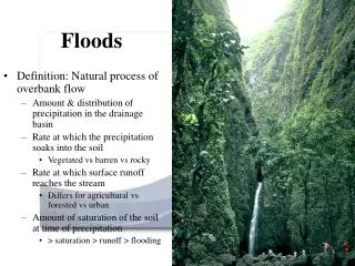
INTRODUCTION A flood is usually caused by rain, heavy thunderstorms, and thawing of snow. Its considered to be a temporary condition of two or more acres of dry land either: • Overflowed with inland or tidal waters • Rapid or runoff of surface waters • Mudflows
How does Flooding Start and end? The shore or land by or surrounding a body of water erodes and this erosion causes waves currents that result in a flood. Flood disasters have been increased because of the expansion of settlements and growth in floodplains. Floods could be slow or fast but usually occur over a matter of days. After the water eventually goes down or dries up. On coastal floods, low tides and high tides makes a change in heights.
Why does it occur?? A flood is too much water in the wrong place. Sometimes a flood occurs from : • Sewer (drain) backup • Collapse of land along the shore of a lake or another body of water. This results in waves or currents during a flood
Where does flooding occur? Flooding is the most worldwide natural disaster. It occurs in every country and wherever there is rainfall or coastal hazards. They are most likely to happen in tropical areas and tsunamis. Most common floods happen around the world’s largest/greatest rivers. Believe it or not, smaller rivers could cause more damage even though people don’t pay as much attention to them. Most Flooding occurs during the beginning of spring.
Characteristics of a Flood A number of criteria determine the dangers of a flood. The University of Wisconsin have came up with the following criteria such as depth of water, duration, velocity, rate of rise, frequency or occurrence, and seasonal. • Velocity- high velocities of flow create erosive forces and can do things like destroy foundations. • Depth of Water- floatation, failures on foundation, vegetation survival, etc.. • Rate of Rise- is the rate at which the water level increases. • Seasonal- the land during growing season, the effects on agriculture production and other things like that.
How Does it Effect People? The amount of people effected by floods from 1999- 2000 is reported to be approximately 1.5 billion. In the U.S. alone there are 10 million people living in areas that could flood.
Precautions to Take To remain safe from floods you need to know when and how to deal with them. Lives could be saved by having more warnings of floods for places in threat. There are things used for antiflood protection and it makes your house, yard and much more, safe and protected when a flood arrives. They can be used over and over again.
Flood Protection Equipment This is a Door Flood Barrier. Its used to fit and seal your door. This is a free standing door barrier. The difference with this one is you can still have use of the door as well. Modular Flood Barrier is the highest level of protection . Its installed to protect your whole property from high bodies of water during a flood.
Predictions of a Flood • Deep Snow can melt into a lot of water. It usually floods because of rain or rapid warm temperatures. • Frozen ground won’t absorb as much water, the rain and/ or snow causes flooding on frozen ground. • Full reservoirs- Reservoirs are very big and are man-made to hold water for drinking or irrigation. It won’t absorb anymore water f full and it causes it to overflow. • High River or Stream Levels- melting flows into a full river and overflows on banks.
Government and Emergency Team Aid There is an organization called World Meteorological Organization. It promotes flood management and water resources management. They have successfully guided and promoted international development of meteorology and hydrology. They give forecasts and warnings. The government’s responsibility of fixing things during a flood are for example :damaged roads, buildings, telephones, and electricity.
This is the natural disasters in U.S. and the cost in millions.
Effects on the Environment Sometimes it’s a good thing when a flood occurs. The environmental benefits of flooding are fisheries, wetlands, and irrigation. Flood plains have one of the highest development potential when it comes to economic development. It also makes a mess of the environment. The soil becomes poor because the oxygen is limited due to so much water. The pH in soil decreases, rate decomposition of organic matter in flooded soil tends only to be half that unflooded soil Trees are effected as well. It effects the height, age, vigor, roots, and species. During the growing season flooding is very harmful especially to woody plants compared a flood in a dormant season. Floods could carry chemicals from agricultural fields, sewage,etc. and can’t handle large bodies of water. Crops die because they can’t survive because of the conditions.
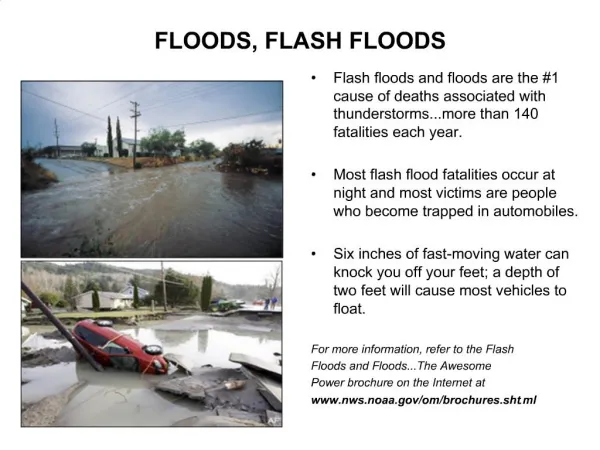
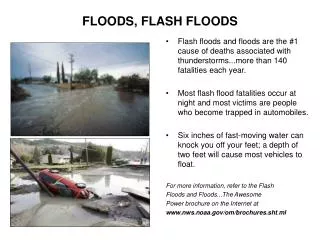
Flash Floods Flash floods happen in a short time, they have a great volume of water, and are local floods. The runoff of intense rain results in high flood waves. Flash floods result in failure of dams and more. It usually happens in desert areas and mountain regions. They are a threat in steep land, high runoff rates, thunderstorms, and narrow streams. This is a picture of a town after a Flash Flood
River Floods Riverine floods are caused by melting of snow and precipitation over large areas. They take place in rivers. Floods in large rivers take hours to days. The ground conditions effects the runoff.
Coastal Floods Coastal floods are caused by tides, storms, tropical cyclones, or tsunamis. They happen in the ocean and effects the general public and maritime interests along the coastline. They are caused by heavy surf, tidal piling, and storm surges, Other factors are tidal cycles, behaviors of the storm, river or stream runoff, no offshore reefs or other barriers, and high winds. Venezuela in December of 1999.
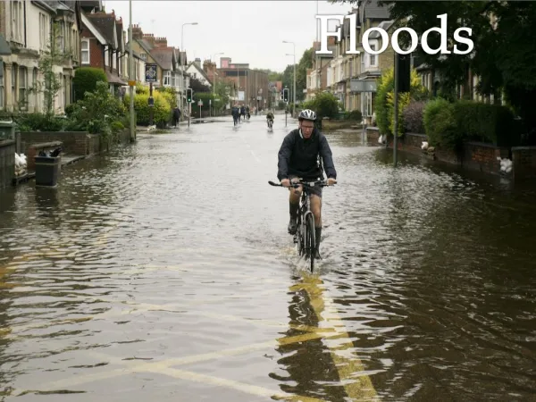
Urban Floods and Ice Jams Urban floods are when the land is turned from fields or woods into roads and parking lots. Since this happens it can’t absorb the rainfall. During the urban floods all the streets become rivers and basements becomefull of water, they are death traps. Ice Jam is floating ice that adds up at a man-made or natural area and stops the flow of water. This causes the area to flood.
Lakeshore Floods Lakeshore floods affect the general public as well as some areas of the Great Lakes. These floods extend from the beaches to rivers that flow into lakes. The extent of the flooding is dependant on surrounding the shore terrain. The causes of these lakeshore floods are seiches in the Great Lakes. The Webster dictionary’s definition of Seiches is: The flow of periodically changing direction of the surface of a landlocked body of water (like a lake) that varies from a few minutes to several hours.
Deaths during Floods Floods often result in death, especially along river banks and low-lying areas. Floods kill more Americans than any other natural disaster each year. You may be surprised but only 6 inches of fast moving water can sweep a person off their feet and cars will float of move in only two feet of water.
Red River Valley Flood The red river valley occurred in 1997 in Minnesota. That winter eight harsh blizzards hit Red River Valley. When the snow started to melt the river started to rise. The flood preparation was made for a 49 foot flood crest. The flood was actually 54.33 feet on April 22, 1997. Areas that were in immediate danger was evacuated on April 18th, people were evacuated from entire cities on the 19th. On the 24th the government officials started to let people back in dry areas. Most of the clean-up was done by the end of 1997 but they were still building houses, basements, and other buildings in 2000. The Red River flood crest emptied into Lake Winnipeg on May 8th, 1997. This ended the largest flood in Red River Valley ever recorded
Mozambique, Africa Flood In Mozambique on March 3rd, 2000 an awful flood had destroyed three villages. Around 1 million people needed shelter, food, and medical care. Thousands of people remained on roofs and rat-infested trees. Rescuers had saved 12,000 people from flood waters after starving for a week. 15,000 remained in Save River Valley, stranded and nowhere to go. The government has estimated 1 million people have been displaced by floods since the beginning of February 2000.
Bangladesh Flood Bangladesh is a country with many rivers. Flooding in this area is common and necessary so it could fertilize from deposits of fresh alluvium. Fresh alluvium is soil that is deposited by moving water. In the fall of 1974 flooding was extended over one half of the country and stayed this way for over a month. At least 1,200 people had died in the floods and 27,500 died from diseases and starvation. 425,000 houses were destroyed and destroyed agriculture. The cost of damages were 325.9 million in U.S. 36 million were effected by this huge flood.
Nova Scotia Flood This horrific storm dumped around 100 millimeters of rain trough the Atlantic on Monday March 3rd, 2003. It was caused by melting snow, rain, high tides, and freezing rain which caused streams and rivers to clog and trees to break. Thousands of people have had to bail out of their homes. The overall damage for provincial roads and bridges is estimated to be 10 million dollars. Nova Scotia’s Transportation Department said 47 bridges have been destroyed or damaged by flooding. Two hundred roads have been damaged in the province as well. Major culverts were ruined and oil tanks ripped from homes. Emergency tenders are being sent out to get repair work started as soon as possible. Unfortunately a seniors couple died when that car got swept away from a flooded road of Lahave River. This flood was one of the worst floods Nova Scotia has had in years.
These are pictures of different parts of Nova Scotia after the flood
Northern California Tunisia Indonesia Zambia Southeastern Africa Northern Australia Western Australia Brazil Madagascar This is where the latest floods have occurred in the world. It was taken by NASA satellite.
Flood Insurance Rate Map A Flood Insurance Rate Map (FIRM) is a map to show flood risk zones and flood elevations.
LEGEND SPECIAL FLOOD HAZARD AREAS INUNDATED BY 100 YEAR FLOOD ZONE A No base flood elevations determined ZONE AE Base flood elevations determined ZONE X Areas of 500 year flood; areas of 100 year flood with average depths of less than 1 foot or with drainage areas less than 1 square mile; and areas protected by levees from 100 year flood OTHER FLOOD AREAS ZONE X Area of 500 year flood; areas of 100 year flood with average depths of less than 1 foot or with drainage areas less than 1 square mile; and areas protected by levees from 100 year flood OTHER AREAS ZONE X Areas determined to be outside 500 year flood plain ZONE D Areas in which flood hazards are undetermined EXPLANATION OF ZONE DESIGNATIONS ZONE A Areas of 100 year flood; base flood elevations and flood hazard factors not determined ZONE A1- A30 Areas of 100 year flood; base flood elevations and flood hazard factors determined ZONE B Areas between limits of the 100 year flood and 500 year flood; or certain areas subject to 100 year flooding with average depths less than (1) foot or where the contribution drainage area is less than one square mile; or areas protected by levees from the base flood ZONE C Areas of minimal flooding ZONE V1 – V30 Areas of 100 year coastal flood with velocity (wave action); base flood elevations and flood hazard factors determined
Flood Hazard Boundary Map A Flood Hazard Boundary Map(FHBM) is for an area and outlines the special flood areas but doesn’t include and elevation information. It shows flood insurance risk zones. Its for 100-500 year flood areas.
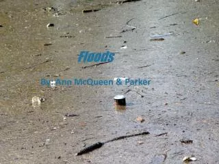
These are pictures of floods in Texas. It was the worst flood since 1998 in Texas. 22 people were killed The NSDU extension service says: These are people from the red cross in China reaching victims in their boat. DURING A FLOOD Listen to the radio for further information. Fill bathtubs, sinks and jugs with clean water in case water becomes contaminated. Bring outdoor belongings, such as patio furniture, indoors. Move valuable household possessions to the upper floors or to safe ground if time permits. If you are instructed by authorities, turn off all utilities at the main power switch and close the main gas valve. Join with neighbors and volunteers to put sandbags or other protection in place. Stack sandbags away from the outside walls of houses to prevent floodwaters from entering. Do not attempt to walk through moving floodwaters. If they are moving fast enough, water one foot deep can sweep you off your feet. Do not attempt to drive over a flooded road. Turn around and go another way.
A Video Clip Click here
Flooding As you can see flooding is not only a reoccurring natural disaster its also very dangerous!! Flooding is costly and threatening…. This is no joke!!!
Bibliography • http://www.fema.gov/hazards/floods • www.und.nodak.edu/dept/library/Collections/og1351.html • http://wmo.ch/apfm • http://www.antiflood.com • www.canada.com/news/story.asp?id=275CB01A-CDDC-47AOO-93/D5274D7244 • www.ssl.sabah.gov.my/clh/environment/flood/flood_effects.html • www.na.fs.fed.us/spfo/pubs/n_resource/flood/toler.htm • www.hydrology.com • http://dmc.engr.wisc.edu/courses/hazards/BB02-06.html • novascotia.cbc.ca/regional/servlet/View?filenames=ns_floodcost20030402 • www.usatoday.com/weather/wfldfac.htm#three • http://ks.water.usgs.gov/kansas/pubs/fact-sheet/fs.023-000.html • www.hollandsentinel.com/stories/030400/new_slow.html • www.property-appraiser.lee.fl.us/GISDepartment/FIRM1.htm • www.savethechildren.org/press/pr_bangladesh.html • www.personal.psu.edu/users/a/l/alal64/projects/geog121/project5/firm_example.htm • www.nws.noaa.gov/om/brochures/ffbro.htm