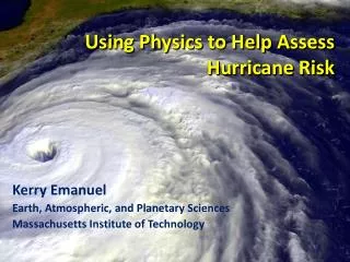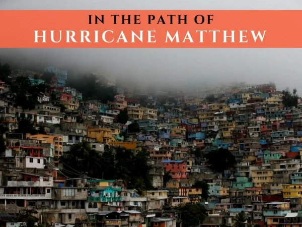
Assessing Hurricane Risk: Present and Future Insights from MIT's Kerry Emanuel
800 likes | 939 Vues
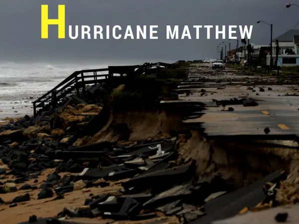
This program explores the complexities of hurricane risk assessment, focusing on the limitations of strictly statistical approaches. It highlights that over 50% of normalized damages are due to the top 8 impactful storms, typically of categories 3-5, despite them representing only 13% of total landfalling events. The study emphasizes the nonstationarity of climate conditions and the inadequacies of landfall statistics, proposing a comprehensive assessment tool incorporating numerical simulations and synthetic storm track generation to better evaluate future hurricane risks in a warming climate.

Assessing Hurricane Risk: Present and Future Insights from MIT's Kerry Emanuel
E N D
Presentation Transcript
Hurricane Risk: Present and Future Kerry Emanuel Program in Atmospheres, Oceans, and Climate Massachusetts Institute of Technology WindRiskTech, L.L.C.
Limitations of a strictly statistical approach • >50% of all normalized damage caused by top 8 events, all category 3, 4 and 5 • >90% of all damage caused by storms of category 3 and greater • Category 3,4 and 5 events are only 13% of total landfalling events; only 30 since 1870 • Landfalling storm statistics are inadequate for assessing hurricane risk
Atlantic Sea Surface Temperatures and Storm Max Power Dissipation (Smoothed with a 1-3-4-3-1 filter) Years included: 1870-2011 Data Sources: NOAA/TPC, UKMO/HADSST1
Risk Assessment by Direct Numerical Simulation of Hurricanes:The Problem • The hurricane eyewall is an intense, circular front, attaining scales of ~ 1 km or less • At the same time, the storm’s circulation extends to ~1000 km and is embedded in much larger scale flows
Histograms of Tropical Cyclone Intensity as Simulated by a Global Model with 50 km grid point spacing. (Courtesy Isaac Held, GFDL) Modeled Observed Global models do not simulate the storms that cause destruction Category 3
Numerical convergence in an axisymmetric, nonhydrostatic model (Rotunno and Emanuel, 1987) Theoretical Maximum Intensity Distance between computational nodes
How to deal with this? • Option 1: Brute force and obstinacy
How to deal with this? • Option 1: Brute force and obstinacy • Option 2: Applied math and modest resources
Basic equations written as a function of radius (distance from the storm Center), altitude, and timeRe-Write in terms of angular momentum, altitude, and time
Angular Momentum Distribution Altitude (km) Storm Center
Originally Developed as a Student Laboratory Tool, Later Adapted as a Hurricane Intensity Forecasting Model(http://wind.mit.edu/~emanuel/storm.html)
How Can We Use This Model to Help Assess Hurricane Risk in Current and Future Climates?
Risk Assessment Approach: Step 1: Seed each ocean basin with a very large number of weak, randomly located cyclones Step 2: Cyclones are assumed to move with the large scale atmospheric flow in which they are embedded, plus a correction for beta drift Step 3: Run the CHIPS model for each cyclone, and note how many achieve at least tropical storm strength Step 4: Using the small fraction of surviving events, determine storm statistics Details: Emanuel et al., Bull. Amer. Meteor. Soc, 2008
Synthetic Track Generation:Generation of Synthetic Wind Time Series • Postulate that TCs move with vertically averaged environmental flow plus a “beta drift” correction for effects of the earth’s curvature and rotation • Approximate “vertically averaged” by weighted mean of about 1.5 and 10 km altitude
Comparison of Random Seeding Genesis Locations with Observations
Calibration Absolute genesis frequency calibrated to globe during the period 1980-2005
6-hour zonal displacements in region bounded by 10o and 30o N latitude, and 80o and 30o W longitude, using only post-1970 hurricane data
Cumulative Distribution of Storm Lifetime Peak Wind Speed, with Sample of 1755Synthetic Tracks 95% confidence bounds
Genesis rates Western North Pacific Southern Hemisphere Eastern North Pacific Atlantic North Indian Ocean
Captures effects of regional climate phenomena (e.g. ENSO, AMM)
Seasonal Cycles Atlantic
Coupling large hurricane event sets to surge models (with Ning Lin) • Couple synthetic tropical cyclone events (Emanuel et al., BAMS, 2008) to surge models • SLOSH • ADCIRC (fine mesh) • ADCIRC (coarse mesh) • Generate probability distributions of surge at desired locations
5000 synthetic storm tracks under current climate. (Red portion of each track is used in surge analysis.)
SLOSH mesh for the New York area (Jelesnianski et al., 1992)
Compare two simulations each from 7 IPCC models: 1.Last 20 years of 20th century simulations2. Years 2180-2200 of IPCC Scenario A1b (CO2 stabilized at 720 ppm)
Example: Intense event in future climate downscaled from CNRM model
Return levels for Tampa, including three cases : control (black), A1B (blue), A1B with 1.1ro and 1.21 rm (red)