Download
1 / 11
110 likes | 136 Vues
This week's weather briefing predicts a hot and dry week with slight chances for showers and thunderstorms. Temperatures will remain unseasonably warm with highs in the mid-90s to near 100. The upper ridge will continue to hold on, resulting in a typical summertime pattern. There may be isolated afternoon thunderstorms, and there is a low chance of development in the tropics. Join our next conference call on Thursday, June 9th at 10 AM for more details.

E N D
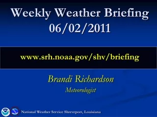
Weekly Weather Briefing06/02/2011www.srh.noaa.gov/shv/briefing Brandi Richardson Meteorologist National Weather Service Shreveport, Louisiana
Overview Rest of this work week HOT and DRY Weekend Slight chances for showers and thunderstorms Temps still unseasonably warm Mon-Wed Typical Summertime Pattern Upper ridge continues to hold on Mid to upper 90s areawide Slight chances for isolated afternoon thunderstorms National Weather Service Shreveport, Louisiana
Currently L H Past few days weather maker
Today and Friday • HOT • Highs in mid 90s to near 100 • No heat advisory • Dewpoints mix out during the day • Dry
Saturday • Weak surface low moves west under the ridge • Slight chances for isolated showers and thunderstorms over SE half of region L L
Sunday Afternoon L Low slides east…slight chances for showers/thunderstorms
Wednesday H The ridge just won’t go away!!!
Tropics Low chance of development in the next 48 hrs
Drought • Upper ridge is no help to drought situation
Summary Today/Friday HOT Saturday-Wednesday Mid to upper 90s most areas…near 100 over NW and N Central LA 20% Chance for isolated afternoon thunderstorms
NEXT CONFERENCE CALL: Thursday June 9, 2011 10 AM www.srh.noaa.gov/shv/briefing National Weather Service Shreveport, Louisiana