Download
1 / 48
500 likes | 900 Vues
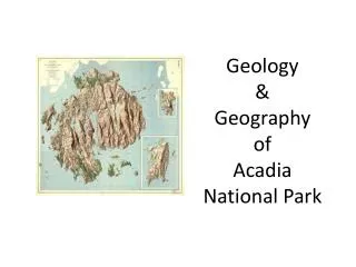
Geology & Geography of Acadia National Park. Geology & Geography of Acadia National Park. Granite underlies most of Acadia Very resistant bedrock Mostly pink course-grained. Magma Intrusion I nto MDI Area.

E N D
Granite underlies most of Acadia • Very resistant bedrock • Mostly pink course-grained
Magma Intrusion Into MDI Area • On Mount Desert Island, igneous rock cooled deep within the crust under deep layers of sedimentary and metamorphic rocks • The sedimentary and metamorphic rocks were folded into a high mountain range, the Appalachians • As time passed, the rocks were eroded away exposing the igneous rocks
Theory of Magma Intrusion Into MDI Area • A pluton (magma mass) intruded and was influenced in different ways at different times which produced rock that shows blending of composition across the island • The igneous rocks are the youngest of the bedrock • The were formed between 360-380 million years ago
Theory of Magma Intrusion Into MDI Area • Two types of igneous rocks, gabbro and diorite, are similar having come from the source pluton first • The are grained rocks made of two minerals: • black pyroxene • white/gray feldspar • Gabbro has more dark minerals than light; diorite has more light than dark
Gabbro: dark-colored rocks rich in ironDiorite: lighter in color
Theory of Magma Intrusion Into MDI Area • The gabbro and diorite formed great, horizontal sheets called sills many miles across • Slow cooling sills produced large, coarse grains, fast cooling produced small grains
MDI Mountains • The mountains of MDI are made of granite • After the gabbro-diorite sills had cooled, the magma mass became active again • Its composition changed • The igneous rock took on a third mineral, quartz, forming granite
MDI Mountains • During the formation of Pangea 350-400 million years ago, magma pushed into the crust forming immense mountain ranges • The large magma chamber split and part moved deep within the earth, cooling very slowly forming large grains, and some forming thinner granite sheets which cooled more quickly.
MDI Mountains • The coarse-grained rock is known as Cadillac granite • The fine- to medium-grained rocks at Southwest Harbor granites and Somesville granites • The mountains of MDI are made up of Cadillac granite
Cadillac Mountain Granite Xenoliths There are occasional xenoliths in the Cadillac Mountain (xenoliths are chunks of the older “country” rock that the pluton intruded, which broke off into the plutonic magma before it hardened)
MDI Mountains • On the eastern side of Somes Sound, there are mountains that belong to the main pluton body and so are coarse-grained • The western mountains formed from the thinner, faster-cooling granites that are small- to medium-grained. • Surrounding the main body of Cadillac granite, there is a zone of broken rock known as a contact or shatter zone
Cadillac Mt. Granite & Shatter Zone Cross section through the Cadillac Mountain granite showing the shatter zone and the saucer-shaped distribution of inclusions.
MDI Shatter Zone This is an area surrounding the Cadillac Mountain Granite in which the country rock is broken into a breccia, with stringers of granite filling the spaces between the broken pieces of rock
MDI Shatter Zone The shatter zone showing angular blocks of older country rock in a fine-grained granite matrix.
Bedrock Geology of Mount Desert Island Link to pdf file: • http://www.maine.gov/dacf/mgs/pubs/online/bedrock/bd-bulletin38.pdf
Joints & Faults • These vertical joints are natural fractures in rocks where little or no movement has occurred.
Joints & Faults Example of exfoliation in granite.
Mount Desert Island Glacial Geology Effects of glaciation: • Deep valleys carved into the bedrock • Boulders transported far from their origin • Glacial-derived sediments ranging in size from clay to boulders
Mount Desert Island Glacial Geology Quaternary Period Ice Ages • Lasted 1.7 million years • Periods of glacial and non-glacial • In North America the most recent glaciation (Wisconsin) reached it maximum 21,000 years ago • Covered the highest mountains • Extended into the Atlantic Ocean at the edge of the continental shelf
Mount Desert Island Glacial Geology • The edge of the glaciation is demarked by a terminal moraine forming: • Cape Cod • Nantucket • Martha’s Vineyard • Long island • The ice sheet began to recede about 18,000 years ago
Mount Desert Island Glacial Geology • The high mountains of New England began to protrude about 14,000 years ago • The lowlands became ice free by about 10,000 years ago.
Glacial Erosion • Eroded bedrock via: • Abrasion • Plucking • Abrasion was stronger on the north-facing slopes which face the ice flow • Creates a scratched, polished surface • The scratches are called striations and indicate direction of ice flow
Glacial Erosion: Abrasion Close-up of polished bedrock surface seen showing striations and arc-shaped fractures (chatter marks) produced by pressure of glacial ice. Note pen for scale. Striations are parallel to the pen.
Glacial Erosion: Abrasion Granite ledge near the Tarn showing brightly polished surface resulting from glacial abrasion. Note two people for scale.
Glacial Erosion: Plucking • Plucking removed large chunks of rock • Produced many of the cliffs in ANP • The process occurred because of changes in pressure on the north sides and south sides of hills and mountains. • At times, slight changes in pressure at the base of a glacier can cause melting
Glacial Erosion: Plucking • Movement of ice over hills on MDI produced a slightly higher pressure on the north side of hills which melted the ice at the bottom of the glacier • The melted water could then seep into fractures in the bedrock
Glacial Erosion: Plucking • The meltwater would freeze again as it moved into zones of lower pressure on the south sides of hills • As the water refroze in rock fractures it expanded and forced the rock apart • Blocks of bedrock were pried loose and frozen into the glacier and carried away
Roche Moutonnée • The combination of glacial abrasion on north slopes and plucking on south slopes cause many of the hills and mountains in ANP to have an asymmetric profile.
The Beehive Near Sand Beach Cliffs on southeast side produced by plucking
Glacially Sculpted U-shaped Valley Glacially sculpted U-shaped valley between Dorr Mountain (right) and Huguenot Head, on east side of Mount Desert Island. The Tarn is the pond in the foreground.
Erratics Bubble Rock on south Bubble
Disappearance of the Glacier • The deglaciation history of the island can be divided into three parts: • glacial downdraw into the sea, • melting of glacial ice on land, and • uplift (rebound) of the Earth's crust as the weight of the ice sheet was removed.
Glacial Downdraw into the Sea • When the last ice sheet was at its greatest extent, sea level was about 330 feet below its present level. • By about 18,000 years ago, however, the climate had warmed enough to begin melting the ice. • The melting of the continental ice sheet returned water to the oceans, causing a rise in sea level.
Glacial Downdraw into the Sea • As the sea rose against the edge of the ice sheet, the water eventually became deep enough to float the seaward edge of the ice up off the bedrock. • Since it was no longer slowed by friction with the underlying ground, the floating ice began to flow rapidly into the sea and disintegrate into icebergs.
Glacial Downdraw into the Sea • This process, called downdraw, may have increased the speed of the glacier in marginal zones by a factor of 10 • However, the downdraw stopped when the ice margin retreated to a position above sea level. • On Mount Desert Island this occurred about 13,000 years ago. • The ice remaining in areas above sea level was land-based, and deglaciation proceeded in a different manner.
Melting of Glacial Ice on Land • Some surface meltwater found its way to the bottom of the ice • The internal meltwater carved channels within the glacier • Meltwater channels were eroded into the bedrock by sediments • Meltwater channels exist high on the sides of all the mountains on MDI
Melting of Glacial Ice on Land • One of the best meltwater channel examples forms the gap between Cadillac Mt. and Dorr Mt.
Jordan Pond End Moraine • A natural dam formed at the southern end of Jordan Pond called an end moraine. • Formed from rock debris from clay to boulders • The Jordan Pond House was built on its crest
Jordan Pond Outwash & Delta • Meltwater dumped sediments into a sand and gravel mixture known as outwash • At the ocean edge the outwash built up into flat-topped deltas • Tops of deltas mark the approximate position of sea level when the deltas formed. • Deltas indicate sea level was 240 feet higher when they formed
Isostatic Rebound Graph showing relative positions of worldwide sea level and the earth's crust in the vicinity of Mount Desert Island during the last cycle of glacial advance and retreat.
Isostatic Rebound • Even though global sea level was lower as the last ice sheet retreated, the land (which hadn't rebounded yet) was even lower than the ocean. • This circumstance allowed the sea to flood much of coastal Maine, including low-lying portions of Mount Desert Island. • The delta south of Jordan Pond is evidence
Isostatic Rebound & Sea level Rise • Rebound continued resulting in sea level about 215 feet lower than it is today. • Continued melting of glaciers worldwide eventually raised sea level to its present position
Recent Geologic Processes on Mount Desert Island • Following the post glacial uplift of the Maine coast, worldwide sea-level rise caused a gradual encroachment by the ocean which continues today. • The sea continually attacks the shore, eroding dikes and other weaker rocks to form; • chasms such as Thunder Hole and cutting • cliffs, • caves, and • sea stacks.