Download
1 / 77
780 likes | 1.01k Vues
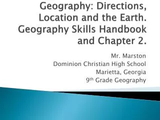
Geography: Directions, Location and the Earth. Geography Skills Handbook and Chapter 2. Mr. Marston Dominion Christian High School Marietta, Georgia 9 th Grade Geography. Location: Where?. Relative : is where something is in relation to something else.

E N D
Geography: Directions, Location and the Earth. Geography Skills Handbook and Chapter 2. Mr. Marston Dominion Christian High School Marietta, Georgia 9th Grade Geography
Location: Where? • Relative: is where something is in relation to something else. • Example #1: By the ice cream shop, two miles from here. • Example #2: Our U.S. office is on Galveston Island located in southeastern Texas in the Gulf of Mexico, about 48 miles southeast of Houston. That's our relative location. • Absolute: exact place where something is located, usually using latitude and longitude. • Example # 1 • Lake Maracaibo of Venezuela is at 10°36' N latitude and 71°33' W longitude.
Reading a map • Key: list that explains what the symbols stand for. • Compass Rose: indicates 4 cardinal directions (north, south, east, and west) • Intermediate directions: (NW, SW, NE, SE) • Scale: shows relationship between map measurements and actual distances
Types of Maps Physical Map Political Map
Additional Maps Special Purpose Map: Showing aid from European Union.
Be Familiar with Terms on page 14 and 15: Geographic Dictionary
Globe vs. Map Globe: A scale model of the Earth. Map: symbolic representation of all or part of the planet on a flat piece of paper.
Common Map Projections Goode’s Interrupted equal Area projection map. WinkelTripel Projection
Common Map Projections Mercator Projection Robinson Projection
Imaginary lines on a globe! • Equator: Located at zero degrees latitude (North or South,) is 24,901.55 miles long and divides the Planet Earth into the Northern and Southern Hemispheres.Tropics of Cancer and Capricorn: Located at 23.5 degrees North and 23.5 degrees South of the Equator, this area of Planet Earth (between those two lines) is known as the "Tropics," and is indicated with a lighter blue color on the above globe. This area experiences no dramatic change in season because the sun is consistently high in the sky throughout the year. Prime Meridian: Located at zero degrees longitude (East or West), it divides the Planet Earth into the Eastern and Western Hemispheres, and is the line from which all other lines of longitude are measured.
Longitude:(shown as vertical lines) is the angular distance, in degrees, minutes, and seconds, of a point east or west of the Prime (Greenwich) Meridian. Lines of longitude are often referred to as meridians.
Prime Meridian 0 degrees. Passes through Greenwich, England.
1884: International Meridian Conference in Washington, DC 2/3 of all ships and tonnage used the Greenwich Meridian by 1884. Many countries had their own meridians. Difficult for international travel.
International Date Line • The International Date Line sits on the 180º line of longitude in the middle of the Pacific Ocean, and is the imaginary line that separates two consecutive calendar days. It is not a perfectly straight line and has been moved slightly over the years to accommodate needs of various countries in the Pacific Ocean. Note how it bends to include all of Kiribati in the Eastern Hemisphere. Immediately to the left of the International Date Line (the date) is always one day ahead of the date (or day) immediately to the right of the International Date Line in the Western Hemisphere.Tonga and Samoa have the same time but are (1) day apart, as Samoa is in the Western Hemisphere, on the opposite side of the International Dateline from Tonga. As you travel further west, note that the time in Fiji is (1) hour earlier than Tonga. You will also notice that Hawaii, further to the east of Samoa, is (1) hour later in time. So, travel east across the International Date Line results in a day, or 24 hours being subtracted. Travel west across the International Date Line results in a day being added.
Latitude (shown as a horizontal line) is the angular distance, in degrees, minutes, and seconds of a point north or south of the Equator. Lines of latitude are often referred to as parallels. Think rungs of a ladder. Other lines of latitude are the Tropic of Cancer and the Tropic of Capricorn.
ContinentsBY SIZE#1 Asia - (44,579,000 sq km) #2 Africa - (30,065,000 sq km) #3 North America - (24,256,000 sq km) #4 South America - (17,819,000 sq km) #5 Antarctica - (13,209,000 sq km) #6 Europe - (9,938,000 sq km) #7 Australia/Oceania - (7,687,000 sq km) BY POPULATION2005 est.#1 Asia - (3,879,000,000) #2 Africa - (877,500,000) #3 Europe - (727,000,000) #4 North America - (501,500,000) #5 South America - (379,500,000) #6 Australia/Oceania - (32,000,000) #7 Antarctica - (0) NUMBERS OF COUNTRIES#1 Africa - (53) #2 Europe - (46) #3 Asia - (44) #4 North America - (23) #5 Oceania - (14) #6 South America - (12) #7 Antarctica - (0)
Africa • Continent Size:30,065,000 sq km 11,608,000 sq miles Coastline:30,539 km 18,976 miles Percent of Earth's Land: 20.2% Population: 877,500,000 (2006) DescriptionAfrica, the planet's 2nd largest continent, includes (53) individual countries. It contains the Nile River, the world's longest, and the massive Sahara Desert, the world's largest. The continent's (highest point) is Mt. Kilimanjaro, in Tanzania, 19,341ft (5,895m), while the (lowest point) is Lac' Assal in the small country of Djibouti, 512 ft (156m) below sea level.
Antartica • Antarctica DetailsSize: 13,209,000 sq km, 5,100,021 sq miles (varies due to changing ice shelves) Percent of Earth's Land: 8.9% Status Antarctica, almost 98% solid ice, was finally considered a continent in 1840, and not just a group of isolated islands. Today it has active territorial claims submitted by Argentina, Australia, Chile, France, New Zealand, Norway and the United Kingdom. (Many of these claims are not recognized by some countries and remain in a constant disputed status)Capital City none Climate Antarctica is the coldest and windiest spot on the planet. In fact, the lowest temperature ever recorded on Earth was recorded in Antarctica (-129.3ºF) and the mean winter temperatures range from -40º to -94ºF. Winds are commonly measured at up to 200 miles per hour. Highest Point Vinson Massif at 16,066 ft. (4,897 m) • Lowest Point Bentley Subglacial Trench, -2,555 m) Latitude/Longitude 90° S, 0.00° E Official Language none Official Currency none Population Officially none, but governmental research stations are populated with small groups of scientists at all times. In addition, in 2003, over 13,000 tourists visited the continent.
Antartica Links • http://www.worldatlas.com/webimage/countrys/an.htm
The Artic • This region of the planet, north of the Arctic Circle, includes the Arctic Ocean, Greenland, Baffin Island, other smaller northern islands, and the far northern parts of Europe, Russia (Siberia), Alaska and Canada. The Arctic Circle, incidentally, is an imaginary line located at 66º, 30'N latitude, and as a guide defines the southernmost part of the Arctic. The climate within the Circle is very cold and much of the area is always covered with ice. In the mid winter months, the sun never rises and temperatures can easily reach lows of - 50º F in the higher latitudes. In the summer months (further south), 24 hours of sunlight a day melts the seas and topsoil, and is the main cause of icebergs breaking off from the frozen north and floating south, causing havoc in the shipping lanes of the north Atlantic. The primary residents of the Arctic include the Eskimos (Inuits), Saami and Russians, with an overall population (of all peoples) exceeding 2 million. The indigenous Eskimos have lived in the area for over 9,000 years, and many have now given up much of their traditional hunting and fishing to work in the oil fields and the varied support villages. The first explorers of the Arctic were Vikings. Norwegians visited the northern regions in the 9th century, and Erik the Red (Icelander) established a settlement in Greenland in 982. In 1909, after numerous attempts by regional explorers, Robert E. Peary reached the North Pole.
Asia • As the planet's largest continent, Asia covers about 30 percent of the world's landmass and includes (44) countries and assorted islands and/or dependencies. Significant features of the continent of Asia include the world's tallest mountain, Mt Everest in Nepal (and China), rising to 29,035 ft (8,850m). It also includes the world's lowest point, found in the Dead Sea, Israel/Jordan, at 1,286 ft (392m) below sea level. In addition, the continent includes the world's most populated countries, China and India; the world's longest coastline, the world's deepest lake; Lake Baykal, and some of the most important rivers on the planet.
Asia cont. • Continent Size: 44,579,000 sq km (17,212,000 sq miles) Percent of Earth's Land: 30% Population: 3,879,000,000 (2005 est) Asia has three important recognized political divisions: The Middle East, (or West Asia) countries are colored a lighter shade of gray; Southeast Asia (or South Asia) countries are colored a medium shade of gray, and North Asia countries are colored a darker shade of gray. Note that European Russia is also considered a part of the Asian Continent.
Asia continued • Asia Geography NotesBurma: Military authorities have promoted the name Myanmar since 1989 as the conventional name for their state. That decision was not (and is not) approved by any sitting legislature in Burma and is not accepted by the U.S. government. However, Myanmar is widely accepted by numerous countries, and by the United Nations. European Russia: The Russian landmass west of the Ural Mountain is commonly referred to as European Russia in most educational atlases, and by the vast majority of geography experts. It is not a separate country, but rather called that because of its political, cultural and geographical blendings with Europe. Middle East: Countries considered part of the Middle East (or West Asia) are shown in a lighter shade of green, and their names are indicated in red. They are all still part of the continent of Asia. Taiwan is still considered by China to be its 23rd province, and not an independent country. Very few other country governments accept China's claims of sovereignty over Taiwan. • Opinions do vary as to what countries make up the modern definition of Asia and the Middle East. Historically, Armenia and Azerbaijan have been long associated with the Middle East, but in recent years, some sources now consider them to be more closely aligned with Europe based on their modern economic and political trends. The same can be said for the island country of Cyprus. Turkey is officially, politically and geographically considered part of both Asia and Europe. The small northwestern portion of Turkey named (Thrace) is a recognized part of Europe, while the largest part (Anatolia) is located in the Middle East, a part of Asia.
Oceania • Continent Size:8,112,000 sq km 3,132,059 sq miles Percent of Earth's Land: 5.3% Population: 32,000,000 Highest Point:Mt Wilhelm, Papua New Guinea14,794 ft (4,509m). Lowest Point: Lake Eyre, Australia, 52ft (16m) below sea level DescriptionOCEANIA, the smallest continent, is one of the most diverse and fascinating areas on the planet. A large percentage of geography experts now consider the long-established continent of Australia to be more accurately defined as Australia/Oceania.Collectively it then combines all of Australia, New Zealand, Papua New Guinea, as well as the thousands of coral atolls and volcanic islands of the South Pacific Ocean, including the Melanesia and Polynesia groups. Oceania also includes Micronesia, a widely scattered group of islands that run along the northern and southern edges of the Equator.
Oceania continued • Geography Notes(Hawaii, Johnston Atoll and Midway Islands are located for reference only, and are not a part of Oceania.)Melanesia includes the independent countries of Fiji and Vanuatu, as well as the Solomon Islands and New Caledonia.Micronesia islands are all part of the same volcanic zone, and include the Marshall Islands, the nations of Micronesia (FSM), Palau, Kiribati and Nauru. In addition, it includes Guam, Saipan, the Northern Mariana Islands, as well as Wake Island. Polynesia contains numerous island groups, including all of French Polynesia and the Austral, Gambier, Marquesas, Society and Tuamoto islands. In addition, the Cook Islands, Easter Island, Niue, the Pitcairn Islands, Tuvalu, and Wallis and Futuna.
Caribbean • Indians were the first inhabitants here, and then, in 1492, Christopher Columbus began his exploration of these islands, becoming the first European to venture into the area. After reportedly landing in the Bahamas, Columbus named these islands the Indies, because he thought he had finally reached Asia (and the East Indies).Numerous explorers followed in his path, then settlers arrived from the Americas and Europe. Included in that mix were religious outcasts, slaves from Africa, and a small army of pirates. Great military powers would fight for control of the islands, and finally, a blended mix of African and European cultures and languages transformed this large group of islands and its peoples into one of the premier tourist destinations on the planet. Long called the West Indies the overall area is now commonly referred to as the Caribbean, a name that became popular after World War II. Note: In reality the Bahamas are not considered a part of the Caribbean, however, we show them here because of their cultural, geographical and political associations with the Greater Antilles, and other Caribbean Islands.
Central America • DescriptionCentral America, a part of North America, is a tropical isthmus that connects North America to South America. It includes (7) countries and many small offshore islands. Overall, the land is fertile and rugged, and dominated through its heart by a string of volcanic mountain ranges that are punctuated by a few active and dangerous volcanoes. Population of Central America: 41,135,300 Highest Point:VolcanTajumulco in Guatemala - 13,816 ft (4,211 m) Lowest Point: Pacific Ocean 0 ft (0 m)
Europe continued • The European continent is separated from Asia by Russia's Ural Mountains, and the Caspian and Black Seas. • Europe's highest point, just north of the Georgia border in European Russia is Mt. Elbrus at 18,481 ft (5,633m). Its lowest point is on the edge of the Caspian Sea, at 92 ft (28m) below sea level. • Historically, Armenia and Azerbaijan have been long associated with Asia and the Middle East. In recent years some sources now consider them to be more closely aligned with Europe based on their modern economic and political trends. • In fact, both are similar to the former CIS country of Georgia, now included as part of Europe. • Continent Size:9,938,000 sq km 3,837,081 sq miles Percent of Earth's Land: 6.7% Population:729,000,000 (2006) DescriptionEurope, the planet's 6th largest continent includes 47 countries and assorted dependencies and territories. In exacting geographic definitions, Europe is really not a continent, but part of the peninsula of Euroasia which includes all of Europe and Asia. However, it's still widely referred to as a continent.
Middle East • The Middle East (or West Asia) sits where Africa, Asia and Europe meet. The countries of the Middle East are all part of Asia, but for clarity reasons we geographically show them here as a separate landmass. Opinions vary as to what countries make up the modern definition of the Middle East. Historically, Armenia and Azerbaijan have been long associated with the Middle East, but in recent years, some sources now consider them to be more closely aligned with Europe based on their modern economic and political trends. • The African country of Egypt is still thought (by some) to be in the Middle East, as well as the northern African countries that border the Mediterranean Sea.
North America • North America, the planet's 3rd largest continent, includes (23) countries and dozens of small island possessions and territories - mostly in the Caribbean. It contains all Caribbean and Central America countries, Canada, Mexico and the United States of America - three of the largest countries on the planet, as well as Greenland - the world's largest island. Continent Size:24,474,000 sq km 9,449,460 sq miles Percent of Earth's Land: 16.5% Population: 501,500,000 Highest Point:Mt McKinley in Alaska, 20,322ft (6,194m) Lowest Point: Death Valley in California, -282 ft (-86m) below sea level.
South America • Description South America, the planet's 4th largest continent, includes (12) countries and (3) major territories. It contains the massive Amazon River and surrounding basin - the largest tropical rain forest in the world; the toothy-edged Andes Mountains, that stretch the entire length of the continent, and some of the most diverse and spectacular landforms on the planet. Continent Size: 17,819,000 sq km 6,879,000 sq miles Percent of Earth's Land: 12% Population: 379,500,000 Highest Point: Cerro AconcaguaAndes Mountains, Argentina - 22,833 ft (6,959m). Lowest Point: Peninsula ValdesArgentina coastline -151 ft (-40m) below sea level
Continental Shelf: part of the continent that extends underwater. (area in aqua on map)
Highs and Lows of Earth: Mt. Everest 29,035 feet above sea level.
Dead Sea 1,349 feet below sea level Separates Israel and Jordan.
Mariana Trench 35,827 feet deep
8 planets and a dwarf planet (Pluto) • Planets: spheres in space that have their own orbits and are large enough to be rounded by their own gravity and has become gravitationally dominant. Inner Planets: Closest to the Sun (Mercury, Venus, Earth, and Mars. Outer Planets: Farthest from the sun (Jupiter, Saturn, Uranus, Neptune, and Pluto) • Terrestrial: solid rocky Crusts (Inner) • Gas Giant: more gaseous and less dense. Each is like a miniature solar system: orbiting moons and thin encircling rings.
Dwarf Planets • Shares orbital neighborhood with another heavenly body. • Other dwarf planets are: Pluto, Ceres (large asteroid), Haumea, Makemake, and Eris. Ceres
Solar System website • http://www.nineplanets.org/overview.html
Solar System Definitions • Asteroid: Asteroids are rocky or metallic objects, most of which orbit the Sun in the asteroid belt between Mars and Jupiter. A few asteroids approach the Sun more closely. None of the asteroids have atmospheres. Asteroids are also known as planetoids or minor planets.
Asteroids range in size from tiny pebbles to about 578 miles (930 kilometers) in diameter (Ceres). Sixteen of the 3,000 known asteroids are over 150 miles (240 km) in diameter. Some asteroids even have orbiting moons. • HOW MANY ASTEROIDS ARE THERE?There are about 40,000 known asteroids that are over 0.5 miles (1 km) in diameter in the asteroid belt. About 3,000 asteroids have been cataloged.
Comets: any particle in space that orbits the Sun that’s not a planet or dwarf planet. They are made up of ice, dust, and small rocky particles and frozen gases such as carbon monoxide, carbon dioxide, methane and ammonia.
Meteoroids: pieces of space debris made up of iron and rock. Those that collide with earth are called meteorites.
Definitions: • Core: iron and nickel. About 4,000 miles below surface of the earth. • Liquid outer core: 1,800 miles below the surface of the earth. • Mantle: Thick layer of hot dense rock. Comprised of silicon, aluminum, magnesium, oxygen and other elements. • Crust: Rocky shell forming the earth’s surface broken into a dozen slabs of rock called plates.